How to get to Flynn Playground by bus?
Click on the bus route to see step by step directions with maps, line arrival times and updated time schedules.
From Castle Island, Boston
115 minFrom Hingham, MA, Hingham
42 minFrom John F. Kennedy Presidential Library And Museum, Boston
84 minFrom Home2 Suites-Boston South Bay, Boston
67 minFrom Fort Independence, Boston
115 minFrom Best Western Adams Inn Quincy - Boston, Quincy
52 minFrom UMass Boston Campus Center, Boston
89 minFrom Castle Island, Boston
110 minFrom Home2 Suites-Boston South Bay (Home2 Stes by Hilton Boston S Bay), Boston
68 min
How to get to Flynn Playground by train?
Click on the train route to see step by step directions with maps, line arrival times and updated time schedules.
How to get to Flynn Playground by subway?
Click on the subway route to see step by step directions with maps, line arrival times and updated time schedules.
From John F. Kennedy Presidential Library And Museum, Boston
50 minFrom Home2 Suites-Boston South Bay, Boston
39 minFrom Best Western Adams Inn Quincy - Boston, Quincy
36 minFrom UMass Boston Campus Center, Boston
51 minFrom Home2 Suites-Boston South Bay (Home2 Stes by Hilton Boston S Bay), Boston
40 min
Bus stops near Flynn Playground in Quincy
Train station near Flynn Playground in Quincy
- Weymouth Landing/East Braintree, 13 min walk,VIEW
Subway station near Flynn Playground in Quincy
- Wollaston, 32 min walk,VIEW
Bus lines to Flynn Playground in Quincy
What are the closest stations to Flynn Playground?
The closest stations to Flynn Playground are:
- Hancock St @ Walter J Hannon Pkwy is 122 yards away, 2 min walk.
- Washington St @ Elm St is 282 yards away, 4 min walk.
- Weymouth Landing/East Braintree is 1064 yards away, 13 min walk.
- Wollaston is 2745 yards away, 32 min walk.
Which bus lines stop near Flynn Playground?
These bus lines stop near Flynn Playground: 210, 215, 220, 222, 225.
Which train line stops near Flynn Playground?
GREENBUSH (#1061 | Greenbush)
Which subway line stops near Flynn Playground?
RED LINE (Ashmont/Braintree)
What’s the nearest train station to Flynn Playground in Quincy?
The nearest train station to Flynn Playground in Quincy is Weymouth Landing/East Braintree. It’s a 13 min walk away.
What’s the nearest bus station to Flynn Playground in Quincy?
The nearest bus station to Flynn Playground in Quincy is Hancock St @ Walter J Hannon Pkwy. It’s a 2 min walk away.
What time is the first subway to Flynn Playground in Quincy?
The RED LINE is the first subway that goes to Flynn Playground in Quincy. It stops nearby at 5:18 AM.
What time is the last subway to Flynn Playground in Quincy?
The RED LINE is the last subway that goes to Flynn Playground in Quincy. It stops nearby at 1:49 AM.
What time is the first train to Flynn Playground in Quincy?
The GREENBUSH is the first train that goes to Flynn Playground in Quincy. It stops nearby at 5:46 AM.
What time is the last train to Flynn Playground in Quincy?
The GREENBUSH is the last train that goes to Flynn Playground in Quincy. It stops nearby at 12:14 AM.
What time is the first bus to Flynn Playground in Quincy?
The 230 is the first bus that goes to Flynn Playground in Quincy. It stops nearby at 4:51 AM.
What time is the last bus to Flynn Playground in Quincy?
The 220 is the last bus that goes to Flynn Playground in Quincy. It stops nearby at 1:49 AM.
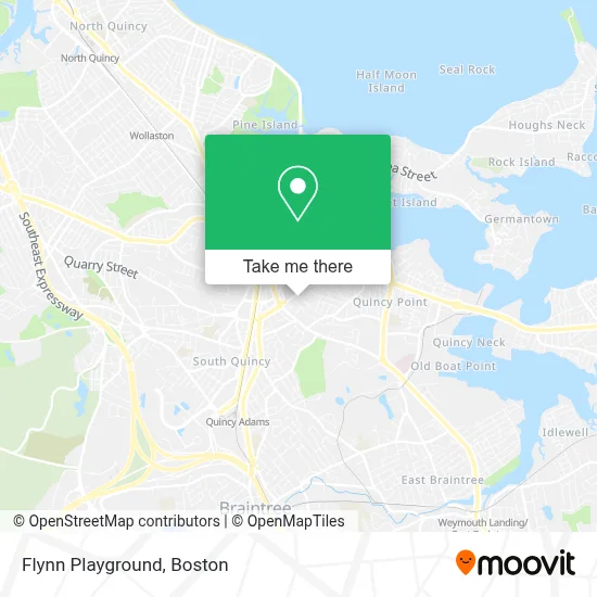
See Flynn Playground, Quincy, on the map
Public Transit to Flynn Playground in Quincy
Wondering how to get to Flynn Playground in Quincy? Moovit helps you find the best way to get to Flynn Playground with step-by-step directions from the nearest public transit station.
Moovit provides free maps and live directions to help you navigate through your city. View schedules, routes, timetables, and find out how long does it take to get to Flynn Playground in real time.
Looking for the nearest stop or station to Flynn Playground? Check out this list of stops closest to your destination: Hancock St @ Walter J Hannon Pkwy; Washington St @ Elm St; Weymouth Landing/East Braintree; Wollaston.
Bus: 210, 215, 220, 222, 225, 230, 236, 238.Train: GREENBUSH.Subway: RED LINE.
Want to see if there’s another route that gets you there at an earlier time? Moovit helps you find alternative routes or times. Get directions from and directions to Flynn Playground easily from the Moovit App or Website.
We make riding to Flynn Playground easy, which is why over 1.7 million users, including users in Quincy, trust Moovit as the best app for public transit. You don’t need to download an individual bus app or train app, Moovit is your all-in-one transit app that helps you find the best bus time or train time available.
For information on prices of bus, subway and train, costs and ride fares to Flynn Playground, please check the Moovit app.
Use the app to navigate to popular places including to the airport, hospital, stadium, grocery store, mall, coffee shop, school, college, and university.
Flynn Playground Address: 527 South St street in Quincy
- Quincy Dentists,
- Dennis Sweeney on Elm Funeral & Cremation Services,
- AM PM Locksmith Co,
- Minuteman Apartments & Homes,
- Geraldo's Plastering & Painting,
- Shaughnessy Law Group,
- Falco & Associates P.C.,
- FASTSIGNS,
- Boston Hair Restoration,
- Arc Design Cabinetry,
- Granite City Electric,
- 24 7 Available Locksmith,
- Packaging Store,
- Fix It Phil,
- Fuji at Woc,
- Monica's Point,
- Urgence Locksmiths,
- Coverall Ins,
- Global Flooring Co.,
- Tko Boxfit
Places Near Flynn Playground (Quincy)
- North End, Boston,
- Td Garden, Boston,
- House Of Blues, Boston,
- Castle Island, Boston,
- Museum Of Science, Boston,
- Prudential Center, Boston,
- Wang Theater, Boston,
- Quincy Market, Boston,
- Faneuil Hall, Boston,
- Isabella Stewart Gardner Museum, Boston,
- Mgm Music Hall, Boston,
- Boston Common, Boston,
- Boston Medical Center, Boston,
- Cheers, Boston,
- Wilbur Theatre, Boston,
- Leader Bank Pavilion (Leader Bank Pavillion), Boston,
- Massachusetts General Hospital, Boston,
- Boston Convention & Exhibition Center, Boston,
- Seaport District, Boston,
- Boston Children's Hospital, Boston
How to get to popular places in Boston with public transit
Get around Quincy by public transit!
Traveling around Quincy has never been so easy. See step by step directions as you travel to any attraction, street or major public transit station. View bus and train schedules, arrival times, service alerts and detailed routes on a map, so you know exactly how to get to anywhere in Quincy.
When traveling to any destination around Quincy use Moovit's Live Directions with Get Off Notifications to know exactly where and how far to walk, how long to wait for your line, and how many stops are left. Moovit will alert you when it's time to get off — no need to constantly re-check whether yours is the next stop.
Wondering how to use public transit in Quincy or how to pay for public transit in Quincy? Moovit public transit app can help you navigate your way with public transit easily, and at minimum cost. It includes public transit fees, ticket prices, and costs. Looking for a map of Quincy public transit lines? Moovit public transit app shows all public transit maps in Quincy with all Bus, Train, Subway and Ferry routes and stops on an interactive map.
Boston has 4 transit type(s), including: Bus, Train, Subway and Ferry, operated by several transit agencies, including MBTA, Southeastern Regional Transit Authority, MetroWest Regional Transit Authority, Rhode Island Public Transit Authority, WRTA, Lowell Regional Transit Authority, Merrimack Valley Transit, Montachusett Regional Transit Authority, Cape Cod Regional Transit Authority, Brockton Area Transit Authority, Martha's Vineyard Transit Authority, the WAVE - Nantucket Regional Transit Authority, GATRA, Cape Ann Transportation Authority and Massport