How to get to Fonefix by bus?
Click on the bus route to see step by step directions with maps, line arrival times and updated time schedules.
From Mayfield Common, Edmonton
57 minFrom Uline Shipping Supplies, St. Albert
60 minFrom W.P. Wagner High School, Edmonton
52 minFrom T5T 5L5, Edmonton
53 minFrom Grenco Industries, Edmonton
48 minFrom Theboldunicorn, Edmonton
36 minFrom 8440 112 Street Northwest, Edmonton
33 minFrom Insight West End Medical Imaging, Edmonton
43 minFrom W P Wagner Senior High School, Edmonton
51 min
Bus stops near Fonefix in Edmonton
Light Rail stations near Fonefix in Edmonton
Bus lines to Fonefix in Edmonton
- 009, Southgate - Eaux Claires,VIEW
- 110X, Eaux Claires - Downtown,VIEW
- 120X, Eaux Claires - Government Centre,VIEW
- 130X, Baturyn - Eaux Claires - Government Centre,VIEW
- 150X, Dunluce - Castle Downs - Government Centre,VIEW
- 103, Castle Downs Transit Centre,VIEW
- 106, Dunvegan - Northgate - Belvedere,VIEW
- 613, Archbishop O'Leary - Queen Elizabeth - Dunluce,VIEW
- 624, O'Leary - Rapperswill,VIEW
- 625, O'Leary - Palisades,VIEW
What are the closest stations to Fonefix?
The closest stations to Fonefix are:
- 97 Street & 128 Avenue is 199 meters away, 3 min walk.
- 102 Street & 127 Avenue is 389 meters away, 6 min walk.
- 97 Street & 132 Avenue is 725 meters away, 10 min walk.
- Stadium Station is 1772 meters away, 23 min walk.
- Nait-Blatchford Market Station is 4405 meters away, 57 min walk.
Which bus line stops near Fonefix?
009 (Eaux Claires Transit Centre→Southgate Transit Centre)
What’s the nearest light rail station to Fonefix in Edmonton?
The nearest light rail station to Fonefix in Edmonton is Stadium Station. It’s a 23 min walk away.
What’s the nearest bus station to Fonefix in Edmonton?
The nearest bus station to Fonefix in Edmonton is 97 Street & 128 Avenue. It’s a 3 min walk away.
What time is the first light rail to Fonefix in Edmonton?
The METRO is the first light rail that goes to Fonefix in Edmonton. It stops nearby at 6:08 AM.
What time is the last light rail to Fonefix in Edmonton?
The METRO is the last light rail that goes to Fonefix in Edmonton. It stops nearby at 12:41 AM.
What time is the first bus to Fonefix in Edmonton?
The 009 is the first bus that goes to Fonefix in Edmonton. It stops nearby at 3:14 AM.
What time is the last bus to Fonefix in Edmonton?
The 009 is the last bus that goes to Fonefix in Edmonton. It stops nearby at 3:15 AM.
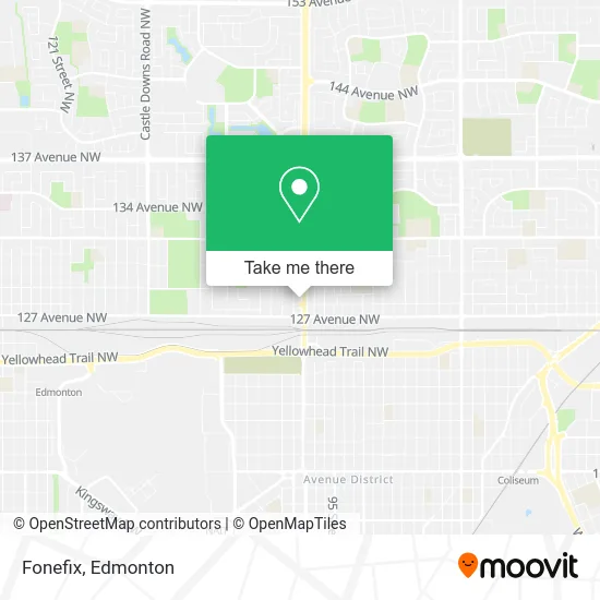
See Fonefix, Edmonton, on the map
Public Transit to Fonefix in Edmonton
Wondering how to get to Fonefix in Edmonton? Moovit helps you find the best way to get to Fonefix with step-by-step directions from the nearest public transit station.
Moovit provides free maps and live directions to help you navigate through your city. View schedules, routes, timetables, and find out how long does it take to get to Fonefix in real time.
Looking for the nearest stop or station to Fonefix? Check out this list of stops closest to your destination: 97 Street & 128 Avenue; 102 Street & 127 Avenue; 97 Street & 132 Avenue; Stadium Station; Nait-Blatchford Market Station.
Bus: 009, 110X, 120X, 130X, 150X, 103, 106, 613, 624, 625.
Want to see if there’s another route that gets you there at an earlier time? Moovit helps you find alternative routes or times. Get directions from and directions to Fonefix easily from the Moovit App or Website.
We make riding to Fonefix easy, which is why over 1.5 million users, including users in Edmonton, trust Moovit as the best app for public transit. You don’t need to download an individual bus app or train app, Moovit is your all-in-one transit app that helps you find the best bus time or train time available.
For information on prices of bus, costs and ride fares to Fonefix, please check the Moovit app.
Use the app to navigate to popular places including to the airport, hospital, stadium, grocery store, mall, coffee shop, school, college, and university.
Fonefix Address: 12828 97 St NW Edmonton, AB T5E 4C3 street in Edmonton
- CIRCLE K,
- Epcor,
- Clean Getaway Car Wash,
- Big Mama's & Papa's Pizzeria,
- Acute Hearing,
- Vca Canada North Central Animal Hospital,
- Wesneda Interiors,
- Edmonton Fire Station 10,
- Edmonton Fire Station #10 (Lauderdale),
- Fuzion Donuts,
- A K Madan Professional,
- Positive Changes,
- Sol Andino Tours & Travels,
- Careme Health Support,
- Daybreak Painting & Decorating,
- Senior Consulting Exec,
- Dolce Vita Accounting,
- Mumbai Junction,
- Sapporo Sushi,
- Motley Que
Places Near Fonefix (Edmonton)
- Fort Edmonton Park, Edmonton,
- Londonderry Mall, Edmonton,
- Rogers Place, Edmonton,
- Kaye Edmonton Clinic, Edmonton,
- Borden Park, Edmonton,
- Whyte Avenue, Edmonton,
- Cross Cancer Institute, Edmonton,
- Grey Nuns Community Hospital, Edmonton,
- Edmonton EXPO Centre, Edmonton,
- Northgate Centre, Edmonton,
- Edmonton Valley Zoo, Edmonton,
- Canada Place Service Canada Centre, Edmonton,
- Edmonton Commonwealth Stadium, Edmonton,
- Royal Alexandra Hospital, Edmonton,
- Kingsway Mall, Edmonton,
- Edmonton VIA Rail Station, Edmonton,
- University of Alberta, Edmonton,
- West Edmonton Mall, Edmonton,
- MacEwan University, Edmonton,
- Alberta Legislature Building, Edmonton
How to get to popular places in Edmonton with public transit
Get around Edmonton by public transit!
Traveling around Edmonton has never been so easy. See step by step directions as you travel to any attraction, street or major public transit station. View bus and train schedules, arrival times, service alerts and detailed routes on a map, so you know exactly how to get to anywhere in Edmonton.
When traveling to any destination around Edmonton use Moovit's Live Directions with Get Off Notifications to know exactly where and how far to walk, how long to wait for your line, and how many stops are left. Moovit will alert you when it's time to get off — no need to constantly re-check whether yours is the next stop.
Wondering how to use public transit in Edmonton or how to pay for public transit in Edmonton? Moovit public transit app can help you navigate your way with public transit easily, and at minimum cost. It includes public transit fees, ticket prices, and costs. Looking for a map of Edmonton public transit lines? Moovit public transit app shows all public transit maps in Edmonton with all Bus and Light Rail routes and stops on an interactive map.
Edmonton has 2 transit type(s), including: Bus and Light Rail, operated by several transit agencies, including ETS LRT, ETS, Strathcona County Transit, St. Albert Transit, Spruce Grove Transit, Fort Saskatchewan Transit, Beaumont Transit and Leduc Transit