How to get to Positive Changes by bus?
Click on the bus route to see step by step directions with maps, line arrival times and updated time schedules.
From Stairs Between Rowland Road And Gretzky Drive, Edmonton
43 minFrom Sun Life Financial, Edmonton
42 minFrom Real Canadian Superstore, Edmonton
50 minFrom Nait, Edmonton
40 minFrom Sobeys Distribution Centre, Edmonton
51 minFrom Original Cellphone Fix South, Edmonton
47 minFrom South Western Insurance Group, Edmonton
43 minFrom 130 Hyndman Crescent Northwest, Edmonton
56 minFrom Meadowlark Health & Shopping Centre, Edmonton
58 minFrom Walmart, Edmonton
39 min
Bus stops near Positive Changes in Edmonton
Light Rail stations near Positive Changes in Edmonton
Bus lines to Positive Changes in Edmonton
- 009, Century Park Transit Centre,VIEW
- 110X, Eaux Claires - Downtown,VIEW
- 120X, Eaux Claires - Government Centre,VIEW
- 130X, Baturyn - Eaux Claires - Government Centre,VIEW
- 150X, Dunluce - Castle Downs - Government Centre,VIEW
- 106, Dunvegan - Northgate - Belvedere,VIEW
- 613, Archbishop O'Leary - Queen Elizabeth - Dunluce,VIEW
- 624, O'Leary - Rapperswill,VIEW
- 625, O'Leary - Palisades,VIEW
- 114, West Clareview Transit Centre,VIEW
- 610, 91 Street & 168 Avenue,VIEW
- 103, Castle Downs Transit Centre,VIEW
What are the closest stations to Positive Changes?
The closest stations to Positive Changes are:
- 97 Street & 129b Avenue is 134 meters away, 3 min walk.
- 97 Street & 127 Avenue is 300 meters away, 5 min walk.
- 97 Street & 132 Avenue is 564 meters away, 8 min walk.
- 95a Street & 132 Avenue Nearside is 580 meters away, 8 min walk.
- 102 Street & 127 Avenue is 649 meters away, 9 min walk.
- Nait-Blatchford Market Station is 3199 meters away, 41 min walk.
- Kathleen Andrews Platform is 3410 meters away, 44 min walk.
Which bus line stops near Positive Changes?
009 (Southgate Transit Centre→Eaux Claires Transit Centre)
What’s the nearest bus station to Positive Changes in Edmonton?
The nearest bus station to Positive Changes in Edmonton is 97 Street & 129b Avenue. It’s a 3 min walk away.
What time is the first light rail to Positive Changes in Edmonton?
The METRO is the first light rail that goes to Positive Changes in Edmonton. It stops nearby at 6:08 AM.
What time is the last light rail to Positive Changes in Edmonton?
The METRO is the last light rail that goes to Positive Changes in Edmonton. It stops nearby at 12:41 AM.
What time is the first bus to Positive Changes in Edmonton?
The 009 is the first bus that goes to Positive Changes in Edmonton. It stops nearby at 3:14 AM.
What time is the last bus to Positive Changes in Edmonton?
The 009 is the last bus that goes to Positive Changes in Edmonton. It stops nearby at 3:15 AM.
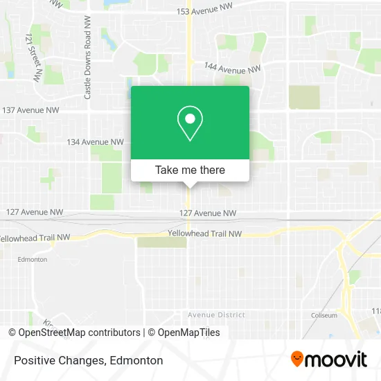
See Positive Changes, Edmonton, on the map
Public Transit to Positive Changes in Edmonton
Wondering how to get to Positive Changes in Edmonton? Moovit helps you find the best way to get to Positive Changes with step-by-step directions from the nearest public transit station.
Moovit provides free maps and live directions to help you navigate through your city. View schedules, routes, timetables, and find out how long does it take to get to Positive Changes in real time.
Looking for the nearest stop or station to Positive Changes? Check out this list of stops closest to your destination: 97 Street & 129b Avenue; 97 Street & 127 Avenue; 97 Street & 132 Avenue; 95a Street & 132 Avenue Nearside; 102 Street & 127 Avenue; Nait-Blatchford Market Station; Kathleen Andrews Platform.
Bus: 009, 110X, 120X, 130X, 150X, 106, 613, 624, 625, 114, 610, 103.
Want to see if there’s another route that gets you there at an earlier time? Moovit helps you find alternative routes or times. Get directions from and directions to Positive Changes easily from the Moovit App or Website.
We make riding to Positive Changes easy, which is why over 1.5 million users, including users in Edmonton, trust Moovit as the best app for public transit. You don’t need to download an individual bus app or train app, Moovit is your all-in-one transit app that helps you find the best bus time or train time available.
For information on prices of bus, costs and ride fares to Positive Changes, please check the Moovit app.
Use the app to navigate to popular places including to the airport, hospital, stadium, grocery store, mall, coffee shop, school, college, and university.
Positive Changes Address: 12907 97 St NW Edmonton, AB T5E 4C2 street in Edmonton
- Careme Health Support,
- Daybreak Painting & Decorating,
- Dolce Vita Accounting,
- Sol Andino Tours & Travels,
- Senior Consulting Exec,
- Mumbai Junction,
- Oscars Barbershop,
- Northgate Halal Meat & Groceries,
- A K Madan Professional,
- Cellular Toy Shoppe,
- Sapporo Sushi,
- Fuzion Donuts,
- Cashco Financial,
- Phillet & McLennan,
- Elite Smoke N Vape,
- Crystals Bridal,
- Global Empire Corp,
- Acute Hearing,
- Deals N Steals,
- Final Boss Video Games
Places Near Positive Changes (Edmonton)
- Whyte Avenue, Edmonton,
- Kingsway Mall, Edmonton,
- MacEwan University, Edmonton,
- Canada Place Service Canada Centre, Edmonton,
- Borden Park, Edmonton,
- Cross Cancer Institute, Edmonton,
- Edmonton VIA Rail Station, Edmonton,
- Edmonton EXPO Centre, Edmonton,
- Grey Nuns Community Hospital, Edmonton,
- Londonderry Mall, Edmonton,
- Alberta Legislature Building, Edmonton,
- Rogers Place, Edmonton,
- Royal Alexandra Hospital, Edmonton,
- West Edmonton Mall, Edmonton,
- Edmonton Commonwealth Stadium, Edmonton,
- University of Alberta, Edmonton,
- Northgate Centre, Edmonton,
- Edmonton Valley Zoo, Edmonton,
- Kaye Edmonton Clinic, Edmonton,
- Fort Edmonton Park, Edmonton
How to get to popular places in Edmonton with public transit
Get around Edmonton by public transit!
Traveling around Edmonton has never been so easy. See step by step directions as you travel to any attraction, street or major public transit station. View bus and train schedules, arrival times, service alerts and detailed routes on a map, so you know exactly how to get to anywhere in Edmonton.
When traveling to any destination around Edmonton use Moovit's Live Directions with Get Off Notifications to know exactly where and how far to walk, how long to wait for your line, and how many stops are left. Moovit will alert you when it's time to get off — no need to constantly re-check whether yours is the next stop.
Wondering how to use public transit in Edmonton or how to pay for public transit in Edmonton? Moovit public transit app can help you navigate your way with public transit easily, and at minimum cost. It includes public transit fees, ticket prices, and costs. Looking for a map of Edmonton public transit lines? Moovit public transit app shows all public transit maps in Edmonton with all Bus and Light Rail routes and stops on an interactive map.
Edmonton has 2 transit type(s), including: Bus and Light Rail, operated by several transit agencies, including ETS LRT, ETS, Strathcona County Transit, St. Albert Transit, Spruce Grove Transit, Fort Saskatchewan Transit, Beaumont Transit and Leduc Transit