How to get to Food For Thought by bus?
Click on the bus route to see step by step directions with maps, line arrival times and updated time schedules.
Bus stop near Food For Thought in Boston
- Old Tower Hill After Narragansett, 2 min walk,VIEW
Bus lines to Food For Thought in Boston
What are the closest stations to Food For Thought?
The closest stations to Food For Thought are:
- Old Tower Hill After Narragansett is 121 yards away, 2 min walk.
Which bus lines stop near Food For Thought?
These bus lines stop near Food For Thought: 65X, 69.
What’s the nearest bus station to Food For Thought in Boston?
The nearest bus station to Food For Thought in Boston is Old Tower Hill After Narragansett. It’s a 2 min walk away.
What time is the first bus to Food For Thought in Boston?
The 69 is the first bus that goes to Food For Thought in Boston. It stops nearby at 6:11 AM.
What time is the last bus to Food For Thought in Boston?
The 69 is the last bus that goes to Food For Thought in Boston. It stops nearby at 10:33 PM.
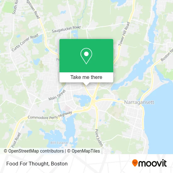
See Food For Thought, Boston, on the map
Public Transit to Food For Thought in Boston
Wondering how to get to Food For Thought in Boston? Moovit helps you find the best way to get to Food For Thought with step-by-step directions from the nearest public transit station.
Moovit provides free maps and live directions to help you navigate through your city. View schedules, routes, timetables, and find out how long does it take to get to Food For Thought in real time.
Looking for the nearest stop or station to Food For Thought? Check out this list of stops closest to your destination: Old Tower Hill After Narragansett.
Bus: 65X, 69.
Want to see if there’s another route that gets you there at an earlier time? Moovit helps you find alternative routes or times. Get directions from and directions to Food For Thought easily from the Moovit App or Website.
We make riding to Food For Thought easy, which is why over 1.7 million users, including users in Boston, trust Moovit as the best app for public transit. You don’t need to download an individual bus app or train app, Moovit is your all-in-one transit app that helps you find the best bus time or train time available.
For information on prices of bus, costs and ride fares to Food For Thought, please check the Moovit app.
Use the app to navigate to popular places including to the airport, hospital, stadium, grocery store, mall, coffee shop, school, college, and university.
Food For Thought Address: 577 Kingstown Rd street in Boston
- Pooch Parlor,
- SOS Retail,
- Key Real Estate,
- A Wakefield Walk-in and Primary Care,
- Tip Top Kennel,
- Psychic Kitty,
- Talent Factory South,
- Cashion Paul D,
- Verizon Wireless,
- Vortechs Hvac,
- USPS,
- FedEx Drop Box,
- Wakefield Prescription,
- Michael Nadeau - Chase Home Lending Advisor - NMLS ID,
- Chase,
- Re-Run Resale,
- Imported Car Parts,
- CARQUEST,
- Perfect Paws,
- Sweet Althea's
Places Near Food For Thought (Boston)
- Boston Convention & Exhibition Center, Boston,
- Castle Island, Boston,
- Museum Of Science, Boston,
- Wilbur Theatre, Boston,
- Seaport District, Boston,
- Quincy Market, Boston,
- House Of Blues, Boston,
- Cheers, Boston,
- Prudential Center, Boston,
- Massachusetts General Hospital, Boston,
- Isabella Stewart Gardner Museum, Boston,
- Boston Common, Boston,
- Boston Children's Hospital, Boston,
- North End, Boston,
- Td Garden, Boston,
- Wang Theater, Boston,
- Faneuil Hall, Boston,
- Mgm Music Hall, Boston,
- Boston Medical Center, Boston,
- Leader Bank Pavilion (Leader Bank Pavillion), Boston
How to get to popular places in Boston with public transit
Get around Boston by public transit!
Traveling around Boston has never been so easy. See step by step directions as you travel to any attraction, street or major public transit station. View bus and train schedules, arrival times, service alerts and detailed routes on a map, so you know exactly how to get to anywhere in Boston.
When traveling to any destination around Boston use Moovit's Live Directions with Get Off Notifications to know exactly where and how far to walk, how long to wait for your line, and how many stops are left. Moovit will alert you when it's time to get off — no need to constantly re-check whether yours is the next stop.
Wondering how to use public transit in Boston or how to pay for public transit in Boston? Moovit public transit app can help you navigate your way with public transit easily, and at minimum cost. It includes public transit fees, ticket prices, and costs. Looking for a map of Boston public transit lines? Moovit public transit app shows all public transit maps in Boston with all Bus, Train, Subway and Ferry routes and stops on an interactive map.
Boston has 4 transit type(s), including: Bus, Train, Subway and Ferry, operated by several transit agencies, including MBTA, Southeastern Regional Transit Authority, MetroWest Regional Transit Authority, Rhode Island Public Transit Authority, WRTA, Lowell Regional Transit Authority, Merrimack Valley Transit, Montachusett Regional Transit Authority, Cape Cod Regional Transit Authority, Brockton Area Transit Authority, Martha's Vineyard Transit Authority, the WAVE - Nantucket Regional Transit Authority, GATRA, Cape Ann Transportation Authority and Massport