How to get to Fore River Bridge by bus?
Click on the bus route to see step by step directions with maps, line arrival times and updated time schedules.
From Cruiseport Boston's Black Falcon Cruise Terminal, Boston
92 minFrom Boston Harbor, Boston
95 minFrom Aloft-Boston Seaport Dist, Boston
89 minFrom Flynn Cruiseport Boston, Boston
93 minFrom Samuel Adams Brewery, Boston
71 minFrom Boston Medical Center / Shapiro Center, Boston
66 minFrom Sam Adams Boston Brewery Tour, Boston
71 minFrom Aloft Boston Seaport, Boston
88 minFrom Capo Restaurant & Supper Club, Boston
66 minFrom Home2 Suites-Boston South Bay (Home2 Stes by Hilton Boston S Bay), Boston
53 min
How to get to Fore River Bridge by train?
Click on the train route to see step by step directions with maps, line arrival times and updated time schedules.
From Aloft-Boston Seaport Dist, Boston
50 minFrom Samuel Adams Brewery, Boston
78 minFrom Boston Medical Center / Shapiro Center, Boston
83 minFrom Sam Adams Boston Brewery Tour, Boston
78 minFrom Aloft Boston Seaport, Boston
50 minFrom Home2 Suites-Boston South Bay (Home2 Stes by Hilton Boston S Bay), Boston
75 min
How to get to Fore River Bridge by subway?
Click on the subway route to see step by step directions with maps, line arrival times and updated time schedules.
From Aloft-Boston Seaport Dist, Boston
48 minFrom Samuel Adams Brewery, Boston
55 minFrom Boston Medical Center / Shapiro Center, Boston
49 minFrom Sam Adams Boston Brewery Tour, Boston
55 minFrom Aloft Boston Seaport, Boston
47 minFrom Capo Restaurant & Supper Club, Boston
44 minFrom Home2 Suites-Boston South Bay (Home2 Stes by Hilton Boston S Bay), Boston
38 min
Bus stops near Fore River Bridge in Quincy
Subway station near Fore River Bridge in Quincy
- Wollaston, 23 min walk,VIEW
Bus lines to Fore River Bridge in Quincy
What are the closest stations to Fore River Bridge?
The closest stations to Fore River Bridge are:
- Hancock St Opp Merrymount Rd is 15 yards away, 1 min walk.
- Adams St Opp Alleyne St is 257 yards away, 4 min walk.
- Wollaston is 1853 yards away, 23 min walk.
Which bus lines stop near Fore River Bridge?
These bus lines stop near Fore River Bridge: 210, 211.
Which train lines stop near Fore River Bridge?
These train lines stop near Fore River Bridge: FALL RIVER/NEW BEDFORD, GREENBUSH.
Which subway line stops near Fore River Bridge?
RED LINE (Ashmont/Braintree)
What’s the nearest subway station to Fore River Bridge in Quincy?
The nearest subway station to Fore River Bridge in Quincy is Wollaston. It’s a 23 min walk away.
What’s the nearest bus station to Fore River Bridge in Quincy?
The nearest bus station to Fore River Bridge in Quincy is Hancock St Opp Merrymount Rd. It’s a 1 min walk away.
What time is the first subway to Fore River Bridge in Quincy?
The RED LINE is the first subway that goes to Fore River Bridge in Quincy. It stops nearby at 5:18 AM.
What time is the last subway to Fore River Bridge in Quincy?
The RED LINE is the last subway that goes to Fore River Bridge in Quincy. It stops nearby at 1:49 AM.
What time is the first bus to Fore River Bridge in Quincy?
The 210 is the first bus that goes to Fore River Bridge in Quincy. It stops nearby at 5:00 AM.
What time is the last bus to Fore River Bridge in Quincy?
The 210 is the last bus that goes to Fore River Bridge in Quincy. It stops nearby at 1:17 AM.
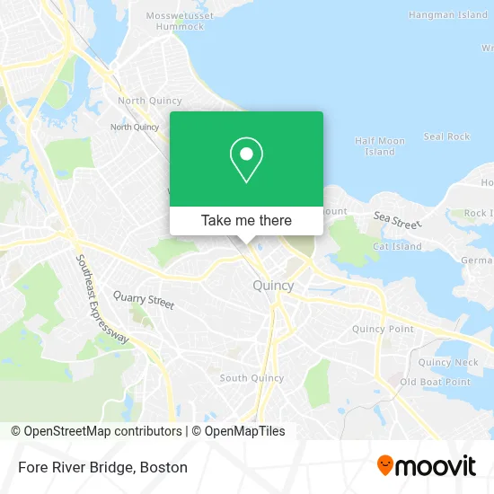
See Fore River Bridge, Quincy, on the map
Public Transit to Fore River Bridge in Quincy
Wondering how to get to Fore River Bridge in Quincy? Moovit helps you find the best way to get to Fore River Bridge with step-by-step directions from the nearest public transit station.
Moovit provides free maps and live directions to help you navigate through your city. View schedules, routes, timetables, and find out how long does it take to get to Fore River Bridge in real time.
Looking for the nearest stop or station to Fore River Bridge? Check out this list of stops closest to your destination: Hancock St Opp Merrymount Rd; Adams St Opp Alleyne St; Wollaston.
Bus: 210, 211, 217, 245.Train: FALL RIVER/NEW BEDFORD, GREENBUSH.Subway: RED LINE.
Want to see if there’s another route that gets you there at an earlier time? Moovit helps you find alternative routes or times. Get directions from and directions to Fore River Bridge easily from the Moovit App or Website.
We make riding to Fore River Bridge easy, which is why over 1.7 million users, including users in Quincy, trust Moovit as the best app for public transit. You don’t need to download an individual bus app or train app, Moovit is your all-in-one transit app that helps you find the best bus time or train time available.
For information on prices of bus, subway and train, costs and ride fares to Fore River Bridge, please check the Moovit app.
Use the app to navigate to popular places including to the airport, hospital, stadium, grocery store, mall, coffee shop, school, college, and university.
Fore River Bridge Address: 9 Bridge St street in Quincy
- Brookside at 999,
- Jason Mitchell Group,
- Pot Em Up,
- City Of Presidents Recruiting,
- Central Middle,
- Red Phoenix Event Group,
- T&J Concepts,
- Head General Contracting,
- New Directions Counseling,
- South Shore Council Churches,
- Proclean,
- New Directions Counseling Center,
- George HOM,
- Happy Children Learning Center,
- Ellen Ochs,
- Eks Music School,
- Remedy Intelligent Staffing,
- Christine Huber Chiropractor,
- Savannah Nails & Spa,
- Dorothy Q Apartments
Places Near Fore River Bridge (Quincy)
- House Of Blues, Boston,
- Prudential Center, Boston,
- Boston Convention & Exhibition Center, Boston,
- Wang Theater, Boston,
- Seaport District, Boston,
- Td Garden, Boston,
- Leader Bank Pavilion (Leader Bank Pavillion), Boston,
- Museum Of Science, Boston,
- North End, Boston,
- Castle Island, Boston,
- Boston Medical Center, Boston,
- Boston Children's Hospital, Boston,
- Boston Common, Boston,
- Quincy Market, Boston,
- Massachusetts General Hospital, Boston,
- Faneuil Hall, Boston,
- Wilbur Theatre, Boston,
- Cheers, Boston,
- Isabella Stewart Gardner Museum, Boston,
- Mgm Music Hall, Boston
How to get to popular places in Boston with public transit
Get around Quincy by public transit!
Traveling around Quincy has never been so easy. See step by step directions as you travel to any attraction, street or major public transit station. View bus and train schedules, arrival times, service alerts and detailed routes on a map, so you know exactly how to get to anywhere in Quincy.
When traveling to any destination around Quincy use Moovit's Live Directions with Get Off Notifications to know exactly where and how far to walk, how long to wait for your line, and how many stops are left. Moovit will alert you when it's time to get off — no need to constantly re-check whether yours is the next stop.
Wondering how to use public transit in Quincy or how to pay for public transit in Quincy? Moovit public transit app can help you navigate your way with public transit easily, and at minimum cost. It includes public transit fees, ticket prices, and costs. Looking for a map of Quincy public transit lines? Moovit public transit app shows all public transit maps in Quincy with all Bus, Train, Subway and Ferry routes and stops on an interactive map.
Boston has 4 transit type(s), including: Bus, Train, Subway and Ferry, operated by several transit agencies, including MBTA, Southeastern Regional Transit Authority, MetroWest Regional Transit Authority, Rhode Island Public Transit Authority, WRTA, Lowell Regional Transit Authority, Merrimack Valley Transit, Montachusett Regional Transit Authority, Cape Cod Regional Transit Authority, Brockton Area Transit Authority, Martha's Vineyard Transit Authority, the WAVE - Nantucket Regional Transit Authority, GATRA, Cape Ann Transportation Authority and Massport