Directions to Form Energy (Somerville) with public transportation
The following transit lines have routes that pass near Form Energy
 Bus: 109, 83, 85, 87.
- Train: FITCHBURG.
- Subway: GREEN LINE E, RED LINE, GREEN LINE B, GREEN LINE C, GREEN LINE D.
How to get to Form Energy by bus?
Click on the bus route to see step by step directions with maps, line arrival times and updated time schedules.
From Roxbury, Boston
53 minFrom Hyatt Regency-Boston Harbor, Boston
73 minFrom Waltham, MA, Waltham
72 minFrom Codman Square, Boston
92 minFrom FOUR POINTS BY SHERATON Boston Newton, Newton
58 minFrom Ramada by Wyndham Boston, Boston
96 minFrom Andrew Square, Boston
57 minFrom Massachusetts College Of Pharmacy And Health Science, Boston
51 minFrom Ramada Boston, Boston
96 minFrom Roslindale, Boston
93 min
How to get to Form Energy by train?
Click on the train route to see step by step directions with maps, line arrival times and updated time schedules.
How to get to Form Energy by subway?
Click on the subway route to see step by step directions with maps, line arrival times and updated time schedules.
From Roxbury, Boston
55 minFrom Hyatt Regency-Boston Harbor, Boston
68 minFrom Codman Square, Boston
66 minFrom Ramada by Wyndham Boston, Boston
75 minFrom Andrew Square, Boston
44 minFrom Massachusetts College Of Pharmacy And Health Science, Boston
59 minFrom Ramada Boston, Boston
75 minFrom Roslindale, Boston
71 min
Bus stops near Form Energy in Somerville
Subway stations near Form Energy in Somerville
Train station near Form Energy in Somerville
- Porter, 31 min walk,VIEW
Bus lines to Form Energy in Somerville
What are the closest stations to Form Energy?
The closest stations to Form Energy are:
- Washington St @ Dane St is 85 yards away, 2 min walk.
- Somerville Ave Opp Loring St is 267 yards away, 4 min walk.
- Somerville Ave @ Central St is 282 yards away, 4 min walk.
- Gilman Square is 716 yards away, 9 min walk.
- Union Square is 793 yards away, 10 min walk.
- Harvard Square is 1420 yards away, 18 min walk.
- Porter is 2613 yards away, 31 min walk.
Which bus lines stop near Form Energy?
These bus lines stop near Form Energy: 109, 83, 85, 87.
Which train line stops near Form Energy?
FITCHBURG (#410 | North Station)
Which subway lines stop near Form Energy?
These subway lines stop near Form Energy: GREEN LINE E, RED LINE.
What’s the nearest subway station to Form Energy in Somerville?
The nearest subway station to Form Energy in Somerville is Gilman Square. It’s a 9 min walk away.
What’s the nearest bus station to Form Energy in Somerville?
The nearest bus station to Form Energy in Somerville is Washington St @ Dane St. It’s a 2 min walk away.
What time is the first subway to Form Energy in Somerville?
The GREEN LINE E is the first subway that goes to Form Energy in Somerville. It stops nearby at 4:49 AM.
What time is the last subway to Form Energy in Somerville?
The GREEN LINE E is the last subway that goes to Form Energy in Somerville. It stops nearby at 2:36 AM.
What time is the first train to Form Energy in Somerville?
The FITCHBURG is the first train that goes to Form Energy in Somerville. It stops nearby at 5:47 AM.
What time is the last train to Form Energy in Somerville?
The FITCHBURG is the last train that goes to Form Energy in Somerville. It stops nearby at 12:17 AM.
What time is the first bus to Form Energy in Somerville?
The 109 is the first bus that goes to Form Energy in Somerville. It stops nearby at 4:55 AM.
What time is the last bus to Form Energy in Somerville?
The 109 is the last bus that goes to Form Energy in Somerville. It stops nearby at 1:31 AM.
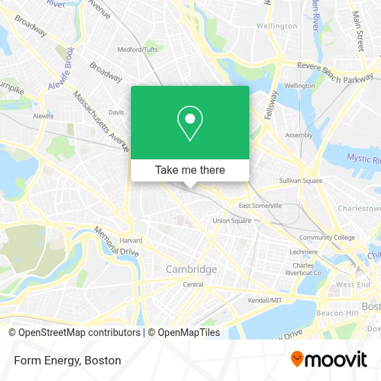
See Form Energy, Somerville, on the map
Public Transit to Form Energy in Somerville
Wondering how to get to Form Energy in Somerville? Moovit helps you find the best way to get to Form Energy with step-by-step directions from the nearest public transit station.
Moovit provides free maps and live directions to help you navigate through your city. View schedules, routes, timetables, and find out how long does it take to get to Form Energy in real time.
Looking for the nearest stop or station to Form Energy? Check out this list of stops closest to your destination: Washington St @ Dane St; Somerville Ave Opp Loring St; Somerville Ave @ Central St; Gilman Square; Union Square; Harvard Square; Porter.
Bus: 109, 83, 85, 87.Train: FITCHBURG.Subway: GREEN LINE E, RED LINE, GREEN LINE B, GREEN LINE C, GREEN LINE D.
Want to see if there’s another route that gets you there at an earlier time? Moovit helps you find alternative routes or times. Get directions from and directions to Form Energy easily from the Moovit App or Website.
We make riding to Form Energy easy, which is why over 1.7 million users, including users in Somerville, trust Moovit as the best app for public transit. You don’t need to download an individual bus app or train app, Moovit is your all-in-one transit app that helps you find the best bus time or train time available.
For information on prices of bus, subway and train, costs and ride fares to Form Energy, please check the Moovit app.
Use the app to navigate to popular places including to the airport, hospital, stadium, grocery store, mall, coffee shop, school, college, and university.
Form Energy Address: 30 Dane St street in Somerville
- Aeronaut Brewing,
- Mimi's Chuka Diner,
- Evaptainers,
- Somerville Shop Cannery,
- Tank Design,
- St Anthony Church Bingo,
- Igreja de Santo Antonio,
- Scalabrini Centers For Migration in Boston,
- Duck Village Stage,
- Stank Factory Recordings,
- New Alliance Audio,
- Shane Signs,
- Palmacci Park,
- Bouldering Project - Somerville,
- Wildgrain Bakehouse,
- Somerville Media Center,
- Dosa-N-Curry,
- Area Four,
- Somernova,
- Sublime Systems
Places Near Form Energy (Somerville)
- Faneuil Hall, Boston,
- Mgm Music Hall, Boston,
- Leader Bank Pavilion (Leader Bank Pavillion), Boston,
- Castle Island, Boston,
- Museum Of Science, Boston,
- Prudential Center, Boston,
- Cheers, Boston,
- Td Garden, Boston,
- Isabella Stewart Gardner Museum, Boston,
- Boston Children's Hospital, Boston,
- Boston Medical Center, Boston,
- North End, Boston,
- House Of Blues, Boston,
- Wilbur Theatre, Boston,
- Seaport District, Boston,
- Wang Theater, Boston,
- Boston Convention & Exhibition Center, Boston,
- Massachusetts General Hospital, Boston,
- Quincy Market, Boston,
- Boston Common, Boston
How to get to popular places in Boston with public transit
Get around Somerville by public transit!
Traveling around Somerville has never been so easy. See step by step directions as you travel to any attraction, street or major public transit station. View bus and train schedules, arrival times, service alerts and detailed routes on a map, so you know exactly how to get to anywhere in Somerville.
When traveling to any destination around Somerville use Moovit's Live Directions with Get Off Notifications to know exactly where and how far to walk, how long to wait for your line, and how many stops are left. Moovit will alert you when it's time to get off — no need to constantly re-check whether yours is the next stop.
Wondering how to use public transit in Somerville or how to pay for public transit in Somerville? Moovit public transit app can help you navigate your way with public transit easily, and at minimum cost. It includes public transit fees, ticket prices, and costs. Looking for a map of Somerville public transit lines? Moovit public transit app shows all public transit maps in Somerville with all Bus, Train, Subway and Ferry routes and stops on an interactive map.
Boston has 4 transit type(s), including: Bus, Train, Subway and Ferry, operated by several transit agencies, including MBTA, Southeastern Regional Transit Authority, MetroWest Regional Transit Authority, Rhode Island Public Transit Authority, WRTA, Lowell Regional Transit Authority, Merrimack Valley Transit, Montachusett Regional Transit Authority, Cape Cod Regional Transit Authority, Brockton Area Transit Authority, Martha's Vineyard Transit Authority, the WAVE - Nantucket Regional Transit Authority, GATRA, Cape Ann Transportation Authority and Massport