Directions to Fort Casey State Park (Seattle - Tacoma, WA) with public transportation
The following transit lines have routes that pass near Fort Casey State Park
Ferry stations near Fort Casey State Park in Seattle - Tacoma, WA
- Coupeville,12 min walk,
What are the closest stations to Fort Casey State Park?
The closest stations to Fort Casey State Park are:
- Coupeville is 951 yards away, 12 min walk.
Which ferry line stops near Fort Casey State Park?
MUKILTEO - CLINTON
What’s the nearest ferry station to Fort Casey State Park in Seattle - Tacoma, WA?
The nearest ferry station to Fort Casey State Park in Seattle - Tacoma, WA is Coupeville. It’s a 12 min walk away.
See Fort Casey State Park, Seattle - Tacoma, WA, on the map
Public Transit to Fort Casey State Park in Seattle - Tacoma, WA
Wondering how to get to Fort Casey State Park in Seattle - Tacoma, WA, United States? Moovit helps you find the best way to get to Fort Casey State Park with step-by-step directions from the nearest public transit station.
Moovit provides free maps and live directions to help you navigate through your city. View schedules, routes, timetables, and find out how long does it take to get to Fort Casey State Park in real time.
Looking for the nearest stop or station to Fort Casey State Park? Check out this list of stops closest to your destination: Coupeville.
Ferry:MUKILTEO - CLINTONCOUPEVILLE - PORT TOWNSENDPORT TOWNSEND - COUPEVILLE
Want to see if there’s another route that gets you there at an earlier time? Moovit helps you find alternative routes or times. Get directions from and directions to Fort Casey State Park easily from the Moovit App or Website.
We make riding to Fort Casey State Park easy, which is why over 1.5 million users, including users in Seattle - Tacoma, WA, trust Moovit as the best app for public transit. You don’t need to download an individual bus app or train app, Moovit is your all-in-one transit app that helps you find the best bus time or train time available.
For information on prices of bus and ferry, costs and ride fares to Fort Casey State Park, please check the Moovit app.
Use the app to navigate to popular places including to the airport, hospital, stadium, grocery store, mall, coffee shop, school, college, and university.
Fort Casey State Park Address: 1280 Engle Rd street in Seattle - Tacoma, WA
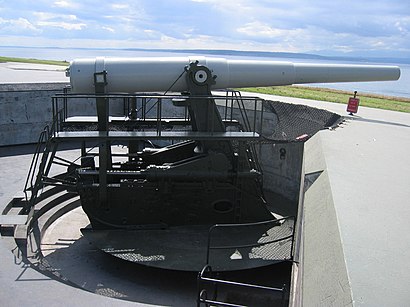
Attractions near Fort Casey State Park
The Switchboard,Fort Casey,Admiralty Head Lighthouse,Admirality Head Lighthouse,Ferry Waiting Area,Coupeville Ferry,Fort Casey Dive Park,Coupeville Ferry Terminal,M.V. Kennewick,Coupeville Ferry Holding,Coupeville,Keystone Harbor,Keystone,Keystone Underwater Park,Keystone Cafe,Keystone Ferry Landing,Ebeys Landing,Coupville Airpark,Ebey's Landing State Park,Patmore Park (Off-Leash Dog Area)How to get to popular attractions in Seattle - Tacoma, WA with public transit
VA Hospital American Lake, North Fort Lewis,Camp Murray,Tacoma Comedy Club, Tacoma,I-5,Seattle Pacific University, Seattle,The Old Spaghetti Factory, Tacoma,Lake Stevens, Lake Stevens,PCC Community Markets - Issaquah, Issaquah,Costco Wholesale, Tacoma,Pike Place Market, Seattle,Downtown Olympia, Olympia,Olympia-Lacey Amtrak Station (OLW),Costco Wholesale, Federal Way,Providence Southgate II, Renton,Hotel Murano, Tacoma,Georgetown Brewing Company, Seattle,Salty's on Alki, Seattle,Fred Meyer, Everett,Regal Cinemas Lakewood 15 & RPX, Lakewood,Dale Turner Family YMCA, ShorelineGet around Seattle - Tacoma, WA by public transit!
Traveling around Seattle - Tacoma, WA has never been so easy. See step by step directions as you travel to any attraction, street or major public transit station. View bus and train schedules, arrival times, service alerts and detailed routes on a map, so you know exactly how to get to anywhere in Seattle - Tacoma, WA.
When traveling to any destination around Seattle - Tacoma, WA use Moovit's Live Directions with Get Off Notifications to know exactly where and how far to walk, how long to wait for your line, and how many stops are left. Moovit will alert you when it's time to get off — no need to constantly re-check whether yours is the next stop.
Wondering how to use public transit in Seattle - Tacoma, WA or how to pay for public transit in Seattle - Tacoma, WA? Moovit public transit app can help you navigate your way with public transit easily, and at minimum cost. It includes public transit fees, ticket prices, and costs. Looking for a map of Seattle - Tacoma, WA public transit lines? Moovit public transit app shows all public transit maps in Seattle - Tacoma, WA with all bus or ferry routes and stops on an interactive map.
Seattle - Tacoma, WA has 2 transit type(s), including: bus or ferry, operated by several transit agencies, including Sound Transit, Seattle Streetcar, Sound Transit, Metro Transit, Metro Transit, Sound Transit, Whatcom Transportation Authority, Mason Transit Authority, Snoqualmie Valley Transportation (SVT), Snoqualmie Valley Transportation, Amtrak, Island Transit, Kitsap Transit, Intercity Transit and Everett Transit