Directions to Fort Devens Cemetery with public transportation
The following transit lines have routes that pass near Fort Devens Cemetery
Which bus line stops near Fort Devens Cemetery?
BOSTON SHUTTLE
Which train line stops near Fort Devens Cemetery?
FITCHBURG LINE
See Fort Devens Cemetery on the map
Public Transportation to Fort Devens Cemetery
Wondering how to get to Fort Devens Cemetery, United States? Moovit helps you find the best way to get to Fort Devens Cemetery with step-by-step directions from the nearest public transit station.
Moovit provides free maps and live directions to help you navigate through your city. View schedules, routes, timetables, and find out how long does it take to get to Fort Devens Cemetery in real time.
Bus: BOSTON SHUTTLE.Train: FITCHBURG LINE.
Want to see if there’s another route that gets you there at an earlier time? Moovit helps you find alternative routes or times. Get directions from and directions to Fort Devens Cemetery easily from the Moovit App or Website.
We make riding to Fort Devens Cemetery easy, which is why over 1.5 million users, including users in Devens, trust Moovit as the best app for public transit. You don’t need to download an individual bus app or train app, Moovit is your all-in-one transit app that helps you find the best bus time or train time available.
For information on prices of bus, train and subway, costs and ride fares to Fort Devens Cemetery, please check the Moovit app.
Use the app to navigate to popular places including to the airport, hospital, stadium, grocery store, mall, coffee shop, school, college, and university.
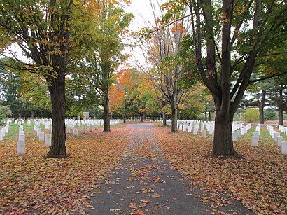
Fort Devens Cemetery Address: Patton Road street in Devens
The Fort Devens Cemetery is the post cemetery for Fort Devens.Wiki
Attractions near Fort Devens Cemetery
Post Cemetery,Fmc Devens - Satellite Camp,Fmc Devens - Federal Medical Center,Bristol-Myers Squibb,15 Sheridan Rd,Bristol-Myers Squibb,Jackson Road,Ft Devens Barracks Bldg 670,26 Jackson Rd,American Superconductor,Bristol Myers Squibb,One Jackson Place,R3 Education,American Superconductor,Devens - MWCC Campus,Bionostics,Bionostics,Mirror Lake,PCI,Seven Hills Foundation Day HabHow to get to popular attractions in Devens with public transit
Target, Everett,Simmons College, Boston,Blue Hills Ski Area,Lasell College, Newton,Royal Sonesta Hotel, Cambridge,Ikea,I-95 / Route 128 & Route 20 Interchange (Exit 26), Waltham,Commonwealth Ave, Boston,Wonderland Parking Garage (Wonderland Station), Revere,Mansfield Ma, Mansfield Center,Hilton Boston Logan Airport, Boston,Christopher Columbus Waterfront Park, Boston,House of Blues , Boston,Tufts Dental School, Boston,Ramada Boston, Boston,12 Channel Street, Boston,Doubletree-Boston Bayside, Boston,Vineyard Vines Whalehouse Sale, Lawrence,Cruiseport Boston's Black Falcon Cruise Terminal, Boston,Renaissance Boston Waterfront Hotel (Renaissance Waterfront Conference Center), BostonGet around Boston by public transit!
Traveling around Boston has never been so easy. See step by step directions as you travel to any attraction, street or major public transit station. View bus and train schedules, arrival times, service alerts and detailed routes on a map, so you know exactly how to get to anywhere in Boston.
When traveling to any destination around Boston use Moovit's Live Directions with Get Off Notifications to know exactly where and how far to walk, how long to wait for your line, and how many stops are left. Moovit will alert you when it's time to get off — no need to constantly re-check whether yours is the next stop.
Wondering how to use public transit in Boston or how to pay for public transit in Boston? Moovit public transit app can help you navigate your way with public transit easily, and at minimum cost. It includes public transit fees, ticket prices, and costs. Looking for a map of Boston public transit lines? Moovit public transit app shows all public transit maps in Boston with all Bus, Train, Subway and Ferry routes and stops on an interactive map.
Boston has 4 transit type(s), including: Bus, Train, Subway and Ferry, operated by several transit agencies, including MBTA, Southeastern Regional Transit Authority, MetroWest Regional Transit Authority, Rhode Island Public Transit Authority, WRTA, Lowell Regional Transit Authority, Merrimack Valley Transit, Montachusett Regional Transit Authority, Cape Cod Regional Transit Authority, Brockton Area Transit Authority, Martha's Vineyard Transit Authority, the WAVE - Nantucket Regional Transit Authority, GATRA, Cape Ann Transportation Authority, Massport