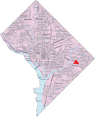
See Fort Dupont, Washington, on the map
Directions to Fort Dupont (Washington) with public transportation
The following transit lines have routes that pass near Fort Dupont
 Bus:
Bus: - Metro:
How to get to Fort Dupont by bus?
Click on the bus route to see step by step directions with maps, line arrival times and updated time schedules.
How to get to Fort Dupont by metro?
Click on the metro route to see step by step directions with maps, line arrival times and updated time schedules.
Bus stations near Fort Dupont in Washington
- Minnesota Ave SE + Randle Cir SE,2 min walk,
- Branch Ave SE + Randle Cir SE,4 min walk,
Metro stations near Fort Dupont in Washington
- Minnesota Ave,34 min walk,
- Potomac Ave,35 min walk,
Light Rail stations near Fort Dupont in Washington
- Benning Rd And Oklahoma Ave NE (Tk 2),49 min walk,
Bus lines to Fort Dupont in Washington
- V2,West To Anacostia,
- V4,East To Capitol Heights,
- A31,North To Minnesota Ave Station,
- S35,South To Bradbury Heights,
What are the closest stations to Fort Dupont?
The closest stations to Fort Dupont are:
- Minnesota Ave SE + Randle Cir SE is 131 yards away, 2 min walk.
- Branch Ave SE + Randle Cir SE is 285 yards away, 4 min walk.
- Minnesota Ave is 2857 yards away, 34 min walk.
- Potomac Ave is 2912 yards away, 35 min walk.
- Benning Rd And Oklahoma Ave NE (Tk 2) is 4180 yards away, 49 min walk.
Which bus lines stop near Fort Dupont?
These bus lines stop near Fort Dupont: 36, V2, V4.
Which metro lines stop near Fort Dupont?
These metro lines stop near Fort Dupont: METRORAIL BLUE LINE, METRORAIL ORANGE LINE, METRORAIL SILVER LINE.
What’s the nearest bus stop to Fort Dupont in Washington?
The nearest bus stop to Fort Dupont in Washington is Minnesota Ave SE + Randle Cir SE. It’s a 2 min walk away.
What time is the first light rail to Fort Dupont in Washington?
The H/BENNING LINE is the first light rail that goes to Fort Dupont in Washington. It stops nearby at 6:01 AM.
What time is the last light rail to Fort Dupont in Washington?
The H/BENNING LINE is the last light rail that goes to Fort Dupont in Washington. It stops nearby at 12:20 AM.
What time is the first metro to Fort Dupont in Washington?
The METRORAIL BLUE LINE is the first metro that goes to Fort Dupont in Washington. It stops nearby at 5:10 AM.
What time is the last metro to Fort Dupont in Washington?
The METRORAIL ORANGE LINE is the last metro that goes to Fort Dupont in Washington. It stops nearby at 12:37 AM.
What time is the first bus to Fort Dupont in Washington?
The V4 is the first bus that goes to Fort Dupont in Washington. It stops nearby at 4:26 AM.
What time is the last bus to Fort Dupont in Washington?
The V2 is the last bus that goes to Fort Dupont in Washington. It stops nearby at 2:03 AM.
How much is the metro fare to Fort Dupont?
The metro fare to Fort Dupont costs about $2.00 - $6.00.
See Fort Dupont, Washington, on the map
Public Transit to Fort Dupont in Washington
Wondering how to get to Fort Dupont in Washington, United States? Moovit helps you find the best way to get to Fort Dupont with step-by-step directions from the nearest public transit station.
Moovit provides free maps and live directions to help you navigate through your city. View schedules, routes, timetables, and find out how long does it take to get to Fort Dupont in real time.
Looking for the nearest stop or station to Fort Dupont? Check out this list of stops closest to your destination: Minnesota Ave SE + Randle Cir SE; Branch Ave SE + Randle Cir SE; Minnesota Ave; Potomac Ave; Benning Rd And Oklahoma Ave NE (Tk 2).
Bus:Metro:
Want to see if there’s another route that gets you there at an earlier time? Moovit helps you find alternative routes or times. Get directions from and directions to Fort Dupont easily from the Moovit App or Website.
We make riding to Fort Dupont easy, which is why over 1.5 million users, including users in Washington, trust Moovit as the best app for public transit. You don’t need to download an individual bus app or train app, Moovit is your all-in-one transit app that helps you find the best bus time or train time available.
For information on prices of bus and metro, costs and ride fares to Fort Dupont, please check the Moovit app.
Use the app to navigate to popular places including to the airport, hospital, stadium, grocery store, mall, coffee shop, school, college, and university.
Location: Washington, Washington, D.C. - Baltimore, MD
Attractions near Fort Dupont
Minnesota Ave and Randle Cir,Fort Dupont Bikeshare Station,Massachusetts Ave SE and Randle Cir,Warren, Eboney Development,798 Croissant Pl SE,924 31st St SE,Massachusetts Ave SE and 31st St,3100 K St SE ,851 31st St SE,Greater Tyson's Temple,3024 Massachusetts Avenue Southeast,Anacostia Loud,31st St SE Minnesota Ave SE,M SE Branch,My Appliance Repair Service,Pavillion 2,Minnesota Ave SE E St,Minnesota SE E St SE,30th & M Pl,Pavillion 3How to get to popular attractions in Washington with public transit
Shaw's Tavern, Washington,Intercounty Connector (ICC) / MD 200, Montgomery County,Bullfeathers, Washington,Anne Arundel Community College, Anne Arundel County,Merritt Downtown Athletic Club, Baltimore,Lyon Hall, Arlington County,AMC Owings Mills 17, Baltimore County,Towson, MD, Baltimore County,Tunnicliff's Tavern, Washington,Pigtown / Washington Village, Baltimore,Baltimore Farmers' Market & Bazaar, Baltimore,The Hippodrome Theatre at the France-Merrick Performing Arts Center, Baltimore,Agora, Washington,Bistrot Du Coin, Washington,Bluejacket Brewery, Washington,Perry Hall, Maryland, Baltimore County,District Chophouse & Brewery, Washington,Little Havana, Baltimore,Union Pub, Washington,Matchbox Vintage Pizza Bistro, WashingtonGet around Washington by public transit!
Traveling around Washington has never been so easy. See step by step directions as you travel to any attraction, street or major public transit station. View bus and train schedules, arrival times, service alerts and detailed routes on a map, so you know exactly how to get to anywhere in Washington.
When traveling to any destination around Washington use Moovit's Live Directions with Get Off Notifications to know exactly where and how far to walk, how long to wait for your line, and how many stops are left. Moovit will alert you when it's time to get off — no need to constantly re-check whether yours is the next stop.
Wondering how to use public transit in Washington or how to pay for public transit in Washington? Moovit public transit app can help you navigate your way with public transit easily, and at minimum cost. It includes public transit fees, ticket prices, and costs. Looking for a map of Washington public transit lines? Moovit public transit app shows all public transit maps in Washington with all bus or metro routes and stops on an interactive map.
Washington has 2 transit type(s), including: bus or metro, operated by several transit agencies, including WMATA, WMATA, Montgomery County Ride On, Fairfax Connector, TheBus, DC Circulator, MDOT MTA, Marc, MDOT MTA, MDOT MTA, Virginia Railway Express (VRE), PRTC, DASH - Alexandria, Arlington Transit (ART) and DC Streetcar