Directions to Fort Heath Radar Station (Winthrop Town) with public transportation
The following transit lines have routes that pass near Fort Heath Radar Station
 Bus: 119, 712.
- Subway: BLUE LINE.
- Ferry: WINTHROP FERRY, WINTHROP/QUINCY FERRY.
How to get to Fort Heath Radar Station by bus?
Click on the bus route to see step by step directions with maps, line arrival times and updated time schedules.
From Copley Square Hotel, Boston
75 minFrom Boston Theatre District, Boston
64 minFrom Moderna Therapeutics - Corporate Headquarters, Cambridge
109 minFrom The Lenox Hotel - Boston, Boston
114 minFrom Registry of Motor Vehicles Haymarket (Boston), Boston
46 minFrom Hyatt Regency-Boston Harbor (Hyatt Harborside At Boston's Logan International Airport Hotel Boston), Boston
76 minFrom Whole Foods, Boston
75 minFrom Boston Marriott Cambridge, Cambridge
107 minFrom Faneuil Hall Marketplace, Boston
50 minFrom SoWa Winter Market, Boston
111 min
How to get to Fort Heath Radar Station by subway?
Click on the subway route to see step by step directions with maps, line arrival times and updated time schedules.
From Copley Square Hotel, Boston
58 minFrom Boston Theatre District, Boston
54 minFrom Moderna Therapeutics - Corporate Headquarters, Cambridge
71 minFrom The Lenox Hotel - Boston, Boston
59 minFrom Registry of Motor Vehicles Haymarket (Boston), Boston
51 minFrom Hyatt Regency-Boston Harbor (Hyatt Harborside At Boston's Logan International Airport Hotel Boston), Boston
67 minFrom Whole Foods, Boston
60 minFrom Boston Marriott Cambridge, Cambridge
64 minFrom Faneuil Hall Marketplace, Boston
48 minFrom SoWa Winter Market, Boston
66 min
Bus stop near Fort Heath Radar Station in Winthrop Town
- Revere St Opp Summit Ave, 3 min walk,VIEW
Ferry station near Fort Heath Radar Station in Winthrop Town
- Winthrop Landing, 30 min walk,VIEW
Subway station near Fort Heath Radar Station in Winthrop Town
- Orient Heights, 31 min walk,VIEW
Bus lines to Fort Heath Radar Station in Winthrop Town
- 712, Winthrop Beach,VIEW
What are the closest stations to Fort Heath Radar Station?
The closest stations to Fort Heath Radar Station are:
- Revere St Opp Summit Ave is 235 yards away, 3 min walk.
- Winthrop Landing is 2485 yards away, 30 min walk.
- Orient Heights is 2622 yards away, 31 min walk.
Which bus lines stop near Fort Heath Radar Station?
These bus lines stop near Fort Heath Radar Station: 119, 712.
Which subway line stops near Fort Heath Radar Station?
BLUE LINE (Wonderland)
What’s the nearest bus station to Fort Heath Radar Station in Winthrop Town?
The nearest bus station to Fort Heath Radar Station in Winthrop Town is Revere St Opp Summit Ave. It’s a 3 min walk away.
What’s the nearest ferry station to Fort Heath Radar Station in Winthrop Town?
The nearest ferry station to Fort Heath Radar Station in Winthrop Town is Winthrop Landing. It’s a 30 min walk away.
What time is the first subway to Fort Heath Radar Station in Winthrop Town?
The BLUE LINE is the first subway that goes to Fort Heath Radar Station in Winthrop Town. It stops nearby at 5:08 AM.
What time is the last subway to Fort Heath Radar Station in Winthrop Town?
The BLUE LINE is the last subway that goes to Fort Heath Radar Station in Winthrop Town. It stops nearby at 2:08 AM.
What time is the first bus to Fort Heath Radar Station in Winthrop Town?
The 712 is the first bus that goes to Fort Heath Radar Station in Winthrop Town. It stops nearby at 4:41 AM.
What time is the last bus to Fort Heath Radar Station in Winthrop Town?
The 712 is the last bus that goes to Fort Heath Radar Station in Winthrop Town. It stops nearby at 12:38 AM.
What time is the first ferry to Fort Heath Radar Station in Winthrop Town?
The WINTHROP FERRY is the first ferry that goes to Fort Heath Radar Station in Winthrop Town. It stops nearby at 6:40 AM.
What time is the last ferry to Fort Heath Radar Station in Winthrop Town?
The WINTHROP FERRY is the last ferry that goes to Fort Heath Radar Station in Winthrop Town. It stops nearby at 9:00 PM.
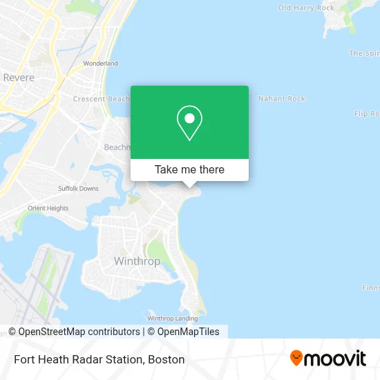
See Fort Heath Radar Station, Winthrop Town, on the map
Public Transit to Fort Heath Radar Station in Winthrop Town
Wondering how to get to Fort Heath Radar Station in Winthrop Town? Moovit helps you find the best way to get to Fort Heath Radar Station with step-by-step directions from the nearest public transit station.
Moovit provides free maps and live directions to help you navigate through your city. View schedules, routes, timetables, and find out how long does it take to get to Fort Heath Radar Station in real time.
Looking for the nearest stop or station to Fort Heath Radar Station? Check out this list of stops closest to your destination: Revere St Opp Summit Ave; Winthrop Landing; Orient Heights.
Bus: 119, 712.Subway: BLUE LINE.Ferry: WINTHROP FERRY, WINTHROP/QUINCY FERRY.
Want to see if there’s another route that gets you there at an earlier time? Moovit helps you find alternative routes or times. Get directions from and directions to Fort Heath Radar Station easily from the Moovit App or Website.
We make riding to Fort Heath Radar Station easy, which is why over 1.7 million users, including users in Winthrop Town, trust Moovit as the best app for public transit. You don’t need to download an individual bus app or train app, Moovit is your all-in-one transit app that helps you find the best bus time or train time available.
For information on prices of bus and subway, costs and ride fares to Fort Heath Radar Station, please check the Moovit app.
Use the app to navigate to popular places including to the airport, hospital, stadium, grocery store, mall, coffee shop, school, college, and university.
Location: Winthrop Town, Boston
- Winthrop Arms Restaurant,
- Cruise Planners,
- Halford Beach,
- Winthrop Beach,
- Belle Isle Section Winthrop Cemetery,
- Winthrop Marketplace (Winthrop Market Place),
- Winthrop Beach,
- Elite Embroidery & Screen Printing Company,
- Beachmont, Massachusetts,
- PC / Mac Computer Techs,
- Vuolo's,
- Broad Sound,
- Nachant Bay,
- Winthrop MA USA,
- Winthrop,
- Belle Isle Marsh,
- 93 Donnelly Sq,
- Belle Isle Lobster & Seafood,
- Beachmont Station,
- Print Boston
Places Near Fort Heath Radar Station (Winthrop Town)
- Boston Children's Hospital, Boston,
- North End, Boston,
- Cheers, Boston,
- Wang Theater, Boston,
- Boston Convention & Exhibition Center, Boston,
- Museum Of Science, Boston,
- Mgm Music Hall, Boston,
- House Of Blues, Boston,
- Boston Medical Center, Boston,
- Wilbur Theatre, Boston,
- Boston Common, Boston,
- Leader Bank Pavilion (Leader Bank Pavillion), Boston,
- Massachusetts General Hospital, Boston,
- Prudential Center, Boston,
- Castle Island, Boston,
- Td Garden, Boston,
- Faneuil Hall, Boston,
- Isabella Stewart Gardner Museum, Boston,
- Seaport District, Boston,
- Quincy Market, Boston
How to get to popular places in Boston with public transit
Get around Winthrop Town by public transit!
Traveling around Winthrop Town has never been so easy. See step by step directions as you travel to any attraction, street or major public transit station. View bus and train schedules, arrival times, service alerts and detailed routes on a map, so you know exactly how to get to anywhere in Winthrop Town.
When traveling to any destination around Winthrop Town use Moovit's Live Directions with Get Off Notifications to know exactly where and how far to walk, how long to wait for your line, and how many stops are left. Moovit will alert you when it's time to get off — no need to constantly re-check whether yours is the next stop.
Wondering how to use public transit in Winthrop Town or how to pay for public transit in Winthrop Town? Moovit public transit app can help you navigate your way with public transit easily, and at minimum cost. It includes public transit fees, ticket prices, and costs. Looking for a map of Winthrop Town public transit lines? Moovit public transit app shows all public transit maps in Winthrop Town with all Bus, Train, Subway and Ferry routes and stops on an interactive map.
Boston has 4 transit type(s), including: Bus, Train, Subway and Ferry, operated by several transit agencies, including MBTA, Southeastern Regional Transit Authority, MetroWest Regional Transit Authority, Rhode Island Public Transit Authority, WRTA, Lowell Regional Transit Authority, Merrimack Valley Transit, Montachusett Regional Transit Authority, Cape Cod Regional Transit Authority, Brockton Area Transit Authority, Martha's Vineyard Transit Authority, the WAVE - Nantucket Regional Transit Authority, GATRA, Cape Ann Transportation Authority and Massport