Directions to Fort Hill Square (Boston) with public transportation
The following transit lines have routes that pass near Fort Hill Square
 Bus: 17, 354, 501, 504, 92.
- Train: FRAMINGHAM/WORCESTER, HAVERHILL, LOWELL.
- Subway: GREEN LINE B, GREEN LINE D, GREEN LINE E, ORANGE LINE, RED LINE.
- Ferry: CHARLESTOWN FERRY.
How to get to Fort Hill Square by bus?
Click on the bus route to see step by step directions with maps, line arrival times and updated time schedules.
From Regent Theatre, Arlington
69 minFrom Arsenal Mall, Watertown Town
71 minFrom The Mall At Chestnut Hill, Newton
78 minFrom Astrazeneca Hope Lodge, Boston
48 minFrom Warrior Ice Arena, Boston
71 minFrom Qea, Quincy
107 minFrom Melrose, MA, Melrose
69 minFrom Watertown, MA, Watertown Town
54 minFrom Marina Bay, Quincy
141 minFrom Warren St, Boston
55 min
How to get to Fort Hill Square by train?
Click on the train route to see step by step directions with maps, line arrival times and updated time schedules.
How to get to Fort Hill Square by subway?
Click on the subway route to see step by step directions with maps, line arrival times and updated time schedules.
Bus stops near Fort Hill Square in Boston
Subway stations near Fort Hill Square in Boston
Ferry stations near Fort Hill Square in Boston
Bus lines to Fort Hill Square in Boston
- 4, North Station Via South Station,VIEW
- BLUE LINE SHUTTLE, Airport - Government Center (Express),VIEW
- BLUE LINE SHUTTLE, Airport - Government Center via Maverick,VIEW
- BLUE LINE SHUTTLE, Orient Heights - Government Center (Local),VIEW
- BLUE LINE SHUTTLE, Orient Heights - Government Center (Express),VIEW
- BLUE LINE SHUTTLE, Airport - Government Center (Local),VIEW
- 501, Downtown via Copley (Express) - Brighton via Copley (Express),VIEW
- 504, Downtown via Copley (Express) - Watertown via Copley and Newton Corner (Express),VIEW
- 505, Downtown (Express) - Waltham (Express),VIEW
- RED LINE SHUTTLE, Harvard - JFK/UMass via Congress Street,VIEW
- RED LINE SHUTTLE, Kendall/MIT - JFK/UMass,VIEW
- RED LINE SHUTTLE, Harvard - Broadway,VIEW
- RED LINE SHUTTLE, Kendall/MIT - Broadway via Downtown Crossing,VIEW
- RED LINE SHUTTLE, JFK/UMass - Kendall/MIT (Shuttle),VIEW
- 92, Sullivan,VIEW
- 93, Sullivan Via Navy Yard,VIEW
- 15, Haymarket Via Fields Corner & Nubian,VIEW
- 39, Haymarket Via Forest Hills,VIEW
- 57, Haymarket Via Kenmore,VIEW
- 7, Federal St,VIEW
What are the closest stations to Fort Hill Square?
The closest stations to Fort Hill Square are:
- Atlantic Ave @ State St is 26 yards away, 1 min walk.
- Aquarium is 60 yards away, 2 min walk.
- Long Wharf (South) is 97 yards away, 2 min walk.
- Aquarium - State St Opp Mckinley Sq is 185 yards away, 3 min walk.
- State Street is 188 yards away, 3 min walk.
- Federal St @ Franklin St is 360 yards away, 5 min walk.
- Devonshire St @ Milk St is 367 yards away, 5 min walk.
- Milk St @ Devonshire St is 378 yards away, 5 min walk.
- Federal St @ Matthews St is 413 yards away, 5 min walk.
- Central Wharf (South) is 668 yards away, 9 min walk.
- Rowes Wharf is 925 yards away, 12 min walk.
Which bus lines stop near Fort Hill Square?
These bus lines stop near Fort Hill Square: 17, 354, 501, 504, 92, SL4.
Which train lines stop near Fort Hill Square?
These train lines stop near Fort Hill Square: FRAMINGHAM/WORCESTER, HAVERHILL, LOWELL.
Which subway lines stop near Fort Hill Square?
These subway lines stop near Fort Hill Square: GREEN LINE B, GREEN LINE D, GREEN LINE E, ORANGE LINE, RED LINE.
What’s the nearest subway station to Fort Hill Square in Boston?
The nearest subway station to Fort Hill Square in Boston is Aquarium. It’s a 2 min walk away.
What’s the nearest bus station to Fort Hill Square in Boston?
The nearest bus station to Fort Hill Square in Boston is Atlantic Ave @ State St. It’s a 1 min walk away.
What’s the nearest ferry station to Fort Hill Square in Boston?
The nearest ferry station to Fort Hill Square in Boston is Long Wharf (South). It’s a 2 min walk away.
What time is the first subway to Fort Hill Square in Boston?
The BLUE LINE is the first subway that goes to Fort Hill Square in Boston. It stops nearby at 5:17 AM.
What time is the last subway to Fort Hill Square in Boston?
The BLUE LINE is the last subway that goes to Fort Hill Square in Boston. It stops nearby at 1:54 AM.
What time is the first bus to Fort Hill Square in Boston?
The 57 is the first bus that goes to Fort Hill Square in Boston. It stops nearby at 5:02 AM.
What time is the last bus to Fort Hill Square in Boston?
The 7 is the last bus that goes to Fort Hill Square in Boston. It stops nearby at 10:14 PM.
What time is the first ferry to Fort Hill Square in Boston?
The HINGHAM FERRY is the first ferry that goes to Fort Hill Square in Boston. It stops nearby at 6:30 AM.
What time is the last ferry to Fort Hill Square in Boston?
The HINGHAM FERRY is the last ferry that goes to Fort Hill Square in Boston. It stops nearby at 8:30 PM.
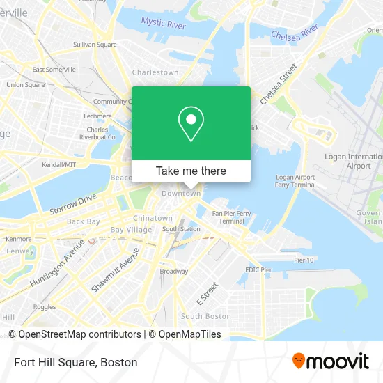
See Fort Hill Square, Boston, on the map
Public Transit to Fort Hill Square in Boston
Wondering how to get to Fort Hill Square in Boston? Moovit helps you find the best way to get to Fort Hill Square with step-by-step directions from the nearest public transit station.
Moovit provides free maps and live directions to help you navigate through your city. View schedules, routes, timetables, and find out how long does it take to get to Fort Hill Square in real time.
Looking for the nearest stop or station to Fort Hill Square? Check out this list of stops closest to your destination: Atlantic Ave @ State St; Aquarium; Long Wharf (South); Aquarium - State St Opp Mckinley Sq; State Street; Federal St @ Franklin St; Devonshire St @ Milk St; Milk St @ Devonshire St; Federal St @ Matthews St; Central Wharf (South); Rowes Wharf.
Bus: 17, 354, 501, 504, 92, SL4, 4, BLUE LINE SHUTTLE, BLUE LINE SHUTTLE, BLUE LINE SHUTTLE, BLUE LINE SHUTTLE, BLUE LINE SHUTTLE, 505, RED LINE SHUTTLE, RED LINE SHUTTLE.Train: FRAMINGHAM/WORCESTER, HAVERHILL, LOWELL.Subway: GREEN LINE B, GREEN LINE D, GREEN LINE E, ORANGE LINE, RED LINE, BLUE LINE.Ferry: CHARLESTOWN FERRY.
Want to see if there’s another route that gets you there at an earlier time? Moovit helps you find alternative routes or times. Get directions from and directions to Fort Hill Square easily from the Moovit App or Website.
We make riding to Fort Hill Square easy, which is why over 1.7 million users, including users in Boston, trust Moovit as the best app for public transit. You don’t need to download an individual bus app or train app, Moovit is your all-in-one transit app that helps you find the best bus time or train time available.
For information on prices of bus, subway and train, costs and ride fares to Fort Hill Square, please check the Moovit app.
Use the app to navigate to popular places including to the airport, hospital, stadium, grocery store, mall, coffee shop, school, college, and university.
Location: Boston
- Palm Restaurant,
- One Love Sports (Onelove Sports Academy),
- White Mountains Capital,
- Howl at the Moon,
- Christian Science Center- Belvidere/ Dalton,
- AAA Boston,
- One International Place,
- GMR Transcription Services,
- Keith Gaffney - Tiaa Wealth Management Advisor (Susan Plunkett - Tiaa Wealth Management Advisor),
- Downtown Boston Rotary Club,
- Sally,
- Clinton M,
- DataRobot,
- 125 High Street,
- Kane's Donuts,
- Kane's Donuts (Kanes Donuts),
- Kane's Donuts in Boston,
- Aviza Christian A,
- Wells Fargo Private Bank,
- Sarah Rimsky Levitin Attorney
Places Near Fort Hill Square (Boston)
- Museum Of Science, Boston,
- Quincy Market, Boston,
- Wilbur Theatre, Boston,
- Wang Theater, Boston,
- Faneuil Hall, Boston,
- North End, Boston,
- House Of Blues, Boston,
- Boston Common, Boston,
- Seaport District, Boston,
- Prudential Center, Boston,
- Cheers, Boston,
- Boston Children's Hospital, Boston,
- Mgm Music Hall, Boston,
- Boston Medical Center, Boston,
- Castle Island, Boston,
- Isabella Stewart Gardner Museum, Boston,
- Boston Convention & Exhibition Center, Boston,
- Massachusetts General Hospital, Boston,
- Td Garden, Boston,
- Leader Bank Pavilion (Leader Bank Pavillion), Boston
How to get to popular places in Boston with public transit
Get around Boston by public transit!
Traveling around Boston has never been so easy. See step by step directions as you travel to any attraction, street or major public transit station. View bus and train schedules, arrival times, service alerts and detailed routes on a map, so you know exactly how to get to anywhere in Boston.
When traveling to any destination around Boston use Moovit's Live Directions with Get Off Notifications to know exactly where and how far to walk, how long to wait for your line, and how many stops are left. Moovit will alert you when it's time to get off — no need to constantly re-check whether yours is the next stop.
Wondering how to use public transit in Boston or how to pay for public transit in Boston? Moovit public transit app can help you navigate your way with public transit easily, and at minimum cost. It includes public transit fees, ticket prices, and costs. Looking for a map of Boston public transit lines? Moovit public transit app shows all public transit maps in Boston with all Bus, Train, Subway and Ferry routes and stops on an interactive map.
Boston has 4 transit type(s), including: Bus, Train, Subway and Ferry, operated by several transit agencies, including MBTA, Southeastern Regional Transit Authority, MetroWest Regional Transit Authority, Rhode Island Public Transit Authority, WRTA, Lowell Regional Transit Authority, Merrimack Valley Transit, Montachusett Regional Transit Authority, Cape Cod Regional Transit Authority, Brockton Area Transit Authority, Martha's Vineyard Transit Authority, the WAVE - Nantucket Regional Transit Authority, GATRA, Cape Ann Transportation Authority and Massport