Directions to Fort Lauderdale with public transportation
The following transit lines have routes that pass near Fort Lauderdale
How to get to Fort Lauderdale by bus?
Click on the bus route to see step by step directions with maps, line arrival times and updated time schedules.
How to get to Fort Lauderdale by train?
Click on the train route to see step by step directions with maps, line arrival times and updated time schedules.
Bus stations near Fort Lauderdale
- Las Olas B/Se 12 A, 6 min walk,
- Us1/Broward B, 8 min walk,
- Us1/Ne 2 S, 9 min walk,
Ferry stations near Fort Lauderdale
- Laura Ward Riverwalk Plaza, 14 min walk,
Bus lines to Fort Lauderdale
- 11, Us 1 - Copans,
- 10, Central Terminal,
- 20, Broward Health North Via Northeast Transit Center,
What are the closest stations to Fort Lauderdale?
The closest stations to Fort Lauderdale are:
- Las Olas B/Se 12 A is 441 yards away, 6 min walk.
- Us1/Broward B is 643 yards away, 8 min walk.
- Us1/Ne 2 S is 694 yards away, 9 min walk.
- Laura Ward Riverwalk Plaza is 1149 yards away, 14 min walk.
Which bus lines stop near Fort Lauderdale?
These bus lines stop near Fort Lauderdale: 01, 10, 11, 30, 50.
Which train line stops near Fort Lauderdale?
BLFM
What’s the nearest bus stop to Fort Lauderdale?
The nearest bus stop to Fort Lauderdale is Las Olas B/Se 12 A. It’s a 6 min walk away.
What’s the nearest ferry station to Fort Lauderdale?
The nearest ferry station to Fort Lauderdale is Laura Ward Riverwalk Plaza. It’s a 14 min walk away.
What time is the first bus to Fort Lauderdale?
The 11 is the first bus that goes to Fort Lauderdale. It stops nearby at 5:26 AM.
What time is the last bus to Fort Lauderdale?
The 11 is the last bus that goes to Fort Lauderdale. It stops nearby at 11:40 PM.
What time is the first ferry to Fort Lauderdale?
The WATER TROLLEY is the first ferry that goes to Fort Lauderdale. It stops nearby at 10:00 AM.
What time is the last ferry to Fort Lauderdale?
The WATER TROLLEY is the last ferry that goes to Fort Lauderdale. It stops nearby at 10:20 PM.
How much is the train fare to Fort Lauderdale?
The train fare to Fort Lauderdale costs about $2.50 - $8.75.
How much is the bus fare to Fort Lauderdale?
The bus fare to Fort Lauderdale costs about $2.00.
See Fort Lauderdale on the map
Own work
Previously published: FlickrPublic Transportation to Fort Lauderdale
Wondering how to get to Fort Lauderdale, United States? Moovit helps you find the best way to get to Fort Lauderdale with step-by-step directions from the nearest public transit station.
Moovit provides free maps and live directions to help you navigate through your city. View schedules, routes, timetables, and find out how long does it take to get to Fort Lauderdale in real time.
Looking for the nearest stop or station to Fort Lauderdale? Check out this list of stops closest to your destination: Las Olas B/Se 12 A; Us1/Broward B; Us1/Ne 2 S; Laura Ward Riverwalk Plaza.
Bus: 01, 10, 11, 30, 50, 20.Train: BLFM.Ferry: WATER TROLLEY.
Want to see if there’s another route that gets you there at an earlier time? Moovit helps you find alternative routes or times. Get directions from and directions to Fort Lauderdale easily from the Moovit App or Website.
We make riding to Fort Lauderdale easy, which is why over 1.5 million users, including users in Fort Lauderdale, trust Moovit as the best app for public transit. You don’t need to download an individual bus app or train app, Moovit is your all-in-one transit app that helps you find the best bus time or train time available.
For information on prices of bus and train, costs and ride fares to Fort Lauderdale, please check the Moovit app.
Use the app to navigate to popular places including to the airport, hospital, stadium, grocery store, mall, coffee shop, school, college, and university.
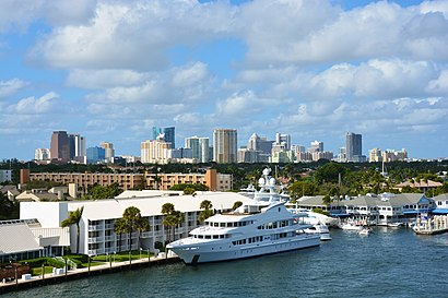
Fort Lauderdale Address: FL 33301 street in Fort Lauderdale
Own work
Previously published: FlickrAttractions near Fort Lauderdale
Biljana Baskot MD,Organic Day Spa Eleven Eleven,David B Levine do,Gym Issues,Brigadeiro Company,Tropical Tree Care,Lawn Love Lawn Care,Booyah Cleaning,Best Color Painting & Remodeling,Xigman,Barbara's Caning & Weaving,Sparkle2clean,New Life Landscaping & Lawn Care,Juan's Barber Studio,Michelle,American Graphic Designers,Notary Public Fort Lauderdale,U-Rentals - Fort Lauderdale,Crossing the Jordan Moving and Storage,DJ Andy KleinHow to get to popular attractions in Fort Lauderdale with public transit
Pompano Beach Service Plaza, Coral Springs-Margate,Coconut Creek, FL, Pompano Beach,Walmart Supercenter, Plantation,Publix, Miami,Lester's Diner, Fort Lauderdale,Miami Biltmore Hotel, Miami,The Breakers Palm Beach, West Palm Beach,The Pub Pembroke, Miramar-Pembroke Pines,West Palm Beach, West Palm Beach,Target, Deerfield Beach,Miller's Ale House - Miami Doral, North Westside,The Cheesecake Factory, Boca Raton,City of Delray Beach, Boynton Beach-Delray Beach,Walmart Supercenter, Hallandale Beach,Roger Dean Stadium, Jupiter,Walmart Supercenter, Miramar-Pembroke Pines,Fresh Market, Miami,The Cheesecake Factory, West Palm Beach,Greenacres, FL, Lake Worth,Makoto, Miami BeachGet around Miami by public transit!
Traveling around Miami has never been so easy. See step by step directions as you travel to any attraction, street or major public transit station. View bus and train schedules, arrival times, service alerts and detailed routes on a map, so you know exactly how to get to anywhere in Miami.
When traveling to any destination around Miami use Moovit's Live Directions with Get Off Notifications to know exactly where and how far to walk, how long to wait for your line, and how many stops are left. Moovit will alert you when it's time to get off — no need to constantly re-check whether yours is the next stop.
Wondering how to use public transit in Miami or how to pay for public transit in Miami? Moovit public transit app can help you navigate your way with public transit easily, and at minimum cost. It includes public transit fees, ticket prices, and costs. Looking for a map of Miami public transit lines? Moovit public transit app shows all public transit maps in Miami with all Bus, Train, Subway, Light Rail and Ferry routes and stops on an interactive map.
Miami has 5 transit type(s), including: Bus, Train, Subway, Light Rail and Ferry, operated by several transit agencies, including Miami-Dade Transit, Miami Dade Transit-Rail, Tri-Rail, Broward County Transit, Palm Tran, Brightline, MARTY, City of Homestead Trolley, Key West Transit, Treasure Coast Connector, GoLine IRT, Amtrak, Greyhound-us, Megabus, FlixBus-us