See Fort Pitt Tunnel, Pittsburgh, on the map
Directions to Fort Pitt Tunnel (Pittsburgh) with public transportation
The following transit lines have routes that pass near Fort Pitt Tunnel
 Bus:
Bus: - Funicular:
How to get to Fort Pitt Tunnel by bus?
Click on the bus route to see step by step directions with maps, line arrival times and updated time schedules.
How to get to Fort Pitt Tunnel by {{TRANSIT_TYPE}}?
Click on the {{TRANSIT_TYPE}} route to see step by step directions with maps, line arrival times and updated time schedules.
Which bus line stops near Fort Pitt Tunnel?
40
Which funicular line stops near Fort Pitt Tunnel?
DQI
See Fort Pitt Tunnel, Pittsburgh, on the map
Public Transit to Fort Pitt Tunnel in Pittsburgh
Wondering how to get to Fort Pitt Tunnel in Pittsburgh, United States? Moovit helps you find the best way to get to Fort Pitt Tunnel with step-by-step directions from the nearest public transit station.
Moovit provides free maps and live directions to help you navigate through your city. View schedules, routes, timetables, and find out how long does it take to get to Fort Pitt Tunnel in real time.
Bus:Funicular:
Want to see if there’s another route that gets you there at an earlier time? Moovit helps you find alternative routes or times. Get directions from and directions to Fort Pitt Tunnel easily from the Moovit App or Website.
We make riding to Fort Pitt Tunnel easy, which is why over 1.5 million users, including users in Pittsburgh, trust Moovit as the best app for public transit. You don’t need to download an individual bus app or train app, Moovit is your all-in-one transit app that helps you find the best bus time or train time available.
For information on prices of bus and funicular, costs and ride fares to Fort Pitt Tunnel, please check the Moovit app.
Use the app to navigate to popular places including to the airport, hospital, stadium, grocery store, mall, coffee shop, school, college, and university.
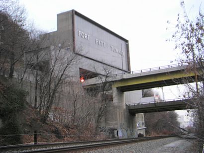
Fort Pitt Tunnel Address: Pittsburgh, PA 15211 street in Pittsburgh
Attractions near Fort Pitt Tunnel
I-376,Sleep Study,Fabrizi Law Offices,HealthAmerica,135 Olympia Street,The Grind,The Sewer Shack,Grandview After Dark,Tony's,Drew's Elf Hut,100 La Belle St,McCrory Kenneth C CPA,One Thousand Grandview,Labelle St,John Satellites Antennas,Clock Doctor,Jetti AT&T,Open Options,Grandview Capital Corp,AJP PropertiesHow to get to popular attractions in Pittsburgh with public transit
APlus, Mount Oliver,Bidwell Training Center, Pittsburgh,Carnegie Park And Ride, Carnegie,New Kensington, New Kensington,Upmc Saint Margaret, Pittsburgh,Edgewood Towne Center, Edgewood,South Hills Medical Building, Jefferson Hills,UPMC St. Margaret Hospital - Department Of Radiology, Pittsburgh,Dollar Bank, Pittsburgh,Bar Louie, Pittsburgh,Sharpsburg, Sharpsburg,Pnc Firstside Center, Pittsburgh,Green Tree, Green Tree,Hillman Cancer Center, Pittsburgh,Tower at Pnc Plaza, Pittsburgh,O1 Ross Flyer, Pittsburgh,Baja Bar And Grill,South Hills Beauty Academy, Dormont,Dick's Sporting Goods Pittsburgh Marathon, Pittsburgh,Carrick, PittsburghGet around Pittsburgh by public transit!
Traveling around Pittsburgh has never been so easy. See step by step directions as you travel to any attraction, street or major public transit station. View bus and train schedules, arrival times, service alerts and detailed routes on a map, so you know exactly how to get to anywhere in Pittsburgh.
When traveling to any destination around Pittsburgh use Moovit's Live Directions with Get Off Notifications to know exactly where and how far to walk, how long to wait for your line, and how many stops are left. Moovit will alert you when it's time to get off — no need to constantly re-check whether yours is the next stop.
Wondering how to use public transit in Pittsburgh or how to pay for public transit in Pittsburgh? Moovit public transit app can help you navigate your way with public transit easily, and at minimum cost. It includes public transit fees, ticket prices, and costs. Looking for a map of Pittsburgh public transit lines? Moovit public transit app shows all public transit maps in Pittsburgh with all bus or funicular routes and stops on an interactive map.
Pittsburgh has 2 transit type(s), including: bus or funicular, operated by several transit agencies, including Pittsburgh Regional Transit, Pittsburgh Regional Transit, CamTran, Amtran, Mid Mon Valley Transit, BCTA, Butler Transit Authority, IndiGo, Area Transportation Authority, Freedom Transit, Pittsburgh Regional Transit, Mountain Line Transit Authority, Megabus, Greyhound-us and Fullington Trailways