Directions to Fort Storage (Gloucester) with public transportation
The following transit lines have routes that pass near Fort Storage
How to get to Fort Storage by bus?
Click on the bus route to see step by step directions with maps, line arrival times and updated time schedules.
How to get to Fort Storage by train?
Click on the train route to see step by step directions with maps, line arrival times and updated time schedules.
Bus stops near Fort Storage in Gloucester
Train station near Fort Storage in Gloucester
- Gloucester, 8 min walk,VIEW
Bus lines to Fort Storage in Gloucester
- GLOUCESTER CROSSING/BUSINESS EXPRESS, Senior Center - Dunkin' Donuts,VIEW
- GLOUCESTER - ROCKPORT VIA EASTERN AVE, Gloucester-Rockport via Eastern Avenue,VIEW
- GLOUCESTER - ROCKPORT VIA THATCHER ROAD, Gloucester-Rockport via Thatcher Rd,VIEW
- GLOUCESTER - WEST GLOUCESTER - ESSEX, Gloucester-West Gloucester-Essex Town Line,VIEW
- LANESVILLE, Gloucester-Rockport Via Lanesville,VIEW
- MAGNOLIA, Gloucester-Magnolia,VIEW
- SATURDAY MALL SHUTTLE, Danvers and Peabody Malls,VIEW
- GLOUCESTER CROSSING/BLACKBURN EXPRESS, Rose Baker Senior Center,VIEW
What are the closest stations to Fort Storage?
The closest stations to Fort Storage are:
- Post Office - City Hall is 126 yards away, 2 min walk.
- Main St & Pleasant St is 227 yards away, 3 min walk.
- Main St & Hancock St is 258 yards away, 4 min walk.
- Gloucester is 640 yards away, 8 min walk.
Which bus lines stop near Fort Storage?
These bus lines stop near Fort Storage: BEVERLY COMMUTER, CITY OF BEVERLY SHUTTLE.
Which train line stops near Fort Storage?
NEWBURYPORT/ROCKPORT (#27 | Rockport)
What’s the nearest train station to Fort Storage in Gloucester?
The nearest train station to Fort Storage in Gloucester is Gloucester. It’s a 8 min walk away.
What’s the nearest bus station to Fort Storage in Gloucester?
The nearest bus station to Fort Storage in Gloucester is Post Office - City Hall. It’s a 2 min walk away.
What time is the first train to Fort Storage in Gloucester?
The NEWBURYPORT/ROCKPORT is the first train that goes to Fort Storage in Gloucester. It stops nearby at 5:14 AM.
What time is the last train to Fort Storage in Gloucester?
The NEWBURYPORT/ROCKPORT is the last train that goes to Fort Storage in Gloucester. It stops nearby at 12:47 AM.
What time is the first bus to Fort Storage in Gloucester?
The GLOUCESTER CROSSING/BLACKBURN EXPRESS is the first bus that goes to Fort Storage in Gloucester. It stops nearby at 6:20 AM.
What time is the last bus to Fort Storage in Gloucester?
The GLOUCESTER CROSSING/BUSINESS EXPRESS is the last bus that goes to Fort Storage in Gloucester. It stops nearby at 6:50 PM.
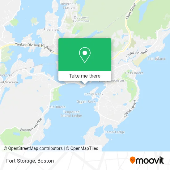
See Fort Storage, Gloucester, on the map
Public Transit to Fort Storage in Gloucester
Wondering how to get to Fort Storage in Gloucester? Moovit helps you find the best way to get to Fort Storage with step-by-step directions from the nearest public transit station.
Moovit provides free maps and live directions to help you navigate through your city. View schedules, routes, timetables, and find out how long does it take to get to Fort Storage in real time.
Looking for the nearest stop or station to Fort Storage? Check out this list of stops closest to your destination: Post Office - City Hall; Main St & Pleasant St; Main St & Hancock St; Gloucester.
Bus: BEVERLY COMMUTER, CITY OF BEVERLY SHUTTLE, GLOUCESTER CROSSING/BUSINESS EXPRESS, GLOUCESTER - ROCKPORT VIA EASTERN AVE, GLOUCESTER - ROCKPORT VIA THATCHER ROAD, GLOUCESTER - WEST GLOUCESTER - ESSEX, LANESVILLE, MAGNOLIA, GLOUCESTER CROSSING/BLACKBURN EXPRESS.Train: NEWBURYPORT/ROCKPORT.
Want to see if there’s another route that gets you there at an earlier time? Moovit helps you find alternative routes or times. Get directions from and directions to Fort Storage easily from the Moovit App or Website.
We make riding to Fort Storage easy, which is why over 1.7 million users, including users in Gloucester, trust Moovit as the best app for public transit. You don’t need to download an individual bus app or train app, Moovit is your all-in-one transit app that helps you find the best bus time or train time available.
For information on prices of train and bus, costs and ride fares to Fort Storage, please check the Moovit app.
Use the app to navigate to popular places including to the airport, hospital, stadium, grocery store, mall, coffee shop, school, college, and university.
Fort Storage Address: 104 Commercial St street in Gloucester
- Giuseppe & Caterina,
- Shop Beauport Hotel,
- Beauport Hotel Gloucester in Gloucester,
- Beauport Hotel Gloucester,
- Cake Ann,
- Audrey's Vendors List,
- Allied Cold Storage,
- Angelica Seafoods,
- EV Charging Station,
- Yankee Pedal,
- Oak To Ember,
- PMC Realty Trust,
- Outfitter Financial,
- Proteus Industries,
- Turningpoint Systems,
- Windfish Private Tours and Fishing Charters,
- Topside Bistro,
- Evenly Orthodontics,
- Cape Ann Weaver,
- Gangnam Gloucester
Places Near Fort Storage (Gloucester)
- Prudential Center, Boston,
- Leader Bank Pavilion (Leader Bank Pavillion), Boston,
- Td Garden, Boston,
- Wang Theater, Boston,
- Massachusetts General Hospital, Boston,
- Isabella Stewart Gardner Museum, Boston,
- Museum Of Science, Boston,
- Boston Children's Hospital, Boston,
- Mgm Music Hall, Boston,
- Quincy Market, Boston,
- Wilbur Theatre, Boston,
- Boston Convention & Exhibition Center, Boston,
- North End, Boston,
- Cheers, Boston,
- Seaport District, Boston,
- Faneuil Hall, Boston,
- House Of Blues, Boston,
- Boston Medical Center, Boston,
- Boston Common, Boston,
- Castle Island, Boston
How to get to popular places in Boston with public transit
Get around Gloucester by public transit!
Traveling around Gloucester has never been so easy. See step by step directions as you travel to any attraction, street or major public transit station. View bus and train schedules, arrival times, service alerts and detailed routes on a map, so you know exactly how to get to anywhere in Gloucester.
When traveling to any destination around Gloucester use Moovit's Live Directions with Get Off Notifications to know exactly where and how far to walk, how long to wait for your line, and how many stops are left. Moovit will alert you when it's time to get off — no need to constantly re-check whether yours is the next stop.
Wondering how to use public transit in Gloucester or how to pay for public transit in Gloucester? Moovit public transit app can help you navigate your way with public transit easily, and at minimum cost. It includes public transit fees, ticket prices, and costs. Looking for a map of Gloucester public transit lines? Moovit public transit app shows all public transit maps in Gloucester with all Bus, Train, Subway and Ferry routes and stops on an interactive map.
Boston has 4 transit type(s), including: Bus, Train, Subway and Ferry, operated by several transit agencies, including MBTA, Southeastern Regional Transit Authority, MetroWest Regional Transit Authority, Rhode Island Public Transit Authority, WRTA, Lowell Regional Transit Authority, Merrimack Valley Transit, Montachusett Regional Transit Authority, Cape Cod Regional Transit Authority, Brockton Area Transit Authority, Martha's Vineyard Transit Authority, the WAVE - Nantucket Regional Transit Authority, GATRA, Cape Ann Transportation Authority and Massport
Public transit lines with stations closest to Fort Storage in Gloucester
Train lines with stations closest to Fort Storage in Gloucester
Bus lines with stations closest to Fort Storage in Gloucester
Main St & Pleasant St
 GLOUCESTER - ROCKPORT VIA EASTERN AVEGloucester-Rockport via Eastern Avenue
- GLOUCESTER - ROCKPORT VIA THATCHER ROADGloucester-Rockport via Thatcher Rd
- GLOUCESTER - WEST GLOUCESTER - ESSEXGloucester-West Gloucester-Essex Town Line
- LANESVILLEGloucester-Rockport Via Lanesville
- MAGNOLIAGloucester-Magnolia