See Fort Totten Metro, Washington, on the map
Directions to Fort Totten Metro (Washington) with public transportation
The following transit lines have routes that pass near Fort Totten Metro
 Bus:
Bus: - Metro:
How to get to Fort Totten Metro by bus?
Click on the bus route to see step by step directions with maps, line arrival times and updated time schedules.
How to get to Fort Totten Metro by metro?
Click on the metro route to see step by step directions with maps, line arrival times and updated time schedules.
Bus stations near Fort Totten Metro in Washington
- Fort Totten Station + Bus Bay A,1 min walk,
- Ft Totten Station & Bus Bay B & C,1 min walk,
- Ft Totten Station + Bus Bay D,2 min walk,
- Ft Totten Station & Bus Bay E, F, G,2 min walk,
- Fort Totten Station + Bus Bay H,3 min walk,
- Takoma,42 min walk,
Metro stations near Fort Totten Metro in Washington
- Georgia Ave - Petworth,38 min walk,
- Brookland-Cua,40 min walk,
Bus lines to Fort Totten Metro in Washington
- RL,North To Glenmont,
- K6,North To White Oak,
- K9,South To Fort Totten,
- RDXA,FOREST GLEN - FORT TOTTEN,
- RDXB,SILVER SPRING - FORT TOTTEN,
- RL1,GLENMONT SHUTTLE,
- 60,FORT TOTTEN-PETWORTH,
- 64,FORT TOTTEN-FEDERAL TRIANGLE,
- R1,North To Adelphi,
- R2,South To Fort Totten,
- E2,IVY CITY-FORT TOTTEN,
- E4,MILITARY ROAD-CROSSTOWN,
- 80,NORTH CAPITOL STREET,
- K2,South To Fort Totten,
- F6,East To New Carrollton,
- METRO STATION CLOSURE SHUTTLE,Fort Totten Metro,
What are the closest stations to Fort Totten Metro?
The closest stations to Fort Totten Metro are:
- Fort Totten Station + Bus Bay A is 22 yards away, 1 min walk.
- Ft Totten Station & Bus Bay B & C is 22 yards away, 1 min walk.
- Ft Totten Station + Bus Bay D is 89 yards away, 2 min walk.
- Ft Totten Station & Bus Bay E, F, G is 106 yards away, 2 min walk.
- Fort Totten Station + Bus Bay H is 177 yards away, 3 min walk.
- Georgia Ave - Petworth is 3197 yards away, 38 min walk.
- Brookland-Cua is 3330 yards away, 40 min walk.
- Takoma is 3548 yards away, 42 min walk.
Which bus lines stop near Fort Totten Metro?
These bus lines stop near Fort Totten Metro: 64, 80, R2.
Which metro lines stop near Fort Totten Metro?
These metro lines stop near Fort Totten Metro: METRORAIL RED LINE, METRORAIL YELLOW LINE.
What’s the nearest bus stop to Fort Totten Metro in Washington?
The nearest bus stops to Fort Totten Metro in Washington are Fort Totten Station + Bus Bay A and Ft Totten Station & Bus Bay B & C. The closest one is a 1 min walk away.
See Fort Totten Metro, Washington, on the map
Public Transit to Fort Totten Metro in Washington
Wondering how to get to Fort Totten Metro in Washington, United States? Moovit helps you find the best way to get to Fort Totten Metro with step-by-step directions from the nearest public transit station.
Moovit provides free maps and live directions to help you navigate through your city. View schedules, routes, timetables, and find out how long does it take to get to Fort Totten Metro in real time.
Looking for the nearest stop or station to Fort Totten Metro? Check out this list of stops closest to your destination: Fort Totten Station + Bus Bay A; Ft Totten Station & Bus Bay B & C; Ft Totten Station + Bus Bay D; Ft Totten Station & Bus Bay E; Fort Totten Station + Bus Bay H; Georgia Ave - Petworth; Brookland-Cua; Takoma.
Bus:Metro:
Want to see if there’s another route that gets you there at an earlier time? Moovit helps you find alternative routes or times. Get directions from and directions to Fort Totten Metro easily from the Moovit App or Website.
We make riding to Fort Totten Metro easy, which is why over 1.5 million users, including users in Washington, trust Moovit as the best app for public transit. You don’t need to download an individual bus app or train app, Moovit is your all-in-one transit app that helps you find the best bus time or train time available.
For information on prices of metro and bus, costs and ride fares to Fort Totten Metro, please check the Moovit app.
Use the app to navigate to popular places including to the airport, hospital, stadium, grocery store, mall, coffee shop, school, college, and university.
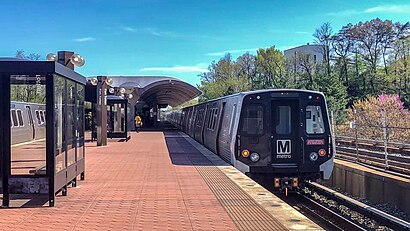
Fort Totten Metro Address: Galloway Street Northeast street in Washington
Attractions near Fort Totten Metro
Metro-Fort Totten,Fort Totten Metro Parking Lot,Ft Totten Station & Alighting Only,WMATA Green Line Metro,Calanderson House,64 Bus Stop Fort Totten,R2 To Calverton,5210 3rd Street Northeast,Keyme,E4 WMATA Bus,Kennedy & 3rd,Kennedy St 3rd St NE,Wook,Fort Totten,Riggs 1st,Keyme,Jefferson St and South Ave,Jefferson St South Dakota,South Dakota NE Jefferson St NE,Meow Wolf DcHow to get to popular attractions in Washington with public transit
Baltimore Farmers' Market & Bazaar, Baltimore,Under Armour, Baltimore,Agora, Washington,White Flint Metro Station, Montgomery County,Shaw's Tavern, Washington,Dumfries, VA, Prince William County,Big Bear Cafe, Washington,Toki Underground, Washington,Sticky Rice, Washington,Damascus, MD, Montgomery County,Manassas, VA, Manassas,New Psalmist Baptist Church, Baltimore County,Earth Treks Climbing Center, Montgomery County,Smith Commons, Washington,Lyon Hall, Arlington County,Gordon Biersch Brewery Restaurant, Fairfax County,Bluejacket Brewery, Washington,Howard Community College, Howard County,Costco Wholesale, Howard County,Sweetwater Tavern, Fairfax CountyGet around Washington by public transit!
Traveling around Washington has never been so easy. See step by step directions as you travel to any attraction, street or major public transit station. View bus and train schedules, arrival times, service alerts and detailed routes on a map, so you know exactly how to get to anywhere in Washington.
When traveling to any destination around Washington use Moovit's Live Directions with Get Off Notifications to know exactly where and how far to walk, how long to wait for your line, and how many stops are left. Moovit will alert you when it's time to get off — no need to constantly re-check whether yours is the next stop.
Wondering how to use public transit in Washington or how to pay for public transit in Washington? Moovit public transit app can help you navigate your way with public transit easily, and at minimum cost. It includes public transit fees, ticket prices, and costs. Looking for a map of Washington public transit lines? Moovit public transit app shows all public transit maps in Washington with all metro or bus routes and stops on an interactive map.
Washington has 2 transit type(s), including: metro or bus, operated by several transit agencies, including WMATA, WMATA, Montgomery County Ride On, Fairfax Connector, TheBus, DC Circulator, MDOT MTA, Marc, MDOT MTA, MDOT MTA, Virginia Railway Express (VRE), PRTC, DASH - Alexandria, Arlington Transit (ART) and DC Streetcar