Directions to Fortefarma Colombo with public transportation
The following transit lines have routes that pass near Fortefarma Colombo
How to get to Fortefarma Colombo by bus?
Click on the bus route to see step by step directions with maps, line arrival times and updated time schedules.
From São Gabriel
35 minFrom Centro Espirita Aprendizes Da Verdade
70 minFrom Rua Lodovico Geronazzo
56 minFrom Avenida Monteiro Tourinho
57 minFrom Santa Candida
38 minFrom Terminal Almirante Tamandaré
72 minFrom Atuba
52 minFrom UPA 24h - Unidade de Pronto Atendimento Boa Vista
42 minFrom Guaraituba
66 minFrom Jardim Graziela
49 min
Bus stops near Fortefarma Colombo
Bus lines to Fortefarma Colombo
- U01 SEDE / MARACANÃ, Terminal Maracanã → Terminal Sede Colombo,VIEW
- U02 PARQUE EMBU / JARDIM FLORENÇA, Parque Embu → Jardim Florença,VIEW
- U05 CAPIVARI, Capivari → Terminal Sede Colombo,VIEW
- U08 GRUTA BACAETAVA, Terminal Sede Colombo → Morro Grande,VIEW
- U11 ITAJACURU / SANTA GEMA (IMBUIAL), Terminal Sede Colombo ↺ Itajacuru / Santa Gema (Circular),VIEW
- S16 GUARACI, Terminal Sede Colombo → Terminal Roça Grande,VIEW
- S19 SEDE / ROÇA GRANDE, Terminal Roça Grande → Terminal Sede Colombo,VIEW
- B72 COLOMBO / GUADALUPE (VIA T. ROÇA GRANDE), Terminal Sede Colombo → Terminal Guadalupe,VIEW
- I91 TAMANDARÉ / COLOMBO, Colombo (Hospital São Rafael de Arcanjo) → Terminal Tamandaré,VIEW
What are the closest stations to Fortefarma Colombo?
The closest stations to Fortefarma Colombo are:
- R. Venâncio Trevisan, 103 is 136 meters away, 2 min walk.
- R. José Leal Fontoura, 226 is 392 meters away, 6 min walk.
Which bus lines stop near Fortefarma Colombo?
These bus lines stop near Fortefarma Colombo: B72 COLOMBO / GUADALUPE (VIA T. ROÇA GRANDE), U01 SEDE / MARACANÃ.
What’s the nearest bus station to Fortefarma Colombo?
The nearest bus station to Fortefarma Colombo is R. Venâncio Trevisan, 103. It’s a 2 min walk away.
What time is the first bus to Fortefarma Colombo?
The B72 COLOMBO / GUADALUPE (VIA T. ROÇA GRANDE) is the first bus that goes to Fortefarma Colombo. It stops nearby at 5:03 AM.
What time is the last bus to Fortefarma Colombo?
The B72 COLOMBO / GUADALUPE (VIA T. ROÇA GRANDE) is the last bus that goes to Fortefarma Colombo. It stops nearby at 1:22 AM.
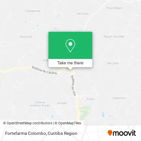
See Fortefarma Colombo on the map
Public Transportation to Fortefarma Colombo
Wondering how to get to Fortefarma Colombo? Moovit helps you find the best way to get to Fortefarma Colombo with step-by-step directions from the nearest public transit station.
Moovit provides free maps and live directions to help you navigate through your city. View schedules, routes, timetables, and find out how long does it take to get to Fortefarma Colombo in real time.
Looking for the nearest stop or station to Fortefarma Colombo? Check out this list of stops closest to your destination: R. Venâncio Trevisan; R. José Leal Fontoura.
Bus: B72 COLOMBO / GUADALUPE (VIA T. ROÇA GRANDE), U01 SEDE / MARACANÃ, U02 PARQUE EMBU / JARDIM FLORENÇA, U05 CAPIVARI, U08 GRUTA BACAETAVA, U11 ITAJACURU / SANTA GEMA (IMBUIAL), I91 TAMANDARÉ / COLOMBO.
Want to see if there’s another route that gets you there at an earlier time? Moovit helps you find alternative routes or times. Get directions from and directions to Fortefarma Colombo easily from the Moovit App or Website.
We make riding to Fortefarma Colombo easy, which is why over 1.5 million users, including users in Colombo, trust Moovit as the best app for public transit. You don’t need to download an individual bus app or train app, Moovit is your all-in-one transit app that helps you find the best bus time or train time available.
For information on prices of bus, costs and ride fares to Fortefarma Colombo, please check the Moovit app.
Use the app to navigate to popular places including to the airport, hospital, stadium, grocery store, mall, coffee shop, school, college, and university.
Fortefarma Colombo Address: Rua Padre Francisco Bonato, 334 Centro Colombo-PR 83414-170 street in Colombo
- Loja do Barulho,
- Farmácia Super Popular,
- Farmacia Oficinal,
- Banco do Brasil,
- Lojas de Móveis Sumar,
- correios - agência centro de colombo,
- ForteFarma,
- M.Dall Acqua Incorporadora,
- AC Colombo,
- Gralha Azul Conservação e Limpeza,
- Vara de Família de Colombo,
- Odontomax,
- Raio de Sol Confeitaria Artesanal,
- Odonto Pinho,
- Acoscor,
- Supermercado Rio Verde,
- Rio Verde,
- Casa Maringa Colombo,
- Armazem da Casa,
- Mundo Animal Veterinária - Pet Shop
Places Near Fortefarma Colombo
- Shopping Palladium, Portão,
- Pontifícia Universidade Católica do Paraná (PUCPR), Prado Velho,
- Hospital Madalena Sofia, Bairro Alto,
- Shopping Estação, Rebouças,
- Arena Da Baixada - Curitiba,
- Hospital Angelina Caron, Campina Grande Do Sul,
- Hospital Universitário Evangélico de Curitiba, Bigorrilho,
- Rua Martim Afonso 558, Mercês,
- Hhhhh, Fazendinha,
- Hospital Erasto Gaertner, Jardim Das Américas,
- Hospital do Rocio, Campo,
- Hospital de Clínicas (HC - UFPR), Centro,
- Parque Barigui, Mercês,
- Jardim Botânico de Curitiba PR, Centro,
- Rua General Mário Tourinho, Campina Do Siqueira,
- Hospital Da Cruz Vermelha, Batel,
- Hospital Nossa Senhora Das Graças, Mercês,
- Campo Largo, Campo,
- Jockey Plaza Shopping Center, Tarumã,
- Park Shopping Barigüi, Mossunguê
How to get to popular places in Curitiba Region with public transit
Get around Colombo by public transit!
Traveling around Colombo has never been so easy. See step by step directions as you travel to any attraction, street or major public transit station. View bus and train schedules, arrival times, service alerts and detailed routes on a map, so you know exactly how to get to anywhere in Colombo.
When traveling to any destination around Colombo use Moovit's Live Directions with Get Off Notifications to know exactly where and how far to walk, how long to wait for your line, and how many stops are left. Moovit will alert you when it's time to get off — no need to constantly re-check whether yours is the next stop.
Wondering how to use public transit in Colombo or how to pay for public transit in Colombo? Moovit public transit app can help you navigate your way with public transit easily, and at minimum cost. It includes public transit fees, ticket prices, and costs. Looking for a map of Colombo public transit lines? Moovit public transit app shows all public transit maps in Colombo with all Bus and Cable Car routes and stops on an interactive map.
Curitiba Region has 2 transit type(s), including: Bus and Cable Car, operated by several transit agencies, including Sistema Integrado de Mobilidade (URBS), Sistema Integrado de Mobilidade (AMEP), URBS (Cartões bancários e Dinheiro), URBS (Cartões bancários / Cartão URBS), AMEP (Cartões bancários / Cartão MetroCard), AMEP (Cartões bancários / Cartão MetroCard / Dinheiro), Viação Colombo (Dinheiro), TRIAR (Cartão TRIAR / Dinheiro), Empresa Curitiba Cerro Azul (Dinheiro), Expresso Nossa Senhora da Penha (Dinheiro), Empresa Campo Alto Tijucas (Dinheiro), Auto Viação São José (Cartão VEM / Dinheiro), BRT S/A (Cartão VEM / Dinheiro), TransPiedade (Cartão Cidadão / Dinheiro) and Oceânica Sul (Cartão Transporte / Dinheiro)