Directions to Fox And Hound Tavern (Quincy) with public transportation
The following transit lines have routes that pass near Fox And Hound Tavern
 Bus: 210, 216.
- Train: FALL RIVER/NEW BEDFORD, GREENBUSH.
- Subway: RED LINE.
How to get to Fox And Hound Tavern by bus?
Click on the bus route to see step by step directions with maps, line arrival times and updated time schedules.
From Hampton Inn Boston Seaport District (Hampton Inn-Hampton Inn Boston), Boston
105 minFrom Element Boston Seaport, Boston
94 minFrom Hingham, MA, Hingham
47 minFrom Homewood Suites-Boston Seaport District, Boston
106 minFrom 240 Mount Vernon Street, Boston
85 minFrom Andrew Station - MBTA - Red Line, Boston
70 minFrom Childrens Museum, Boston
69 minFrom Aloft Boston Seaport, Boston
95 minFrom Dolphin Day Surgery Waiting Area, Weymouth Town
62 minFrom Curry College, Milton
80 min
How to get to Fox And Hound Tavern by train?
Click on the train route to see step by step directions with maps, line arrival times and updated time schedules.
From Hampton Inn Boston Seaport District (Hampton Inn-Hampton Inn Boston), Boston
59 minFrom Element Boston Seaport, Boston
59 minFrom Homewood Suites-Boston Seaport District, Boston
59 minFrom 240 Mount Vernon Street, Boston
66 minFrom Andrew Station - MBTA - Red Line, Boston
91 minFrom Childrens Museum, Boston
81 minFrom Aloft Boston Seaport, Boston
58 minFrom Curry College, Milton
97 min
How to get to Fox And Hound Tavern by subway?
Click on the subway route to see step by step directions with maps, line arrival times and updated time schedules.
From Hampton Inn Boston Seaport District (Hampton Inn-Hampton Inn Boston), Boston
61 minFrom Element Boston Seaport, Boston
54 minFrom Homewood Suites-Boston Seaport District, Boston
61 minFrom 240 Mount Vernon Street, Boston
38 minFrom Andrew Station - MBTA - Red Line, Boston
36 minFrom Childrens Museum, Boston
56 minFrom Aloft Boston Seaport, Boston
55 min
Bus stop near Fox And Hound Tavern in Quincy
- Sea St @ Cemetery, 3 min walk,VIEW
Subway station near Fox And Hound Tavern in Quincy
- Wollaston, 35 min walk,VIEW
Bus lines to Fox And Hound Tavern in Quincy
- 216, Quincy Center,VIEW
What are the closest stations to Fox And Hound Tavern?
The closest stations to Fox And Hound Tavern are:
- Sea St @ Cemetery is 177 yards away, 3 min walk.
- Wollaston is 2972 yards away, 35 min walk.
Which bus lines stop near Fox And Hound Tavern?
These bus lines stop near Fox And Hound Tavern: 210, 216.
Which train lines stop near Fox And Hound Tavern?
These train lines stop near Fox And Hound Tavern: FALL RIVER/NEW BEDFORD, GREENBUSH.
Which subway line stops near Fox And Hound Tavern?
RED LINE (Ashmont/Braintree)
What’s the nearest bus station to Fox And Hound Tavern in Quincy?
The nearest bus station to Fox And Hound Tavern in Quincy is Sea St @ Cemetery. It’s a 3 min walk away.
What time is the first subway to Fox And Hound Tavern in Quincy?
The RED LINE is the first subway that goes to Fox And Hound Tavern in Quincy. It stops nearby at 5:18 AM.
What time is the last subway to Fox And Hound Tavern in Quincy?
The RED LINE is the last subway that goes to Fox And Hound Tavern in Quincy. It stops nearby at 1:49 AM.
What time is the first bus to Fox And Hound Tavern in Quincy?
The 216 is the first bus that goes to Fox And Hound Tavern in Quincy. It stops nearby at 4:41 AM.
What time is the last bus to Fox And Hound Tavern in Quincy?
The 216 is the last bus that goes to Fox And Hound Tavern in Quincy. It stops nearby at 1:28 AM.
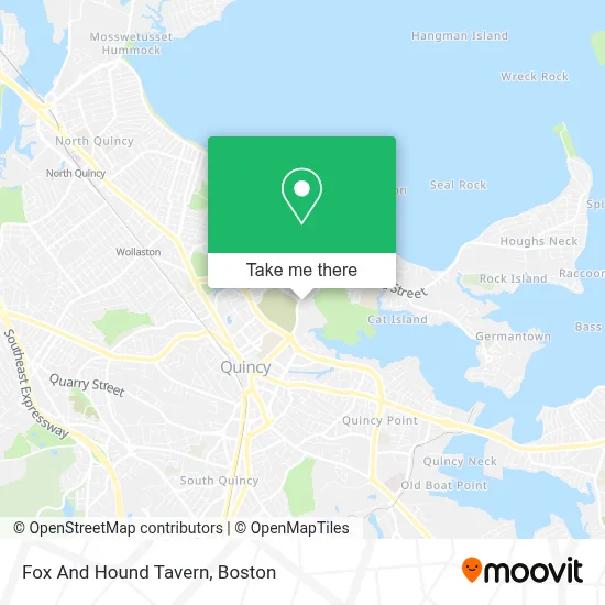
See Fox And Hound Tavern, Quincy, on the map
Public Transit to Fox And Hound Tavern in Quincy
Wondering how to get to Fox And Hound Tavern in Quincy? Moovit helps you find the best way to get to Fox And Hound Tavern with step-by-step directions from the nearest public transit station.
Moovit provides free maps and live directions to help you navigate through your city. View schedules, routes, timetables, and find out how long does it take to get to Fox And Hound Tavern in real time.
Looking for the nearest stop or station to Fox And Hound Tavern? Check out this list of stops closest to your destination: Sea St @ Cemetery; Wollaston.
Bus: 210, 216.Train: FALL RIVER/NEW BEDFORD, GREENBUSH.Subway: RED LINE.
Want to see if there’s another route that gets you there at an earlier time? Moovit helps you find alternative routes or times. Get directions from and directions to Fox And Hound Tavern easily from the Moovit App or Website.
We make riding to Fox And Hound Tavern easy, which is why over 1.7 million users, including users in Quincy, trust Moovit as the best app for public transit. You don’t need to download an individual bus app or train app, Moovit is your all-in-one transit app that helps you find the best bus time or train time available.
For information on prices of bus, train and subway, costs and ride fares to Fox And Hound Tavern, please check the Moovit app.
Use the app to navigate to popular places including to the airport, hospital, stadium, grocery store, mall, coffee shop, school, college, and university.
Fox And Hound Tavern Address: 123 Sea St street in Quincy
- Skyline Terrace Apartments,
- Heart-Strings,
- Thuan Loi,
- MBTA Transit Police Academy,
- Aarons Locksmith Co,
- Quincy Locksmith PRO,
- Livfitness,
- Arc Dry Cleaning,
- Merrymount, Massachusetts,
- City of Quincy,
- Always Affective Available Emergency Locks,
- Father Bill's Place (Father Bill's Shelter Clinic),
- Les Mer Productions,
- Young Scholars Learning Center,
- Duncan's Den, Quincy,
- Popeyes Louisiana Kitchen,
- Quincy High School,
- Luongo Contracting, LLC,
- ACE Rent A Car,
- Accurate Communications
Places Near Fox And Hound Tavern (Quincy)
- Wang Theater, Boston,
- Museum Of Science, Boston,
- Massachusetts General Hospital, Boston,
- Isabella Stewart Gardner Museum, Boston,
- Seaport District, Boston,
- Boston Common, Boston,
- Wilbur Theatre, Boston,
- Boston Medical Center, Boston,
- Td Garden, Boston,
- House Of Blues, Boston,
- Boston Convention & Exhibition Center, Boston,
- Leader Bank Pavilion (Leader Bank Pavillion), Boston,
- North End, Boston,
- Castle Island, Boston,
- Cheers, Boston,
- Prudential Center, Boston,
- Mgm Music Hall, Boston,
- Faneuil Hall, Boston,
- Quincy Market, Boston,
- Boston Children's Hospital, Boston
How to get to popular places in Boston with public transit
Get around Quincy by public transit!
Traveling around Quincy has never been so easy. See step by step directions as you travel to any attraction, street or major public transit station. View bus and train schedules, arrival times, service alerts and detailed routes on a map, so you know exactly how to get to anywhere in Quincy.
When traveling to any destination around Quincy use Moovit's Live Directions with Get Off Notifications to know exactly where and how far to walk, how long to wait for your line, and how many stops are left. Moovit will alert you when it's time to get off — no need to constantly re-check whether yours is the next stop.
Wondering how to use public transit in Quincy or how to pay for public transit in Quincy? Moovit public transit app can help you navigate your way with public transit easily, and at minimum cost. It includes public transit fees, ticket prices, and costs. Looking for a map of Quincy public transit lines? Moovit public transit app shows all public transit maps in Quincy with all Bus, Train, Subway and Ferry routes and stops on an interactive map.
Boston has 4 transit type(s), including: Bus, Train, Subway and Ferry, operated by several transit agencies, including MBTA, Southeastern Regional Transit Authority, MetroWest Regional Transit Authority, Rhode Island Public Transit Authority, WRTA, Lowell Regional Transit Authority, Merrimack Valley Transit, Montachusett Regional Transit Authority, Cape Cod Regional Transit Authority, Brockton Area Transit Authority, Martha's Vineyard Transit Authority, the WAVE - Nantucket Regional Transit Authority, GATRA, Cape Ann Transportation Authority and Massport