Directions to Fp Movement (Boston) with public transportation
The following transit lines have routes that pass near Fp Movement
 Bus: 1, 504, BB, GREEN LINE B SHUTTLE, GREEN LINE B SHUTTLE.
- Train: FRAMINGHAM/WORCESTER, NEWBURYPORT/ROCKPORT.
- Subway: GREEN LINE B, GREEN LINE C, GREEN LINE D, GREEN LINE E.
How to get to Fp Movement by bus?
Click on the bus route to see step by step directions with maps, line arrival times and updated time schedules.
From Winter Hill, Somerville
57 minFrom Beth Israel Deaconess Hospital-Milton, Milton
92 minFrom Milton, MA, Milton
102 minFrom Canobie Lake Park, Chelsea
67 minFrom Six Flags New England, Newton
46 minFrom Terrace Room, Paige Hall, Medford
54 minFrom Milton Academy, Milton
101 minFrom Qea, Quincy
108 minFrom Rental Car Center - Logan Airport, Boston
31 minFrom MBTA Suffolk Downs Station, Boston
93 min
How to get to Fp Movement by train?
Click on the train route to see step by step directions with maps, line arrival times and updated time schedules.
How to get to Fp Movement by subway?
Click on the subway route to see step by step directions with maps, line arrival times and updated time schedules.
From MBTA Suffolk Downs Station, Boston
31 minFrom Winter Hill, Somerville
47 minFrom Beth Israel Deaconess Hospital-Milton, Milton
78 minFrom Milton, MA, Milton
80 minFrom Rental Car Center - Logan Airport, Boston
28 minFrom Terrace Room, Paige Hall, Medford
42 minFrom Milton Academy, Milton
65 minFrom Qea, Quincy
41 min
Bus stops near Fp Movement in Boston
- Hynes - Commonwealth Ave @ Massachusetts Ave, 1 min walk,VIEW
- Hynes Convention Center - Commonwealth Ave @ Massachusetts Ave, 2 min walk,VIEW
- Massachusetts Ave @ Marlborough St, 3 min walk,VIEW
- Hynes Convention Center - Cambria St @ Boylston St, 5 min walk,VIEW
- Massachusetts Ave @ Newbury St, 5 min walk,VIEW
- Boylston St @ Massachusetts Ave, 5 min walk,VIEW
- Hynes T Station (To Bumc), 6 min walk,VIEW
- Announcement #3 - Airport To Back Bay, 7 min walk,VIEW
Subway station near Fp Movement in Boston
- Copley, 3 min walk,VIEW
Bus lines to Fp Movement in Boston
- GREEN LINE B SHUTTLE, Babcock Street - Back Bay,VIEW
- GREEN LINE B SHUTTLE, Babcock Street - Copley,VIEW
- GREEN LINE B SHUTTLE, Boston College - Back Bay (Shuttle),VIEW
- GREEN LINE B SHUTTLE, Babcock Street - Back Bay via Copley (Shuttle),VIEW
- GREEN LINE B SHUTTLE, Kenmore - Back Bay via Copley (Shuttle),VIEW
- GREEN LINE D SHUTTLE, Brookline Hills - Back Bay (Shuttle),VIEW
- GREEN LINE SHUTTLE, Kenmore - Back Bay,VIEW
- GREEN LINE SHUTTLE, Kenmore (Shuttle),VIEW
- 1, Harvard,VIEW
- GREEN LINE B SHUTTLE, Back Bay (Shuttle),VIEW
- GREEN LINE C SHUTTLE, Saint Mary's Street (Shuttle),VIEW
- GREEN LINE SHUTTLE, Park Street (Shuttle),VIEW
- 55, Arlington,VIEW
- 57, Watertown Via Kenmore,VIEW
- 1 BU (CHARLES RIVER-MEDICAL CAMPUS), Comm Ave @ Buick St,VIEW
- BB, Back Bay,VIEW
What are the closest stations to Fp Movement?
The closest stations to Fp Movement are:
- Hynes - Commonwealth Ave @ Massachusetts Ave is 62 yards away, 1 min walk.
- Hynes Convention Center - Commonwealth Ave @ Massachusetts Ave is 117 yards away, 2 min walk.
- Massachusetts Ave @ Marlborough St is 211 yards away, 3 min walk.
- Copley is 217 yards away, 3 min walk.
- Hynes Convention Center - Cambria St @ Boylston St is 375 yards away, 5 min walk.
- Massachusetts Ave @ Newbury St is 386 yards away, 5 min walk.
- Boylston St @ Massachusetts Ave is 394 yards away, 5 min walk.
- Hynes T Station (To Bumc) is 421 yards away, 6 min walk.
- Announcement #3 - Airport To Back Bay is 552 yards away, 7 min walk.
Which bus lines stop near Fp Movement?
These bus lines stop near Fp Movement: 1, 504, BB.
Which train lines stop near Fp Movement?
These train lines stop near Fp Movement: FRAMINGHAM/WORCESTER, NEWBURYPORT/ROCKPORT.
Which subway lines stop near Fp Movement?
These subway lines stop near Fp Movement: GREEN LINE B, GREEN LINE C, GREEN LINE D.
What’s the nearest subway station to Fp Movement in Boston?
The nearest subway station to Fp Movement in Boston is Copley. It’s a 3 min walk away.
What’s the nearest bus station to Fp Movement in Boston?
The nearest bus station to Fp Movement in Boston is Hynes - Commonwealth Ave @ Massachusetts Ave. It’s a 1 min walk away.
What time is the first subway to Fp Movement in Boston?
The GREEN LINE D is the first subway that goes to Fp Movement in Boston. It stops nearby at 5:00 AM.
What time is the last subway to Fp Movement in Boston?
The GREEN LINE D is the last subway that goes to Fp Movement in Boston. It stops nearby at 2:18 AM.
What time is the first bus to Fp Movement in Boston?
The 1 is the first bus that goes to Fp Movement in Boston. It stops nearby at 4:50 AM.
What time is the last bus to Fp Movement in Boston?
The 1 is the last bus that goes to Fp Movement in Boston. It stops nearby at 2:32 AM.
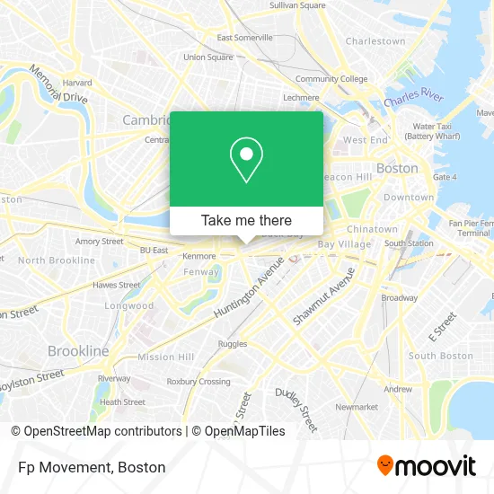
See Fp Movement, Boston, on the map
Public Transit to Fp Movement in Boston
Wondering how to get to Fp Movement in Boston? Moovit helps you find the best way to get to Fp Movement with step-by-step directions from the nearest public transit station.
Moovit provides free maps and live directions to help you navigate through your city. View schedules, routes, timetables, and find out how long does it take to get to Fp Movement in real time.
Looking for the nearest stop or station to Fp Movement? Check out this list of stops closest to your destination: Hynes - Commonwealth Ave @ Massachusetts Ave; Hynes Convention Center - Commonwealth Ave @ Massachusetts Ave; Massachusetts Ave @ Marlborough St; Copley; Hynes Convention Center - Cambria St @ Boylston St; Massachusetts Ave @ Newbury St; Boylston St @ Massachusetts Ave; Hynes T Station (To Bumc); Announcement #3 - Airport To Back Bay.
Bus: 1, 504, BB, GREEN LINE B SHUTTLE, GREEN LINE B SHUTTLE, GREEN LINE B SHUTTLE, GREEN LINE B SHUTTLE, GREEN LINE B SHUTTLE, GREEN LINE SHUTTLE, GREEN LINE B SHUTTLE, GREEN LINE C SHUTTLE, 55, 57.Train: FRAMINGHAM/WORCESTER, NEWBURYPORT/ROCKPORT.Subway: GREEN LINE B, GREEN LINE C, GREEN LINE D, GREEN LINE E.
Want to see if there’s another route that gets you there at an earlier time? Moovit helps you find alternative routes or times. Get directions from and directions to Fp Movement easily from the Moovit App or Website.
We make riding to Fp Movement easy, which is why over 1.7 million users, including users in Boston, trust Moovit as the best app for public transit. You don’t need to download an individual bus app or train app, Moovit is your all-in-one transit app that helps you find the best bus time or train time available.
For information on prices of subway, bus and train, costs and ride fares to Fp Movement, please check the Moovit app.
Use the app to navigate to popular places including to the airport, hospital, stadium, grocery store, mall, coffee shop, school, college, and university.
Fp Movement Address: 333 Newbury St street in Boston
- lululemon athletica,
- Newbury Comics,
- The North Face,
- Trident Booksellers & Cafe,
- Friends Experience,
- Art of the Brick,
- Viyada Thai Spa - Newbury Street,
- Town Nail & Skin Salon 336,
- Trident Booksellers & Cafe (Trident Book and Restaurant),
- Brandy Melville,
- Patagonia,
- Converse,
- Mass General Hospital Back Bay,
- Fablevision,
- Talanian Design,
- STARBUCKS,
- Arc'Teryx,
- Santouka Ramen,
- Shechtman Gary I,
- Canner Law & Associates
Places Near Fp Movement (Boston)
- Td Garden, Boston,
- House Of Blues, Boston,
- Museum Of Science, Boston,
- Castle Island, Boston,
- Boston Children's Hospital, Boston,
- Quincy Market, Boston,
- Faneuil Hall, Boston,
- Mgm Music Hall, Boston,
- Boston Common, Boston,
- Seaport District, Boston,
- Wilbur Theatre, Boston,
- North End, Boston,
- Boston Medical Center, Boston,
- Leader Bank Pavilion (Leader Bank Pavillion), Boston,
- Massachusetts General Hospital, Boston,
- Cheers, Boston,
- Wang Theater, Boston,
- Prudential Center, Boston,
- Boston Convention & Exhibition Center, Boston,
- Isabella Stewart Gardner Museum, Boston
How to get to popular places in Boston with public transit
Get around Boston by public transit!
Traveling around Boston has never been so easy. See step by step directions as you travel to any attraction, street or major public transit station. View bus and train schedules, arrival times, service alerts and detailed routes on a map, so you know exactly how to get to anywhere in Boston.
When traveling to any destination around Boston use Moovit's Live Directions with Get Off Notifications to know exactly where and how far to walk, how long to wait for your line, and how many stops are left. Moovit will alert you when it's time to get off — no need to constantly re-check whether yours is the next stop.
Wondering how to use public transit in Boston or how to pay for public transit in Boston? Moovit public transit app can help you navigate your way with public transit easily, and at minimum cost. It includes public transit fees, ticket prices, and costs. Looking for a map of Boston public transit lines? Moovit public transit app shows all public transit maps in Boston with all Bus, Train, Subway and Ferry routes and stops on an interactive map.
Boston has 4 transit type(s), including: Bus, Train, Subway and Ferry, operated by several transit agencies, including MBTA, Southeastern Regional Transit Authority, MetroWest Regional Transit Authority, Rhode Island Public Transit Authority, WRTA, Lowell Regional Transit Authority, Merrimack Valley Transit, Montachusett Regional Transit Authority, Cape Cod Regional Transit Authority, Brockton Area Transit Authority, Martha's Vineyard Transit Authority, the WAVE - Nantucket Regional Transit Authority, GATRA, Cape Ann Transportation Authority and Massport