How to get to Fp Movement by bus?
Click on the bus route to see step by step directions with maps, line arrival times and updated time schedules.
From Bose Corp, Framingham
45 minFrom I-95 / Route 128 & Route 16 Interchange (Exit 21), Newton
48 minFrom Wellesley, MA, Wellesley
46 minFrom Babson College, Wellesley
43 minFrom Newton Wellesley Hospital Green Building, Newton
52 minFrom Staples Corporate HQ, Framingham
33 minFrom Boston Marriott Newton, Newton
74 minFrom Boston Children's Hospital at Waltham, Waltham
135 minFrom Lasell College, Newton
65 minFrom Newton-Wellesley Hospital, Newton
52 min
How to get to Fp Movement by train?
Click on the train route to see step by step directions with maps, line arrival times and updated time schedules.
Bus stops near Fp Movement in Boston
Train station near Fp Movement in Boston
- West Natick, 27 min walk,VIEW
Bus lines to Fp Movement in Boston
What are the closest stations to Fp Movement?
The closest stations to Fp Movement are:
- Kohls is 340 yards away, 5 min walk.
- Remote Terminal Parking Lot is 900 yards away, 12 min walk.
- Shoppers World Shelter is 1224 yards away, 16 min walk.
- Natick Mall - Wegmans is 1290 yards away, 16 min walk.
- West Natick is 2311 yards away, 27 min walk.
Which bus lines stop near Fp Movement?
These bus lines stop near Fp Movement: 01, 09, 11, FH.
Which train line stops near Fp Movement?
FRAMINGHAM/WORCESTER (#521 | Worcester)
What’s the nearest train station to Fp Movement in Boston?
The nearest train station to Fp Movement in Boston is West Natick. It’s a 27 min walk away.
What’s the nearest bus station to Fp Movement in Boston?
The nearest bus station to Fp Movement in Boston is Kohls. It’s a 5 min walk away.
What time is the first train to Fp Movement in Boston?
The FRAMINGHAM/WORCESTER is the first train that goes to Fp Movement in Boston. It stops nearby at 4:59 AM.
What time is the last train to Fp Movement in Boston?
The FRAMINGHAM/WORCESTER is the last train that goes to Fp Movement in Boston. It stops nearby at 12:41 AM.
What time is the first bus to Fp Movement in Boston?
The FH is the first bus that goes to Fp Movement in Boston. It stops nearby at 3:00 AM.
What time is the last bus to Fp Movement in Boston?
The FH is the last bus that goes to Fp Movement in Boston. It stops nearby at 2:15 AM.
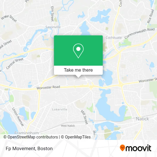
See Fp Movement, Boston, on the map
Public Transit to Fp Movement in Boston
Wondering how to get to Fp Movement in Boston? Moovit helps you find the best way to get to Fp Movement with step-by-step directions from the nearest public transit station.
Moovit provides free maps and live directions to help you navigate through your city. View schedules, routes, timetables, and find out how long does it take to get to Fp Movement in real time.
Looking for the nearest stop or station to Fp Movement? Check out this list of stops closest to your destination: Kohls; Remote Terminal Parking Lot; Shoppers World Shelter; Natick Mall - Wegmans; West Natick.
Bus: 01, 09, 11, FH, 02, 04N, FLIXBUS 2611, 03, 10, MWES.Train: FRAMINGHAM/WORCESTER.
Want to see if there’s another route that gets you there at an earlier time? Moovit helps you find alternative routes or times. Get directions from and directions to Fp Movement easily from the Moovit App or Website.
We make riding to Fp Movement easy, which is why over 1.7 million users, including users in Boston, trust Moovit as the best app for public transit. You don’t need to download an individual bus app or train app, Moovit is your all-in-one transit app that helps you find the best bus time or train time available.
For information on prices of bus and train, costs and ride fares to Fp Movement, please check the Moovit app.
Use the app to navigate to popular places including to the airport, hospital, stadium, grocery store, mall, coffee shop, school, college, and university.
Fp Movement Address: 1245 Worcester St Ste 01760 street in Boston
- Shell Recharge,
- Burger Bar,
- PB Teen,
- THE NORTH FACE,
- Untuckit,
- BUILD-A-BEAR WORKSHOP,
- Tory Burch,
- Tesla,
- PANDORA,
- Zara,
- American Eagle,
- The LEGO Store,
- ifix,
- Natick Mall,
- Lovesac,
- Clarks,
- Buckle,
- Verizon Wireless,
- Macy's,
- M.A.C
Places Near Fp Movement (Boston)
- Isabella Stewart Gardner Museum, Boston,
- Wang Theater, Boston,
- House Of Blues, Boston,
- Cheers, Boston,
- Faneuil Hall, Boston,
- Leader Bank Pavilion (Leader Bank Pavillion), Boston,
- Td Garden, Boston,
- Castle Island, Boston,
- Massachusetts General Hospital, Boston,
- Mgm Music Hall, Boston,
- Prudential Center, Boston,
- North End, Boston,
- Museum Of Science, Boston,
- Seaport District, Boston,
- Boston Children's Hospital, Boston,
- Quincy Market, Boston,
- Boston Common, Boston,
- Boston Medical Center, Boston,
- Boston Convention & Exhibition Center, Boston,
- Wilbur Theatre, Boston
How to get to popular places in Boston with public transit
Get around Boston by public transit!
Traveling around Boston has never been so easy. See step by step directions as you travel to any attraction, street or major public transit station. View bus and train schedules, arrival times, service alerts and detailed routes on a map, so you know exactly how to get to anywhere in Boston.
When traveling to any destination around Boston use Moovit's Live Directions with Get Off Notifications to know exactly where and how far to walk, how long to wait for your line, and how many stops are left. Moovit will alert you when it's time to get off — no need to constantly re-check whether yours is the next stop.
Wondering how to use public transit in Boston or how to pay for public transit in Boston? Moovit public transit app can help you navigate your way with public transit easily, and at minimum cost. It includes public transit fees, ticket prices, and costs. Looking for a map of Boston public transit lines? Moovit public transit app shows all public transit maps in Boston with all Bus, Train, Subway and Ferry routes and stops on an interactive map.
Boston has 4 transit type(s), including: Bus, Train, Subway and Ferry, operated by several transit agencies, including MBTA, Southeastern Regional Transit Authority, MetroWest Regional Transit Authority, Rhode Island Public Transit Authority, WRTA, Lowell Regional Transit Authority, Merrimack Valley Transit, Montachusett Regional Transit Authority, Cape Cod Regional Transit Authority, Brockton Area Transit Authority, Martha's Vineyard Transit Authority, the WAVE - Nantucket Regional Transit Authority, GATRA, Cape Ann Transportation Authority and Massport