Directions to Framingham Family Resource Center & Community Connections with public transportation
The following transit lines have routes that pass near Framingham Family Resource Center & Community Connections
 Bus: 03, 04N, 04S, 05, 07.
- Train: FRAMINGHAM/WORCESTER, LAKE SHORE LIMITED.
How to get to Framingham Family Resource Center & Community Connections by bus?
Click on the bus route to see step by step directions with maps, line arrival times and updated time schedules.
How to get to Framingham Family Resource Center & Community Connections by train?
Click on the train route to see step by step directions with maps, line arrival times and updated time schedules.
Bus stops near Framingham Family Resource Center & Community Connections
Train stations near Framingham Family Resource Center & Community Connections
Bus lines to Framingham Family Resource Center & Community Connections
- GREYHOUND US0270S, Albany Bus Terminal, NY,VIEW
- WORCESTER LINE SHUTTLE, Ashland - Framingham,VIEW
- 05, RT05,VIEW
- 06, RT06,VIEW
- 14, RT14,VIEW
- 04S, RT04S,VIEW
- 02, RT02,VIEW
- 03, RT03,VIEW
- 07, RT07,VIEW
- 09, RT09,VIEW
- 07C, RT07C,VIEW
- 04N, RT04N,VIEW
- 01, RT01,VIEW
- 10, RT10,VIEW
- 11, RT11,VIEW
- MBCS, Mass Bay Campus to Campus Shuttle,VIEW
- MBRS, Mass Bay Riverside Shuttle,VIEW
- MWES, MathWorks Framingham Shuttle,VIEW
- NCS, MathWorks Natick Shuttle,VIEW
What are the closest stations to Framingham Family Resource Center & Community Connections?
The closest stations to Framingham Family Resource Center & Community Connections are:
- Framingham (Framingham Intermodal) is 454 yards away, 6 min walk.
- Framingham Mbta Station is 499 yards away, 6 min walk.
- Banana Lot/Intermodal Center is 521 yards away, 7 min walk.
- Blandin Hub is 1098 yards away, 14 min walk.
- West Natick is 5451 yards away, 64 min walk.
- Framingham Amtrak is 5463 yards away, 64 min walk.
Which bus lines stop near Framingham Family Resource Center & Community Connections?
These bus lines stop near Framingham Family Resource Center & Community Connections: 03, 04N, 04S, 05, 07, 07C.
Which train line stops near Framingham Family Resource Center & Community Connections?
FRAMINGHAM/WORCESTER (#521 | Worcester)
What’s the nearest bus station to Framingham Family Resource Center & Community Connections?
The nearest bus stations to Framingham Family Resource Center & Community Connections are Framingham (Framingham Intermodal) and Framingham Mbta Station. The closest one is a 6 min walk away.
What time is the first train to Framingham Family Resource Center & Community Connections?
The FRAMINGHAM/WORCESTER is the first train that goes to Framingham Family Resource Center & Community Connections. It stops nearby at 4:54 AM.
What time is the last train to Framingham Family Resource Center & Community Connections?
The LAKE SHORE LIMITED is the last train that goes to Framingham Family Resource Center & Community Connections. It stops nearby at 8:00 PM.
What time is the first bus to Framingham Family Resource Center & Community Connections?
The 07C is the first bus that goes to Framingham Family Resource Center & Community Connections. It stops nearby at 5:00 AM.
What time is the last bus to Framingham Family Resource Center & Community Connections?
The 07 is the last bus that goes to Framingham Family Resource Center & Community Connections. It stops nearby at 11:36 PM.
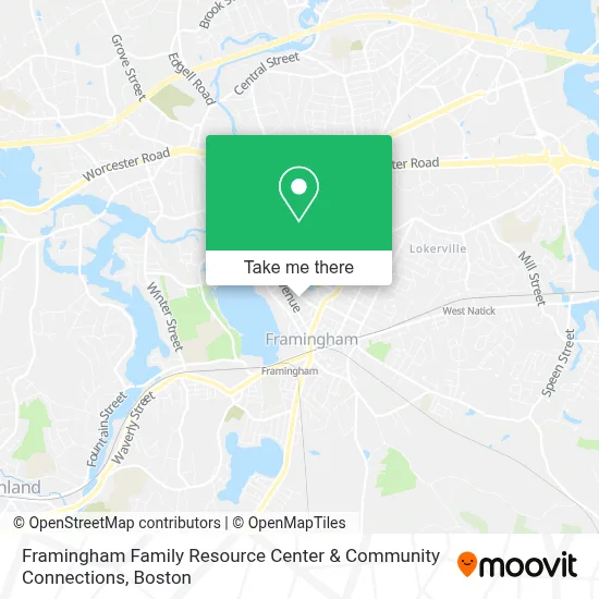
See Framingham Family Resource Center & Community Connections on the map
Public Transportation to Framingham Family Resource Center & Community Connections
Wondering how to get to Framingham Family Resource Center & Community Connections? Moovit helps you find the best way to get to Framingham Family Resource Center & Community Connections with step-by-step directions from the nearest public transit station.
Moovit provides free maps and live directions to help you navigate through your city. View schedules, routes, timetables, and find out how long does it take to get to Framingham Family Resource Center & Community Connections in real time.
Looking for the nearest stop or station to Framingham Family Resource Center & Community Connections? Check out this list of stops closest to your destination: Framingham (Framingham Intermodal); Framingham Mbta Station; Banana Lot/Intermodal Center; Blandin Hub; West Natick; Framingham Amtrak.
Bus: 03, 04N, 04S, 05, 07, 07C, GREYHOUND US0270S, WORCESTER LINE SHUTTLE, 06, 14, 02, 09, 01, 10, 11, MBCS, MBRS.Train: FRAMINGHAM/WORCESTER, LAKE SHORE LIMITED.
Want to see if there’s another route that gets you there at an earlier time? Moovit helps you find alternative routes or times. Get directions from and directions to Framingham Family Resource Center & Community Connections easily from the Moovit App or Website.
We make riding to Framingham Family Resource Center & Community Connections easy, which is why over 1.7 million users, including users in Framingham, trust Moovit as the best app for public transit. You don’t need to download an individual bus app or train app, Moovit is your all-in-one transit app that helps you find the best bus time or train time available.
For information on prices of bus and train, costs and ride fares to Framingham Family Resource Center & Community Connections, please check the Moovit app.
Use the app to navigate to popular places including to the airport, hospital, stadium, grocery store, mall, coffee shop, school, college, and university.
Framingham Family Resource Center & Community Connections Address: 88 Lincoln St street in Framingham
- Tempo Young Adult Resource Center,
- Henry St Young Adult Program,
- Boyle Brothers Funeral Home - Henry C Boyle III,
- Metrowest Zerona,
- VHS,
- Ansari Husam MD,
- Iasis Solutions,
- Life Arts Center for Healing & Shamanic Studies,
- Hayes Gary,
- Boston Framingham Town Taxi,
- Pro-Tech Pest Control,
- Metrowest Physician Services,
- Aesthetic & Vascular Center of Metro West,
- Metro West Community Services,
- The Vascular Care Group,
- Computer & Mobile Solutions,
- Frank Coco, MD,
- Carla Dupont, Pa,
- Abigail Ciampa, Msn - Metro West Physician Services,
- Zachary Spigelman, MD
Places Near Framingham Family Resource Center & Community Connections
- Wang Theater, Boston,
- Isabella Stewart Gardner Museum, Boston,
- Td Garden, Boston,
- Faneuil Hall, Boston,
- Seaport District, Boston,
- Boston Medical Center, Boston,
- North End, Boston,
- Wilbur Theatre, Boston,
- Mgm Music Hall, Boston,
- Castle Island, Boston,
- Quincy Market, Boston,
- Boston Children's Hospital, Boston,
- House Of Blues, Boston,
- Prudential Center, Boston,
- Boston Common, Boston,
- Boston Convention & Exhibition Center, Boston,
- Leader Bank Pavilion (Leader Bank Pavillion), Boston,
- Massachusetts General Hospital, Boston,
- Cheers, Boston,
- Museum Of Science, Boston
How to get to popular places in Boston with public transit
Get around Framingham by public transit!
Traveling around Framingham has never been so easy. See step by step directions as you travel to any attraction, street or major public transit station. View bus and train schedules, arrival times, service alerts and detailed routes on a map, so you know exactly how to get to anywhere in Framingham.
When traveling to any destination around Framingham use Moovit's Live Directions with Get Off Notifications to know exactly where and how far to walk, how long to wait for your line, and how many stops are left. Moovit will alert you when it's time to get off — no need to constantly re-check whether yours is the next stop.
Wondering how to use public transit in Framingham or how to pay for public transit in Framingham? Moovit public transit app can help you navigate your way with public transit easily, and at minimum cost. It includes public transit fees, ticket prices, and costs. Looking for a map of Framingham public transit lines? Moovit public transit app shows all public transit maps in Framingham with all Bus, Train, Subway and Ferry routes and stops on an interactive map.
Boston has 4 transit type(s), including: Bus, Train, Subway and Ferry, operated by several transit agencies, including MBTA, Southeastern Regional Transit Authority, MetroWest Regional Transit Authority, Rhode Island Public Transit Authority, WRTA, Lowell Regional Transit Authority, Merrimack Valley Transit, Montachusett Regional Transit Authority, Cape Cod Regional Transit Authority, Brockton Area Transit Authority, Martha's Vineyard Transit Authority, the WAVE - Nantucket Regional Transit Authority, GATRA, Cape Ann Transportation Authority and Massport