See Francis Scott Key School, Philadelphia, on the map
Directions to Francis Scott Key School (Philadelphia) with public transportation
The following transit lines have routes that pass near Francis Scott Key School
 Bus:
Bus: - Train:
- Subway:
How to get to Francis Scott Key School by bus?
Click on the bus route to see step by step directions with maps, line arrival times and updated time schedules.
How to get to Francis Scott Key School by train?
Click on the train route to see step by step directions with maps, line arrival times and updated time schedules.
How to get to Francis Scott Key School by subway?
Click on the subway route to see step by step directions with maps, line arrival times and updated time schedules.
Bus stations near Francis Scott Key School in Philadelphia
- 8th St & Jackson St ,2 min walk,
- Snyder Av & 8th St ,4 min walk,
Subway stations near Francis Scott Key School in Philadelphia
- Snyder,13 min walk,
Bus lines to Francis Scott Key School in Philadelphia
- 47,8th-Oregon,
- 47M,Spring Garden Via 9th St,
- 79,Columbus Commons,
What are the closest stations to Francis Scott Key School?
The closest stations to Francis Scott Key School are:
- 8th St & Jackson St is 97 yards away, 2 min walk.
- Snyder Av & 8th St is 234 yards away, 4 min walk.
- Snyder is 1068 yards away, 13 min walk.
Which bus lines stop near Francis Scott Key School?
These bus lines stop near Francis Scott Key School: 47, 68, G.
Which train lines stop near Francis Scott Key School?
These train lines stop near Francis Scott Key School: LANSDALE/DOYLESTOWN, MEDIA/ELWYN, PAOLI/THORNDALE, WARMINSTER.
Which subway line stops near Francis Scott Key School?
BSL
What’s the nearest subway station to Francis Scott Key School in Philadelphia?
The nearest subway station to Francis Scott Key School in Philadelphia is Snyder. It’s a 13 min walk away.
What’s the nearest bus stop to Francis Scott Key School in Philadelphia?
The nearest bus stop to Francis Scott Key School in Philadelphia is 8th St & Jackson St. It’s a 2 min walk away.
What time is the first subway to Francis Scott Key School in Philadelphia?
The BSL is the first subway that goes to Francis Scott Key School in Philadelphia. It stops nearby at 4:52 AM.
What time is the last subway to Francis Scott Key School in Philadelphia?
The BSL is the last subway that goes to Francis Scott Key School in Philadelphia. It stops nearby at 12:44 AM.
What time is the first bus to Francis Scott Key School in Philadelphia?
The 47 is the first bus that goes to Francis Scott Key School in Philadelphia. It stops nearby at 3:03 AM.
What time is the last bus to Francis Scott Key School in Philadelphia?
The 47 is the last bus that goes to Francis Scott Key School in Philadelphia. It stops nearby at 3:22 AM.
How much is the light rail fare to Francis Scott Key School?
The light rail fare to Francis Scott Key School costs about $2.00.
How much is the subway fare to Francis Scott Key School?
The subway fare to Francis Scott Key School costs about $1.40 - $3.00.
How much is the bus fare to Francis Scott Key School?
The bus fare to Francis Scott Key School costs about $2.00.
See Francis Scott Key School, Philadelphia, on the map
Public Transit to Francis Scott Key School in Philadelphia
Wondering how to get to Francis Scott Key School in Philadelphia, United States? Moovit helps you find the best way to get to Francis Scott Key School with step-by-step directions from the nearest public transit station.
Moovit provides free maps and live directions to help you navigate through your city. View schedules, routes, timetables, and find out how long does it take to get to Francis Scott Key School in real time.
Looking for the nearest stop or station to Francis Scott Key School? Check out this list of stops closest to your destination: 8th St & Jackson St ; Snyder Av & 8th St ; Snyder.
Bus:Train:Subway:
Want to see if there’s another route that gets you there at an earlier time? Moovit helps you find alternative routes or times. Get directions from and directions to Francis Scott Key School easily from the Moovit App or Website.
We make riding to Francis Scott Key School easy, which is why over 1.5 million users, including users in Philadelphia, trust Moovit as the best app for public transit. You don’t need to download an individual bus app or train app, Moovit is your all-in-one transit app that helps you find the best bus time or train time available.
For information on prices of bus, subway, train and light rail, costs and ride fares to Francis Scott Key School, please check the Moovit app.
Use the app to navigate to popular places including to the airport, hospital, stadium, grocery store, mall, coffee shop, school, college, and university.
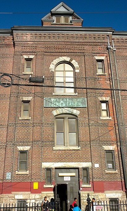
Francis Scott Key School Address: South Mildred Street street in Philadelphia
Attractions near Francis Scott Key School
Porn King Clubhouse,Wayne's World Moving,Sonido Masterboy,Kingsessing Office,Franklin Day Babies,Lala Boutique,Pacto 12 & 13 Station,R & A Jewelry Store,The Gallo Tax Group,Chhour Heng,Nor Halal Meats and GR,Magnificent Cleaning and Services,John's Builders,Urban Hound,Didomenico Bro's,9th St & Ritner St,Donnefit Physical Therapy,Bach van Nguyen MD,Angel's Philly Nail Salon,East South Asian CuisineHow to get to popular attractions in Philadelphia with public transit
Moriarty's Restaurant & Irish Pub, Philadelphia,Fogo De Chão, Philadelphia,Philadelphia Premium Outlets, Limerick,Dalessandro’s Steaks and Hoagies, Philadelphia,New Jersey State House, Trenton,The Franklin Fountain, Philadelphia,Philadelphia Mills, Philadelphia,Lansdowne, PA, Lansdowne,SEPTA Forest Hills Station, Philadelphia,Talula's Garden, Philadelphia,The Cheesecake Factory, Willow Grove,Quaker Bridge Mall,Westville, NJ, Westville,Croydon, PA, Croydon,Hamilton Square, NJ, Hamilton Square,Drexel Dragon Route CC Shuttle Stop, Philadelphia,Vedge, Philadelphia,Hamilton, NJ, Hamilton Square,Fado Irish Pub, Philadelphia,WegmansGet around Philadelphia by public transit!
Traveling around Philadelphia has never been so easy. See step by step directions as you travel to any attraction, street or major public transit station. View bus and train schedules, arrival times, service alerts and detailed routes on a map, so you know exactly how to get to anywhere in Philadelphia.
When traveling to any destination around Philadelphia use Moovit's Live Directions with Get Off Notifications to know exactly where and how far to walk, how long to wait for your line, and how many stops are left. Moovit will alert you when it's time to get off — no need to constantly re-check whether yours is the next stop.
Wondering how to use public transit in Philadelphia or how to pay for public transit in Philadelphia? Moovit public transit app can help you navigate your way with public transit easily, and at minimum cost. It includes public transit fees, ticket prices, and costs. Looking for a map of Philadelphia public transit lines? Moovit public transit app shows all public transit maps in Philadelphia with all bus, subway, train or light rail routes and stops on an interactive map.
Philadelphia has 4 transit type(s), including: bus, subway, train or light rail, operated by several transit agencies, including SEPTA Subway, SEPTA Trolley, SEPTA Rail, SEPTA, SEPTA, NJ TRANSIT RAIL-Rail, NJ TRANSIT RAIL-Tram, NJ TRANSIT BUS, Port Authority Transit Corporation, Navy Yard, Penn Transit, Drexel University, Pottstown Area Rapid Transit (PART), Fullington Tours and Chescobus