Directions to Frank Licht Judicial Complex (Boston) with public transportation
The following transit lines have routes that pass near Frank Licht Judicial Complex
 Bus: 1, 21, 35, 54, 32.
- Train: PROVIDENCE/STOUGHTON, ACELA, NORTHEAST REGIONAL, PROVIDENCE LINE SHUTTLE, PROVIDENCE LINE SHUTTLE.
How to get to Frank Licht Judicial Complex by bus?
Click on the bus route to see step by step directions with maps, line arrival times and updated time schedules.
How to get to Frank Licht Judicial Complex by train?
Click on the train route to see step by step directions with maps, line arrival times and updated time schedules.
Bus stops near Frank Licht Judicial Complex in Boston
Train stations near Frank Licht Judicial Complex in Boston
- Providence, 11 min walk,VIEW
Bus lines to Frank Licht Judicial Complex in Boston
- 1, South Attleboro Station Via Hope St,VIEW
- 32, Kennedy Plaza Via Martin St,VIEW
- 33, Kennedy Plaza,VIEW
- 34, Seekonk Sq (Mass) Via Wampanoag Plaza,VIEW
- 40, Butler Hospital,VIEW
- 60, Newport Via W Main Rd,VIEW
- 61X, Providence,VIEW
- 35, Kennedy Plaza,VIEW
- 78, Kennedy Plaza Via Beverage Hill Ave,VIEW
- 92, Ri College Via Mt Pleasant Hs,VIEW
- 6, Prairie Ave/Roger Williams Park Zoo,VIEW
- 20, Elmwood Ave/Airport,VIEW
- 22, Pontiac Ave,VIEW
- 9X, Pascoag Express,VIEW
- 10X, North Scituate Express,VIEW
- 12X, Arctic/RI-117 Express,VIEW
- 59X, North Smithfield/Lincoln Express,VIEW
- 65X, Narragansett/Wakefield Express,VIEW
- 95X, Westerly Express,VIEW
- 50, Bryant University,VIEW
What are the closest stations to Frank Licht Judicial Complex?
The closest stations to Frank Licht Judicial Complex are:
- S Main Ns Washington is 136 yards away, 2 min walk.
- Tunnel Before S Main is 155 yards away, 2 min walk.
- Westminster After Memorial is 238 yards away, 4 min walk.
- Turks Head (Weybosset Before Post Office) is 378 yards away, 5 min walk.
- Kennedy Plaza (Stop J) is 453 yards away, 6 min walk.
- Kennedy Plaza (Stop I) is 469 yards away, 6 min walk.
- Kennedy Plaza (Stop D) is 488 yards away, 6 min walk.
- Providence is 903 yards away, 11 min walk.
Which bus lines stop near Frank Licht Judicial Complex?
These bus lines stop near Frank Licht Judicial Complex: 1, 21, 35, 54.
Which train line stops near Frank Licht Judicial Complex?
PROVIDENCE/STOUGHTON (#827 | Wickford Junction)
What’s the nearest train station to Frank Licht Judicial Complex in Boston?
The nearest train station to Frank Licht Judicial Complex in Boston is Providence. It’s a 11 min walk away.
What’s the nearest bus station to Frank Licht Judicial Complex in Boston?
The nearest bus stations to Frank Licht Judicial Complex in Boston are S Main Ns Washington and Tunnel Before S Main. The closest one is a 2 min walk away.
What time is the first train to Frank Licht Judicial Complex in Boston?
The PROVIDENCE/STOUGHTON is the first train that goes to Frank Licht Judicial Complex in Boston. It stops nearby at 4:10 AM.
What time is the last train to Frank Licht Judicial Complex in Boston?
The NORTHEAST REGIONAL is the last train that goes to Frank Licht Judicial Complex in Boston. It stops nearby at 9:17 AM.
What time is the first bus to Frank Licht Judicial Complex in Boston?
The 50 is the first bus that goes to Frank Licht Judicial Complex in Boston. It stops nearby at 5:20 AM.
What time is the last bus to Frank Licht Judicial Complex in Boston?
The 20 is the last bus that goes to Frank Licht Judicial Complex in Boston. It stops nearby at 1:09 AM.
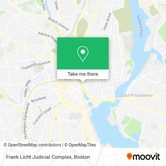
See Frank Licht Judicial Complex, Boston, on the map
Public Transit to Frank Licht Judicial Complex in Boston
Wondering how to get to Frank Licht Judicial Complex in Boston? Moovit helps you find the best way to get to Frank Licht Judicial Complex with step-by-step directions from the nearest public transit station.
Moovit provides free maps and live directions to help you navigate through your city. View schedules, routes, timetables, and find out how long does it take to get to Frank Licht Judicial Complex in real time.
Looking for the nearest stop or station to Frank Licht Judicial Complex? Check out this list of stops closest to your destination: S Main Ns Washington; Tunnel Before S Main; Westminster After Memorial; Turks Head (Weybosset Before Post Office); Kennedy Plaza (Stop J); Kennedy Plaza (Stop I); Kennedy Plaza (Stop D); Providence.
Bus: 1, 21, 35, 54, 32, 33, 34, 40, 78, 92, 6, 20, 22, 9X, 10X.Train: PROVIDENCE/STOUGHTON, ACELA, NORTHEAST REGIONAL, PROVIDENCE LINE SHUTTLE, PROVIDENCE LINE SHUTTLE, PROVIDENCE LINE SHUTTLE, FOXBORO EVENT SERVICE.
Want to see if there’s another route that gets you there at an earlier time? Moovit helps you find alternative routes or times. Get directions from and directions to Frank Licht Judicial Complex easily from the Moovit App or Website.
We make riding to Frank Licht Judicial Complex easy, which is why over 1.7 million users, including users in Boston, trust Moovit as the best app for public transit. You don’t need to download an individual bus app or train app, Moovit is your all-in-one transit app that helps you find the best bus time or train time available.
For information on prices of bus and train, costs and ride fares to Frank Licht Judicial Complex, please check the Moovit app.
Use the app to navigate to popular places including to the airport, hospital, stadium, grocery store, mall, coffee shop, school, college, and university.
Frank Licht Judicial Complex Address: 250 Benefit St street in Boston
- Rhode Island Supreme Court (Supreme Ct-Fugitive Task Force),
- RISD,
- RISD Museum,
- Ghosts of Providence by US Ghost Adventures,
- Korean War Memorial,
- Rhode Island School of Design Msm (Museum of Art),
- Brown University,
- Hemenway's Restaurant,
- Textron Building Garage,
- Morgan Stanley,
- Greater Kennedy Plaza,
- University Hall (Brown University),
- Elizabeth P Santilli Attorney,
- Brown University College Green,
- Jameson-Mead Building,
- Avtek,
- Keeney Quad,
- nude,
- Providence Innovation District Park,
- Epic-Realtor-Sadd
Places Near Frank Licht Judicial Complex (Boston)
- Wang Theater, Boston,
- Leader Bank Pavilion (Leader Bank Pavillion), Boston,
- Boston Children's Hospital, Boston,
- Mgm Music Hall, Boston,
- Isabella Stewart Gardner Museum, Boston,
- Quincy Market, Boston,
- Boston Medical Center, Boston,
- Massachusetts General Hospital, Boston,
- Seaport District, Boston,
- Prudential Center, Boston,
- Faneuil Hall, Boston,
- Castle Island, Boston,
- Boston Convention & Exhibition Center, Boston,
- Wilbur Theatre, Boston,
- Boston Common, Boston,
- Td Garden, Boston,
- Cheers, Boston,
- North End, Boston,
- Museum Of Science, Boston,
- House Of Blues, Boston
How to get to popular places in Boston with public transit
Get around Boston by public transit!
Traveling around Boston has never been so easy. See step by step directions as you travel to any attraction, street or major public transit station. View bus and train schedules, arrival times, service alerts and detailed routes on a map, so you know exactly how to get to anywhere in Boston.
When traveling to any destination around Boston use Moovit's Live Directions with Get Off Notifications to know exactly where and how far to walk, how long to wait for your line, and how many stops are left. Moovit will alert you when it's time to get off — no need to constantly re-check whether yours is the next stop.
Wondering how to use public transit in Boston or how to pay for public transit in Boston? Moovit public transit app can help you navigate your way with public transit easily, and at minimum cost. It includes public transit fees, ticket prices, and costs. Looking for a map of Boston public transit lines? Moovit public transit app shows all public transit maps in Boston with all Bus, Train, Subway and Ferry routes and stops on an interactive map.
Boston has 4 transit type(s), including: Bus, Train, Subway and Ferry, operated by several transit agencies, including MBTA, Southeastern Regional Transit Authority, MetroWest Regional Transit Authority, Rhode Island Public Transit Authority, WRTA, Lowell Regional Transit Authority, Merrimack Valley Transit, Montachusett Regional Transit Authority, Cape Cod Regional Transit Authority, Brockton Area Transit Authority, Martha's Vineyard Transit Authority, the WAVE - Nantucket Regional Transit Authority, GATRA, Cape Ann Transportation Authority and Massport