Directions to Frank P. Fechner, Md, Llc (Worcester) with public transportation
The following transit lines have routes that pass near Frank P. Fechner, Md, Llc
 Bus: 15, 24, GREYHOUND US0230.
- Train: FRAMINGHAM/WORCESTER.
How to get to Frank P. Fechner, Md, Llc by bus?
Click on the bus route to see step by step directions with maps, line arrival times and updated time schedules.
Bus stops near Frank P. Fechner, Md, Llc in Worcester
Bus lines to Frank P. Fechner, Md, Llc in Worcester
What are the closest stations to Frank P. Fechner, Md, Llc?
The closest stations to Frank P. Fechner, Md, Llc are:
- Hospital Dr. at Belmont is 253 yards away, 4 min walk.
- Shrewsbury St at Imperial is 507 yards away, 7 min walk.
Which bus lines stop near Frank P. Fechner, Md, Llc?
These bus lines stop near Frank P. Fechner, Md, Llc: 15, 24, GREYHOUND US0230.
Which train line stops near Frank P. Fechner, Md, Llc?
FRAMINGHAM/WORCESTER (#525 | Worcester)
What’s the nearest bus station to Frank P. Fechner, Md, Llc in Worcester?
The nearest bus station to Frank P. Fechner, Md, Llc in Worcester is Hospital Dr. at Belmont. It’s a 4 min walk away.
What time is the first bus to Frank P. Fechner, Md, Llc in Worcester?
The 15 is the first bus that goes to Frank P. Fechner, Md, Llc in Worcester. It stops nearby at 5:24 AM.
What time is the last bus to Frank P. Fechner, Md, Llc in Worcester?
The 15 is the last bus that goes to Frank P. Fechner, Md, Llc in Worcester. It stops nearby at 9:17 PM.
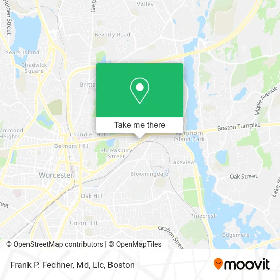
See Frank P. Fechner, Md, Llc, Worcester, on the map
Public Transit to Frank P. Fechner, Md, Llc in Worcester
Wondering how to get to Frank P. Fechner, Md, Llc in Worcester? Moovit helps you find the best way to get to Frank P. Fechner, Md, Llc with step-by-step directions from the nearest public transit station.
Moovit provides free maps and live directions to help you navigate through your city. View schedules, routes, timetables, and find out how long does it take to get to Frank P. Fechner, Md, Llc in real time.
Looking for the nearest stop or station to Frank P. Fechner, Md, Llc? Check out this list of stops closest to your destination: Hospital Dr. at Belmont; Shrewsbury St at Imperial.
Bus: 15, 24, GREYHOUND US0230.Train: FRAMINGHAM/WORCESTER.
Want to see if there’s another route that gets you there at an earlier time? Moovit helps you find alternative routes or times. Get directions from and directions to Frank P. Fechner, Md, Llc easily from the Moovit App or Website.
We make riding to Frank P. Fechner, Md, Llc easy, which is why over 1.7 million users, including users in Worcester, trust Moovit as the best app for public transit. You don’t need to download an individual bus app or train app, Moovit is your all-in-one transit app that helps you find the best bus time or train time available.
For information on prices of bus and train, costs and ride fares to Frank P. Fechner, Md, Llc, please check the Moovit app.
Use the app to navigate to popular places including to the airport, hospital, stadium, grocery store, mall, coffee shop, school, college, and university.
Frank P. Fechner, Md, Llc Address: 428 Shrewsbury St street in Worcester
- Fechner MD Plastic Surgery & Medical Spa,
- Appliance Repair Marvel Repair Service,
- Steve's Auto Repair,
- Latin American Health Alliance,
- Global Glass of New England,
- Petersen R Mark,
- Men's Jewelry Estate Jewelry Engagement,
- Bx3 Aesthetics,
- Natalie Delpeche - Delpeche Realty - Exit Beacon Pointe Realty,
- Integral Primary Care Practice,
- Piercing Emporium,
- Caitlin McGlone Esthetics,
- Glow,
- Little Caesars (Little Caesar's Pizza),
- ANYTIME FITNESS,
- Terra Brasilis Restaurant,
- Worcester Cell Phone Repair Shop,
- Primeira Igreja Batista de Worcester,
- Tabbutt Asphalt and Excavation,
- Cline H B Locksmith Co
Places Near Frank P. Fechner, Md, Llc (Worcester)
- Mgm Music Hall, Boston,
- Quincy Market, Boston,
- Td Garden, Boston,
- Boston Common, Boston,
- House Of Blues, Boston,
- Wilbur Theatre, Boston,
- Isabella Stewart Gardner Museum, Boston,
- Leader Bank Pavilion (Leader Bank Pavillion), Boston,
- Boston Children's Hospital, Boston,
- Boston Medical Center, Boston,
- Wang Theater, Boston,
- Museum Of Science, Boston,
- Massachusetts General Hospital, Boston,
- Castle Island, Boston,
- Prudential Center, Boston,
- Cheers, Boston,
- Faneuil Hall, Boston,
- Seaport District, Boston,
- North End, Boston,
- Boston Convention & Exhibition Center, Boston
How to get to popular places in Boston with public transit
Get around Worcester by public transit!
Traveling around Worcester has never been so easy. See step by step directions as you travel to any attraction, street or major public transit station. View bus and train schedules, arrival times, service alerts and detailed routes on a map, so you know exactly how to get to anywhere in Worcester.
When traveling to any destination around Worcester use Moovit's Live Directions with Get Off Notifications to know exactly where and how far to walk, how long to wait for your line, and how many stops are left. Moovit will alert you when it's time to get off — no need to constantly re-check whether yours is the next stop.
Wondering how to use public transit in Worcester or how to pay for public transit in Worcester? Moovit public transit app can help you navigate your way with public transit easily, and at minimum cost. It includes public transit fees, ticket prices, and costs. Looking for a map of Worcester public transit lines? Moovit public transit app shows all public transit maps in Worcester with all Bus, Train, Subway and Ferry routes and stops on an interactive map.
Boston has 4 transit type(s), including: Bus, Train, Subway and Ferry, operated by several transit agencies, including MBTA, Southeastern Regional Transit Authority, MetroWest Regional Transit Authority, Rhode Island Public Transit Authority, WRTA, Lowell Regional Transit Authority, Merrimack Valley Transit, Montachusett Regional Transit Authority, Cape Cod Regional Transit Authority, Brockton Area Transit Authority, Martha's Vineyard Transit Authority, the WAVE - Nantucket Regional Transit Authority, GATRA, Cape Ann Transportation Authority and Massport