Frankford Transportation Center stop - Wednesday schedule
| Line | Direction | Time |
|---|---|---|
| 66 | Frankford-Knights | 4:32 AM |
| L1 OWL | Frankford Transit Center | 4:32 AM |
| 82 | Wissahickon Transit Center | 4:33 AM |
| L1 OWL | 69th St Transit Center | 4:36 AM |
| 14 | Oxford Valley Mall Via Neshaminy Mall | 4:37 AM |
| 20 | Frankford Transit Center Via Keswick | 4:38 AM |
| 3 | 33rd-Cecil B Moore | 4:40 AM |
| 67 | Bustleton-Northeast Ave | 4:42 AM |
| 82 | Frankford Transit Center | 4:43 AM |
| 66 | Frankford-Knights | 4:47 AM |
| L1 OWL | Frankford Transit Center | 4:47 AM |
| 25 | Front-Spring Garden | 4:47 AM |
| 73 | Richmond-Westmoreland | 4:50 AM |
| BLVDDIR | Neshaminy Mall | 4:50 AM |
| 14 | Frankford Transit Center | 4:51 AM |
| 82 | Henry-Midvale | 4:51 AM |
| L1 OWL | 69th St Transit Center | 4:51 AM |
| 66 | Frankford Transit Center | 4:52 AM |
| 58 | Bustleton-County Line | 4:56 AM |
| 14 | Neshaminy Mall | 4:58 AM |
| 73 | Frankford Transit Center | 4:59 AM |
| 20 | Knights-Mechanicsville Via Keswick | 5:00 AM |
| 67 | Philadelphia Mills | 5:01 AM |
| 66 | Frankford-Knights | 5:02 AM |
| L1 OWL | Frankford Transit Center | 5:02 AM |
Directions to Frankford Transportation Center stop (Philadelphia) with public transit
The following transit lines have routes that pass near Frankford Transportation Center
How to get to Frankford Transportation Center stop by bus?
Click on the bus route to see step by step directions with maps, line arrival times and updated time schedules.
How to get to Frankford Transportation Center stop by train?
Click on the train route to see step by step directions with maps, line arrival times and updated time schedules.
How to get to Frankford Transportation Center stop by metro?
Click on the metro route to see step by step directions with maps, line arrival times and updated time schedules.
Bus stops near Frankford Transportation Center stop in Philadelphia
- Frankford Av & Bridge St - FS, 1 min walk,
- Bridge St & Darrah St, 2 min walk,
- Frankford Transportation Center - Rt 3, 3 min walk,
- Frankford Av & Wakeling St, 4 min walk,
- Penn St & Pratt St, 5 min walk,
- Pratt St & Saul St, 7 min walk,
- Cheltenham Av & Bustleton Av, 7 min walk,
Metro stations near Frankford Transportation Center station in Philadelphia
- Frankford Transportation Center, 2 min walk,
Cable Car stations near Frankford Transportation Center station in Philadelphia
- Cheltenham Av & Frankford Av - Mbns, 6 min walk,
- Oxford Av & Dyre St , 11 min walk,
Bus lines to Frankford Transportation Center stop in Philadelphia
- 25, Frankford Transit Center,
- 73, Richmond-Westmoreland,
- 84, Philadelphia Mills,
- 26, Pulaski-Rittenhouse,
- 426, 426: 10th-Lycoming,
- L1 OWL, Frankford Transit Center,
- 5, 2nd-Market,
- 3, 33rd-Cecil B Moore,
- 24, Gloria Dei Bethayres,
- 82, Frankford Transit Center Via Henry-Midvale,
- 447, 447: Henry-Cinnaminson,
- 19, Torresdale Station to Frankford TC,
- 67, Phila Mills/Bustletn to Frankfrd TC,
- 445, 445: Frankford Transit Center,
What are the closest stations to Frankford Transportation Center?
The closest stations to Frankford Transportation Center are:
- Frankford Av & Bridge St - FS is 52 yards away, 1 min walk.
- Frankford Transportation Center is 98 yards away, 2 min walk.
- Bridge St & Darrah St is 110 yards away, 2 min walk.
- Frankford Transportation Center - Rt 3 is 186 yards away, 3 min walk.
- Frankford Av & Wakeling St is 301 yards away, 4 min walk.
- Penn St & Pratt St is 388 yards away, 5 min walk.
- Cheltenham Av & Frankford Av - Mbns is 463 yards away, 6 min walk.
- Pratt St & Saul St is 496 yards away, 7 min walk.
- Cheltenham Av & Bustleton Av is 527 yards away, 7 min walk.
- Oxford Av & Dyre St is 861 yards away, 11 min walk.
Which bus lines stop near Frankford Transportation Center?
These bus lines stop near Frankford Transportation Center: 24, 25, 3, 5, 82.
Which train line stops near Frankford Transportation Center?
TRE (#707 - Trenton)
Which metro line stops near Frankford Transportation Center?
L1 (Frankford Transit Center)
What’s the nearest metro station to Frankford Transportation Center in Philadelphia?
The nearest metro station to Frankford Transportation Center in Philadelphia is Frankford Transportation Center. It’s a 2 min walk away.
What’s the nearest bus station to Frankford Transportation Center in Philadelphia?
The nearest bus station to Frankford Transportation Center in Philadelphia is Frankford Av & Bridge St - FS. It’s a 1 min walk away.
What’s the nearest cable car station to Frankford Transportation Center in Philadelphia?
The nearest cable car station to Frankford Transportation Center in Philadelphia is Cheltenham Av & Frankford Av - Mbns. It’s a 6 min walk away.
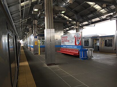
Frankford Transportation Center station
 Taken by Anonymous
See Frankford Transportation Center stop, Philadelphia, on the map
Public transit to Frankford Transportation Center stop (ID: 31033) in Philadelphia
Looking for directions to Frankford Transportation Center in Philadelphia, United States?
Download the Moovit App to find the current schedule and step-by-step directions for Bus, Metro or Train routes that pass through Frankford Transportation Center.
Looking for the nearest stops closest to Frankford Transportation Center ? Check out this list of closest stops to your destination: Frankford Av & Bridge St - FS; Frankford Transportation Center; Bridge St & Darrah St; Frankford Transportation Center - Rt 3; Frankford Av & Wakeling St; Penn St & Pratt St; Cheltenham Av & Frankford Av - Mbns; Pratt St & Saul St; Cheltenham Av & Bustleton Av; Oxford Av & Dyre St .
Bus: 24, 25, 3, 5, 82, 73, 84, 26, 426, L1 OWL.Train: TRE.Metro: L1.Cable Car: 66.
We make riding on public transit to Frankford Transportation Center easy, which is why over 1.5 million users, including users in Philadelphia trust Moovit as the best app for public transit.
Use the app to navigate to popular places including to the airport, hospital, stadium, grocery store, mall, coffee shop, school, college, and university.
Frankford Transportation Center stop’s code is 31033
The first line to this stop is 66, at 4:32 AM, and the last line is 20 at 4:28 AM.
5250 Frankford Ave, Philadelphia, PA, USA
This stop serves SEPTA and SEPTA’s lines
Popular routes from Frankford Transportation Center stop, Philadelphia
Bus stops near Frankford Transportation Center stop
Metro station near Frankford Transportation Center station
Cable Car stations near Frankford Transportation Center station
Popular public transit stations in Philadelphia
Get around Philadelphia by public transit!
Traveling around Philadelphia has never been so easy. See step by step directions as you travel to any attraction, street or major public transit station. View bus and train schedules, arrival times, service alerts and detailed routes on a map, so you know exactly how to get to anywhere in Philadelphia.
When traveling to any destination around Philadelphia use Moovit's Live Directions with Get Off Notifications to know exactly where and how far to walk, how long to wait for your line, and how many stops are left. Moovit will alert you when it's time to get off — no need to constantly re-check whether yours is the next stop.
Wondering how to use public transit in Philadelphia or how to pay for public transit in Philadelphia? Moovit public transit app can help you navigate your way with public transit easily, and at minimum cost. It includes public transit fees, ticket prices, and costs. Looking for a map of Philadelphia public transit lines? Moovit public transit app shows all public transit maps in Philadelphia with all Bus, Train, Metro, Light Rail and Cable Car routes and stops on an interactive map.
Philadelphia has 5 transit type(s), including: Bus, Train, Metro, Light Rail and Cable Car, operated by several transit agencies, including SEPTA Subway, SEPTA Rail, SEPTA, NJ Transit Rail, NJ Transit Bus, Port Authority Transit Corporation, Navy Yard, Penn Transit, Drexel University, Pottstown Area Rapid Transit (PART), Fullington Tours, Chescobus, Amtrak, Greyhound-us and FlixBus-us