Frankfurt (Main) Westbahnhof station - Friday schedule
| Line | Direction | Time |
|---|---|---|
| S3 | Frankfurt (Main) Südbahnhof | 03:05 |
| S6 | Friedberg (Hessen) Bahnhof | 03:10 |
| S6 | Frankfurt (Main) Hauptbahnhof Südseite | 03:33 |
| S5 | Frankfurt (Main) Hauptbahnhof | 04:00 |
| S6 | Frankfurt (Main) Südbahnhof | 04:20 |
| S5 | Frankfurt (Main) Südbahnhof | 04:30 |
| S5 | Friedrichsdorf Bahnhof | 04:30 |
| S6 | Frankfurt (Main) Südbahnhof | 04:50 |
| RB40 | Gießen Bahnhof | 04:57 |
| S5 | Frankfurt (Main) Südbahnhof | 05:00 |
| S5 | Friedrichsdorf Bahnhof | 05:00 |
| S4 | Kronberg (Taunus) Bahnhof | 05:05 |
| S6 | Friedberg (Hessen) Bahnhof | 05:10 |
| S6 | Frankfurt (Main) Südbahnhof | 05:20 |
| RB41 | Frankfurt (Main) Hauptbahnhof | 05:23 |
| S5 | Frankfurt (Main) Südbahnhof | 05:30 |
| S5 | Friedrichsdorf Bahnhof | 05:30 |
| S6 | Frankfurt (Main) Südbahnhof | 05:35 |
| S6 | Friedberg (Hessen) Bahnhof | 05:40 |
| S6 | Frankfurt (Main) Südbahnhof | 05:50 |
| RB40 | Dillenburg Bahnhof | 05:55 |
| RB41 | Schwalmstadt-Treysa | 05:55 |
| S5 | Frankfurt (Main) Südbahnhof | 06:00 |
| S5 | Friedrichsdorf Bahnhof | 06:00 |
| RB40 | Frankfurt (Main) Hauptbahnhof | 06:04 |
See Frankfurt (Main) Westbahnhof, Frankfurt Am Main, on the map
Directions to Frankfurt (Main) Westbahnhof (Frankfurt Am Main) with public transportation
The following transit lines have routes that pass near Frankfurt (Main) Westbahnhof
 Train:
 - Subway:
- Bus:
How to get to Frankfurt (Main) Westbahnhof by bus?
Click on the bus route to see step by step directions with maps, line arrival times and updated time schedules.
How to get to Frankfurt (Main) Westbahnhof by train?
Click on the train route to see step by step directions with maps, line arrival times and updated time schedules.
How to get to Frankfurt (Main) Westbahnhof by subway?
Click on the subway route to see step by step directions with maps, line arrival times and updated time schedules.
Bus stations near Frankfurt (Main) Westbahnhof in Frankfurt Am Main
- Frankfurt (Main) Westbahnhof,2 min walk,
- Frankfurt (Main) Adalbert-/Schloßstraße,7 min walk,
- Frankfurt (Main) Schönhof,10 min walk,
- Frankfurt (Main) Philipp-Reis-Straße,11 min walk,
- Frankfurt (Main) Kasernenstraße,11 min walk,
Light Rail stations near Frankfurt (Main) Westbahnhof in Frankfurt Am Main
- Frankfurt (Main) Adalbert-/Schloßstraße,6 min walk,
- Frankfurt (Main) Kuhwaldstraße,7 min walk,
Bus lines to Frankfurt (Main) Westbahnhof in Frankfurt Am Main
- M32,Frankfurt (Main) Westbahnhof,
- M36,Frankfurt (Main) Westbahnhof,
- M73,Frankfurt (Main) Nordwestzentrum,
- N16,Frankfurt (Main) Ginnheim,
- M34,Frankfurt (Main) Bornheim Mitte,
- N7,Frankfurt (Main) Enkheim,
- 50,Frankfurt (Main) Unterliederbach West,
- M72,Frankfurt (Main) Rödelheim Bahnhof,
What are the closest stations to Frankfurt (Main) Westbahnhof?
The closest stations to Frankfurt (Main) Westbahnhof are:
- Frankfurt (Main) Westbahnhof is 85 meters away, 2 min walk.
- Frankfurt (Main) Adalbert-/Schloßstraße is 417 meters away, 6 min walk.
- Frankfurt (Main) Kuhwaldstraße is 512 meters away, 7 min walk.
- Frankfurt (Main) Schönhof is 699 meters away, 10 min walk.
- Frankfurt (Main) Philipp-Reis-Straße is 801 meters away, 11 min walk.
- Frankfurt (Main) Kasernenstraße is 816 meters away, 11 min walk.
Which train lines stop near Frankfurt (Main) Westbahnhof?
These train lines stop near Frankfurt (Main) Westbahnhof: RB34, S5, S6.
Which subway lines stop near Frankfurt (Main) Westbahnhof?
These subway lines stop near Frankfurt (Main) Westbahnhof: U6, U7.
Which bus lines stop near Frankfurt (Main) Westbahnhof?
These bus lines stop near Frankfurt (Main) Westbahnhof: M32, M34, M36, M73.
What’s the nearest light rail station to Frankfurt (Main) Westbahnhof in Frankfurt Am Main?
The nearest light rail station to Frankfurt (Main) Westbahnhof in Frankfurt Am Main is Frankfurt (Main) Adalbert-/Schloßstraße. It’s a 6 min walk away.
What’s the nearest bus stop to Frankfurt (Main) Westbahnhof in Frankfurt Am Main?
The nearest bus stop to Frankfurt (Main) Westbahnhof in Frankfurt Am Main is Frankfurt (Main) Westbahnhof. It’s a 2 min walk away.
What time is the first light rail to Frankfurt (Main) Westbahnhof in Frankfurt Am Main?
The 10 is the first light rail that goes to Frankfurt (Main) Westbahnhof in Frankfurt Am Main. It stops nearby at 3:44 AM.
What time is the last light rail to Frankfurt (Main) Westbahnhof in Frankfurt Am Main?
The 16 is the last light rail that goes to Frankfurt (Main) Westbahnhof in Frankfurt Am Main. It stops nearby at 1:48 AM.
What time is the first bus to Frankfurt (Main) Westbahnhof in Frankfurt Am Main?
The M36 is the first bus that goes to Frankfurt (Main) Westbahnhof in Frankfurt Am Main. It stops nearby at 3:00 AM.
What time is the last bus to Frankfurt (Main) Westbahnhof in Frankfurt Am Main?
The N16 is the last bus that goes to Frankfurt (Main) Westbahnhof in Frankfurt Am Main. It stops nearby at 3:36 AM.
How much is the subway fare to Frankfurt (Main) Westbahnhof?
The subway fare to Frankfurt (Main) Westbahnhof costs about €2.25 - €3.65.
How much is the bus fare to Frankfurt (Main) Westbahnhof?
The bus fare to Frankfurt (Main) Westbahnhof costs about €2.25 - €3.65.
How much is the train fare to Frankfurt (Main) Westbahnhof?
The train fare to Frankfurt (Main) Westbahnhof costs about €2.25 - €3.65.
How much is the light rail fare to Frankfurt (Main) Westbahnhof?
The light rail fare to Frankfurt (Main) Westbahnhof costs about €2.25 - €3.65.
See Frankfurt (Main) Westbahnhof, Frankfurt Am Main, on the map
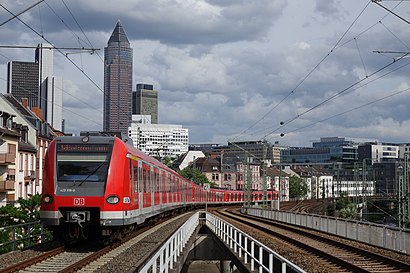
Public transit to Frankfurt (Main) Westbahnhof station in Frankfurt Am Main
Looking for directions to Frankfurt (Main) Westbahnhof in Frankfurt Am Main, Germany?
Download the Moovit App to find the current schedule and step-by-step directions for Train, Bus, Subway or Light Rail routes that pass through Frankfurt (Main) Westbahnhof.
Looking for the nearest stops closest to Frankfurt (Main) Westbahnhof ? Check out this list of closest stops to your destination: Frankfurt (Main) Westbahnhof; Frankfurt (Main) Adalbert-/Schloßstraße; Frankfurt (Main) Kuhwaldstraße; Frankfurt (Main) Schönhof; Frankfurt (Main) Philipp-Reis-Straße; Frankfurt (Main) Kasernenstraße.
Train:Subway:Bus:
We make riding on public transit to Frankfurt (Main) Westbahnhof easy, which is why over 1.5 million users, including users in Frankfurt Am Main trust Moovit as the best app for public transit.
Use the app to navigate to popular places including to the airport, hospital, stadium, grocery store, mall, coffee shop, school, college, and university.
The first line to this station is S3, at 03:05, and the last line is S4 at 02:55.
Kasseler Straße 3, Frankfurt am Main, Germany
This station serves Hessische Landesbahn GmbH, DB Fernverkehr AG, DB Regio AG S-Bahn Rhein-Main, DB Regio AG Mitte Region Hessen and Nahreisezug’s lines
Bus stops near Frankfurt (Main) Westbahnhof
Frankfurt (Main) Westbahnhof,Frankfurt (Main) Adalbert-/Schloßstraße,Frankfurt (Main) Schönhof,Frankfurt (Main) Philipp-Reis-Straße,Frankfurt (Main) KasernenstraßeLight Rail stations near Frankfurt (Main) Westbahnhof
Frankfurt (Main) Adalbert-/Schloßstraße,Frankfurt (Main) KuhwaldstraßePopular public transit stations in Frankfurt Am Main
Finthen, Markthalle,Hasselroth-Neuenhaßlau Festplatz,Wiesbaden-Schierstein Reichsapfelstraße,Rennerod Hauptstr.,Kleinostheim, Hörsteiner Str.,Bad Nauheim Trinkkuranlage,Babenhausen Joachim-Schumann-Schule,Bad Homburg V.D.H.-Kirdorf Friedhof,Linden-Großen-Linden Anne-Frank-Schule,Ebersheim, Fritz-Erler-Straße,Pflaumheim, Zelterhof,Ebsdorfergrund-Heskem Mölln,Wiesbaden-Naurod Erbsenacker,Bensheim, Peter-Krenkel-Straße,Obertshausen Vogelsbergstraße,Wiesbaden-Mainz-Kostheim Luisenstraße,AB-Nilkheim, Jean-Stock-Str.,AB-Damm, Albrechtstraße,Katzenelnbogen Schulzentrum,Bad Homburg V.D.H. BrüningstraßeGet around Frankfurt Am Main by public transit!
Traveling around Frankfurt Am Main has never been so easy. See step by step directions as you travel to any attraction, street or major public transit station. View bus and train schedules, arrival times, service alerts and detailed routes on a map, so you know exactly how to get to anywhere in Frankfurt Am Main.
When traveling to any destination around Frankfurt Am Main use Moovit's Live Directions with Get Off Notifications to know exactly where and how far to walk, how long to wait for your line, and how many stops are left. Moovit will alert you when it's time to get off — no need to constantly re-check whether yours is the next stop.
Wondering how to use public transit in Frankfurt Am Main or how to pay for public transit in Frankfurt Am Main? Moovit public transit app can help you navigate your way with public transit easily, and at minimum cost. It includes public transit fees, ticket prices, and costs. Looking for a map of Frankfurt Am Main public transit lines? Moovit public transit app shows all public transit maps in Frankfurt Am Main with all train, bus, subway or light rail routes and stops on an interactive map.
Frankfurt Am Main has 4 transit type(s), including: train, bus, subway or light rail, operated by several transit agencies, including Stadtwerke Verkehrsgesellschaft Frankfurt, In-der-City-Bus, Stadtwerke Verkehrsgesellschaft Frankfurt, Stadtwerke Verkehrsgesellschaft Frankfurt, DB Regio AG S-Bahn Rhein-Main, Mainzer Mobilität, Mainzer Mobilität, Verkehrsbetriebe Westfalen-Süd GmbH, Magistrat der Stadt Homburg v.d.H., HEAG Mobilo, Stadtverkehr Ingelheim, DB Regio Mitte, Stadtwerke Rüsselsheim, Stadtwerke Gießen and HEAG mobiBus GmbH + Co. KG