How to get to Frankies Laundry by bus?
Click on the bus route to see step by step directions with maps, line arrival times and updated time schedules.
From Stone Zoo, Stoneham
61 minFrom Holiday Inn Express-Saugus, Saugus
81 minFrom Brighton District Court, Boston
86 minFrom Hampton Inn & Suites-Hampton Watertown Boston (Hampton Inn & Suites Watertown Boston), Watertown Town
97 minFrom The Colonnade Hotel Boston, Boston
70 minFrom Andrew Square, Boston
64 minFrom The Monument, Boston
85 minFrom 110 Francis Street Garage, Boston
93 minFrom Apple Cinemas, Cambridge
98 minFrom Brandy Melville, Boston
52 min
How to get to Frankies Laundry by subway?
Click on the subway route to see step by step directions with maps, line arrival times and updated time schedules.
Bus stops near Frankies Laundry in Boston
Subway station near Frankies Laundry in Boston
- Airport, 15 min walk,VIEW
Ferry station near Frankies Laundry in Boston
- Lewis Mall Wharf, 22 min walk,VIEW
Bus lines to Frankies Laundry in Boston
What are the closest stations to Frankies Laundry?
The closest stations to Frankies Laundry are:
- Meridian St @ White St is 42 yards away, 1 min walk.
- Lexington St @ Putnam St is 294 yards away, 4 min walk.
- Airport is 1259 yards away, 15 min walk.
- Lewis Mall Wharf is 1843 yards away, 22 min walk.
Which bus lines stop near Frankies Laundry?
These bus lines stop near Frankies Laundry: 104, 114, 116, SL3.
Which subway line stops near Frankies Laundry?
BLUE LINE (Wonderland)
What’s the nearest subway station to Frankies Laundry in Boston?
The nearest subway station to Frankies Laundry in Boston is Airport. It’s a 15 min walk away.
What’s the nearest bus station to Frankies Laundry in Boston?
The nearest bus station to Frankies Laundry in Boston is Meridian St @ White St. It’s a 1 min walk away.
What’s the nearest ferry station to Frankies Laundry in Boston?
The nearest ferry station to Frankies Laundry in Boston is Lewis Mall Wharf. It’s a 22 min walk away.
What time is the first subway to Frankies Laundry in Boston?
The BLUE LINE is the first subway that goes to Frankies Laundry in Boston. It stops nearby at 5:10 AM.
What time is the last subway to Frankies Laundry in Boston?
The BLUE LINE is the last subway that goes to Frankies Laundry in Boston. It stops nearby at 2:01 AM.
What time is the first bus to Frankies Laundry in Boston?
The 116 is the first bus that goes to Frankies Laundry in Boston. It stops nearby at 4:40 AM.
What time is the last bus to Frankies Laundry in Boston?
The 116 is the last bus that goes to Frankies Laundry in Boston. It stops nearby at 2:13 AM.
What time is the first ferry to Frankies Laundry in Boston?
The EAST is the first ferry that goes to Frankies Laundry in Boston. It stops nearby at 5:55 AM.
What time is the last ferry to Frankies Laundry in Boston?
The EAST BOSTON FERRY is the last ferry that goes to Frankies Laundry in Boston. It stops nearby at 7:55 PM.
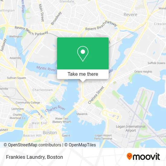
See Frankies Laundry, Boston, on the map
Public Transit to Frankies Laundry in Boston
Wondering how to get to Frankies Laundry in Boston? Moovit helps you find the best way to get to Frankies Laundry with step-by-step directions from the nearest public transit station.
Moovit provides free maps and live directions to help you navigate through your city. View schedules, routes, timetables, and find out how long does it take to get to Frankies Laundry in real time.
Looking for the nearest stop or station to Frankies Laundry? Check out this list of stops closest to your destination: Meridian St @ White St; Lexington St @ Putnam St; Airport; Lewis Mall Wharf.
Bus: 104, 114, 116, SL3, 121.Subway: BLUE LINE.Ferry: EAST BOSTON FERRY, EAST.
Want to see if there’s another route that gets you there at an earlier time? Moovit helps you find alternative routes or times. Get directions from and directions to Frankies Laundry easily from the Moovit App or Website.
We make riding to Frankies Laundry easy, which is why over 1.7 million users, including users in Boston, trust Moovit as the best app for public transit. You don’t need to download an individual bus app or train app, Moovit is your all-in-one transit app that helps you find the best bus time or train time available.
For information on prices of bus and subway, costs and ride fares to Frankies Laundry, please check the Moovit app.
Use the app to navigate to popular places including to the airport, hospital, stadium, grocery store, mall, coffee shop, school, college, and university.
Frankies Laundry Address: 411 Meridian St street in Boston
- Nueva Vida Christiana Iglesia (Iglesia Cristiana Nueva Vida Page),
- Iglesia Cristiana Nueva Vida,
- Eagle Hill Community Garden,
- Mario Umana Academy,
- Fiorentino J. Dicarolis Square,
- Veronica Robles Cultural Center,
- East Boston Public Library Building,
- Central Park Lanes Bowling Center,
- Ria Money Transfer,
- Central Park Lanes,
- Eb's Thrifty Center,
- Kelley Square Pub,
- Montecristo (Restaurante Monte Cristo),
- El Peñol (El Penllo Arriba Peru),
- Consulado de El Salvador en Boston,
- El Peñol,
- Rino's Place,
- Liberty Plaza,
- America Soccer Store,
- Billiards Colombia (Billares Colombia)
Places Near Frankies Laundry (Boston)
- Isabella Stewart Gardner Museum, Boston,
- Mgm Music Hall, Boston,
- Wilbur Theatre, Boston,
- Boston Medical Center, Boston,
- Quincy Market, Boston,
- Leader Bank Pavilion (Leader Bank Pavillion), Boston,
- Cheers, Boston,
- Castle Island, Boston,
- House Of Blues, Boston,
- Wang Theater, Boston,
- Boston Children's Hospital, Boston,
- Seaport District, Boston,
- Faneuil Hall, Boston,
- Boston Convention & Exhibition Center, Boston,
- Massachusetts General Hospital, Boston,
- Prudential Center, Boston,
- North End, Boston,
- Td Garden, Boston,
- Museum Of Science, Boston,
- Boston Common, Boston
How to get to popular places in Boston with public transit
Get around Boston by public transit!
Traveling around Boston has never been so easy. See step by step directions as you travel to any attraction, street or major public transit station. View bus and train schedules, arrival times, service alerts and detailed routes on a map, so you know exactly how to get to anywhere in Boston.
When traveling to any destination around Boston use Moovit's Live Directions with Get Off Notifications to know exactly where and how far to walk, how long to wait for your line, and how many stops are left. Moovit will alert you when it's time to get off — no need to constantly re-check whether yours is the next stop.
Wondering how to use public transit in Boston or how to pay for public transit in Boston? Moovit public transit app can help you navigate your way with public transit easily, and at minimum cost. It includes public transit fees, ticket prices, and costs. Looking for a map of Boston public transit lines? Moovit public transit app shows all public transit maps in Boston with all Bus, Train, Subway and Ferry routes and stops on an interactive map.
Boston has 4 transit type(s), including: Bus, Train, Subway and Ferry, operated by several transit agencies, including MBTA, Southeastern Regional Transit Authority, MetroWest Regional Transit Authority, Rhode Island Public Transit Authority, WRTA, Lowell Regional Transit Authority, Merrimack Valley Transit, Montachusett Regional Transit Authority, Cape Cod Regional Transit Authority, Brockton Area Transit Authority, Martha's Vineyard Transit Authority, the WAVE - Nantucket Regional Transit Authority, GATRA, Cape Ann Transportation Authority and Massport