See Franklin Flea, Philadelphia, on the map
Directions to Franklin Flea (Philadelphia) with public transportation
The following transit lines have routes that pass near Franklin Flea
 Bus:
Bus: - Train:
- Subway:
How to get to Franklin Flea by bus?
Click on the bus route to see step by step directions with maps, line arrival times and updated time schedules.
How to get to Franklin Flea by train?
Click on the train route to see step by step directions with maps, line arrival times and updated time schedules.
How to get to Franklin Flea by subway?
Click on the subway route to see step by step directions with maps, line arrival times and updated time schedules.
Bus stations near Franklin Flea in Philadelphia
- 12th St & Market St ,2 min walk,
- Market St At 12th St,3 min walk,
- Market St & 12th St,3 min walk,
- Market St & 11th St - Mbns,3 min walk,
Bus lines to Franklin Flea in Philadelphia
- 23,11th-Market,
- 45,Broad-Oregon,
- 313,Cape May-Wildwood-Phila,
- 315,Cape May-Wildwood-Phila,
- 316,Cape May-Wildwood-Phila Exp,
- 317,Asbury Park-Fort Dix-Phila,
- 400,Sicklerville - Philadelphia,
- 401,Salem - Philadelphia,
- 402,Pennsville - Philadelphia,
- 404,CherryHillMall-Pennsauken-Ph,
- 406,Berlin-Marlton-Philadelphia,
- 408,Millville - Philadelphia,
- 409,Trenton-Willingboro-Phila,
- 410,Bridgeton - Philadelphia,
- 412,Sewell-Glassboro-Phila,
- 414,Philadelphia - Moorestown,
- 417,Mt. Holly-Willingboro-Phila,
- 551,Philadelphia - Atlantic City,
- 555,Phila-Avandale Park&Ride,
- 17,2nd-Market,
What are the closest stations to Franklin Flea?
The closest stations to Franklin Flea are:
- 12th St & Market St is 101 yards away, 2 min walk.
- Market St At 12th St is 182 yards away, 3 min walk.
- Market St & 12th St is 198 yards away, 3 min walk.
- Market St & 11th St - Mbns is 205 yards away, 3 min walk.
Which bus lines stop near Franklin Flea?
These bus lines stop near Franklin Flea: 23, 409, 551, 61.
Which train lines stop near Franklin Flea?
These train lines stop near Franklin Flea: PAOLI/THORNDALE LINE, PATCO, TRENTON LINE.
Which subway lines stop near Franklin Flea?
These subway lines stop near Franklin Flea: BSL, MFL.
What’s the nearest bus stop to Franklin Flea in Philadelphia?
The nearest bus stop to Franklin Flea in Philadelphia is 12th St & Market St. It’s a 2 min walk away.
See Franklin Flea, Philadelphia, on the map
Public Transit to Franklin Flea in Philadelphia
Wondering how to get to Franklin Flea in Philadelphia, United States? Moovit helps you find the best way to get to Franklin Flea with step-by-step directions from the nearest public transit station.
Moovit provides free maps and live directions to help you navigate through your city. View schedules, routes, timetables, and find out how long does it take to get to Franklin Flea in real time.
Looking for the nearest stop or station to Franklin Flea? Check out this list of stops closest to your destination: 12th St & Market St ; Market St At 12th St; Market St & 12th St; Market St & 11th St - Mbns.
Bus:Train:Subway:
Want to see if there’s another route that gets you there at an earlier time? Moovit helps you find alternative routes or times. Get directions from and directions to Franklin Flea easily from the Moovit App or Website.
We make riding to Franklin Flea easy, which is why over 1.5 million users, including users in Philadelphia, trust Moovit as the best app for public transit. You don’t need to download an individual bus app or train app, Moovit is your all-in-one transit app that helps you find the best bus time or train time available.
For information on prices of train, bus and subway, costs and ride fares to Franklin Flea, please check the Moovit app.
Use the app to navigate to popular places including to the airport, hospital, stadium, grocery store, mall, coffee shop, school, college, and university.
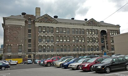
Franklin Flea Address: 1180 Filbert St street in Philadelphia
Attractions near Franklin Flea
Reading Station,MSU Alumni Club Of Greater Philadelphia @ The Field House,Shibumi,Field House,1150 Filbert Street,AirTran Airways,New Sun Fashions,Mercedes-Benz At Philly Auto Show,Wan's Seafood,Terminal Seafoods,Original Turkey,Cjmr Inc Ta The Original Turkey,Bassetts Ice Cream,Mueller Chocolate,Salumeria,Big Bus Company Stop 5,Lady K Kafe Center City Philadelphia,Emergency Anytime Locksmith,Corner Bakery Cafe,Amy's PlaceHow to get to popular attractions in Philadelphia with public transit
Malvern, PA, Malvern,West Chester, PA, West Chester,Honey's Sit 'n Eat, Philadelphia,Voyeur, Philadelphia,Starbucks, Philadelphia,Spring Valley YMCA, Limerick,Havertown, PA, Haverford,Amada, Philadelphia,Sharon Hill, PA, Collingdale,Hard Rock Cafe Philadelphia, Philadelphia,Woody's, Philadelphia,Moriarty's Restaurant & Irish Pub, Philadelphia,SEPTA Torresdale Station, Philadelphia,Hyatt Regency Princeton,Our Lady of Lourdes Hospital, Camden,Williamstown, NJ, Williamstown,Bristol Borough, Bristol,Hamilton Square, NJ, Hamilton Square,Three Monkeys Café, Philadelphia,Cuba Libre Restaurant & Rum Bar, PhiladelphiaGet around Philadelphia by public transit!
Traveling around Philadelphia has never been so easy. See step by step directions as you travel to any attraction, street or major public transit station. View bus and train schedules, arrival times, service alerts and detailed routes on a map, so you know exactly how to get to anywhere in Philadelphia.
When traveling to any destination around Philadelphia use Moovit's Live Directions with Get Off Notifications to know exactly where and how far to walk, how long to wait for your line, and how many stops are left. Moovit will alert you when it's time to get off — no need to constantly re-check whether yours is the next stop.
Wondering how to use public transit in Philadelphia or how to pay for public transit in Philadelphia? Moovit public transit app can help you navigate your way with public transit easily, and at minimum cost. It includes public transit fees, ticket prices, and costs. Looking for a map of Philadelphia public transit lines? Moovit public transit app shows all public transit maps in Philadelphia with all train, bus or subway routes and stops on an interactive map.
Philadelphia has 3 transit type(s), including: train, bus or subway, operated by several transit agencies, including SEPTA Subway, SEPTA Trolley, SEPTA Rail, SEPTA, SEPTA, NJ TRANSIT RAIL-Rail, NJ TRANSIT RAIL-Tram, NJ TRANSIT BUS, Port Authority Transit Corporation, Navy Yard, Penn Transit, Drexel University, Pottstown Area Rapid Transit (PART), Fullington Tours and Chescobus