Directions to Franklin Highlands (Boston) with public transportation
The following transit lines have routes that pass near Franklin Highlands
 Bus: 22, 29, 44, 32, 34.
- Train: FAIRMOUNT, FRANKLIN/FOXBORO, PROVIDENCE/STOUGHTON.
- Subway: ORANGE LINE.
How to get to Franklin Highlands by bus?
Click on the bus route to see step by step directions with maps, line arrival times and updated time schedules.
From Intercontinental Boston Hotel Boston, Boston
43 minFrom Wellington Station, Medford
97 minFrom Hampton Inn Boston Logan Airport Chelsea, Chelsea
85 minFrom Qea, Quincy
89 minFrom Gateway Center, Everett
102 minFrom Academy Of the Pacific Rim Charter Public School, Boston
71 minFrom Costco, Everett
122 minFrom TownePlace Suites Boston Logan Airport/Chelsea, Chelsea
77 minFrom Edic Pier, Boston
54 minFrom Bostonia Public House, Boston
51 min
How to get to Franklin Highlands by train?
Click on the train route to see step by step directions with maps, line arrival times and updated time schedules.
How to get to Franklin Highlands by subway?
Click on the subway route to see step by step directions with maps, line arrival times and updated time schedules.
From Intercontinental Boston Hotel Boston, Boston
46 minFrom Wellington Station, Medford
48 minFrom Qea, Quincy
66 minFrom Gateway Center, Everett
65 minFrom Costco, Everett
63 minFrom TownePlace Suites Boston Logan Airport/Chelsea, Chelsea
63 minFrom Edic Pier, Boston
69 minFrom Bostonia Public House, Boston
41 min
Bus stops near Franklin Highlands in Boston
Train station near Franklin Highlands in Boston
- Four Corners/Geneva, 8 min walk,VIEW
Subway station near Franklin Highlands in Boston
- Jackson Square, 20 min walk,VIEW
Bus lines to Franklin Highlands in Boston
What are the closest stations to Franklin Highlands?
The closest stations to Franklin Highlands are:
- Humboldt Ave @ Seaver St is 300 yards away, 4 min walk.
- Seaver St @ Humboldt Ave is 355 yards away, 5 min walk.
- Four Corners/Geneva is 619 yards away, 8 min walk.
- Jackson Square is 1657 yards away, 20 min walk.
Which bus lines stop near Franklin Highlands?
These bus lines stop near Franklin Highlands: 22, 29, 44.
Which train line stops near Franklin Highlands?
FAIRMOUNT (#1619 | Fairmount)
Which subway line stops near Franklin Highlands?
ORANGE LINE (Forest Hills)
What’s the nearest subway station to Franklin Highlands in Boston?
The nearest subway station to Franklin Highlands in Boston is Jackson Square. It’s a 20 min walk away.
What’s the nearest train station to Franklin Highlands in Boston?
The nearest train station to Franklin Highlands in Boston is Four Corners/Geneva. It’s a 8 min walk away.
What’s the nearest bus station to Franklin Highlands in Boston?
The nearest bus station to Franklin Highlands in Boston is Humboldt Ave @ Seaver St. It’s a 4 min walk away.
What time is the first subway to Franklin Highlands in Boston?
The ORANGE LINE is the first subway that goes to Franklin Highlands in Boston. It stops nearby at 5:16 AM.
What time is the last subway to Franklin Highlands in Boston?
The ORANGE LINE is the last subway that goes to Franklin Highlands in Boston. It stops nearby at 1:56 AM.
What time is the first train to Franklin Highlands in Boston?
The FAIRMOUNT is the first train that goes to Franklin Highlands in Boston. It stops nearby at 6:30 AM.
What time is the last train to Franklin Highlands in Boston?
The FAIRMOUNT is the last train that goes to Franklin Highlands in Boston. It stops nearby at 12:00 AM.
What time is the first bus to Franklin Highlands in Boston?
The 22 is the first bus that goes to Franklin Highlands in Boston. It stops nearby at 5:03 AM.
What time is the last bus to Franklin Highlands in Boston?
The 22 is the last bus that goes to Franklin Highlands in Boston. It stops nearby at 2:08 AM.
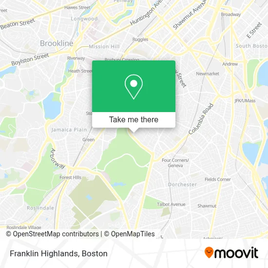
See Franklin Highlands, Boston, on the map
Public Transit to Franklin Highlands in Boston
Wondering how to get to Franklin Highlands in Boston? Moovit helps you find the best way to get to Franklin Highlands with step-by-step directions from the nearest public transit station.
Moovit provides free maps and live directions to help you navigate through your city. View schedules, routes, timetables, and find out how long does it take to get to Franklin Highlands in real time.
Looking for the nearest stop or station to Franklin Highlands? Check out this list of stops closest to your destination: Humboldt Ave @ Seaver St; Seaver St @ Humboldt Ave; Four Corners/Geneva; Jackson Square.
Bus: 22, 29, 44, 32, 34, 36, 38.Train: FAIRMOUNT, FRANKLIN/FOXBORO, PROVIDENCE/STOUGHTON.Subway: ORANGE LINE.
Want to see if there’s another route that gets you there at an earlier time? Moovit helps you find alternative routes or times. Get directions from and directions to Franklin Highlands easily from the Moovit App or Website.
We make riding to Franklin Highlands easy, which is why over 1.7 million users, including users in Boston, trust Moovit as the best app for public transit. You don’t need to download an individual bus app or train app, Moovit is your all-in-one transit app that helps you find the best bus time or train time available.
For information on prices of bus, subway and train, costs and ride fares to Franklin Highlands, please check the Moovit app.
Use the app to navigate to popular places including to the airport, hospital, stadium, grocery store, mall, coffee shop, school, college, and university.
Franklin Highlands Address: 278 Humboldt Ave street in Boston
- USPS Collection Box - Blue Box,
- h block,
- Robinhoodmarketplacebo,
- United House Of Prayer,
- A-Plus Welders 4 Hire,
- Overall Construction,
- 176 Humboldt Avenue Condominium Association,
- Opportunities Unlimited,
- Franklin Park Zoo @ Birds,
- Zoorassic Park @ Franklin Park Zoo,
- Sunny Hill Garden Suites,
- Franklin Park - Overlook Ruins,
- William H Darling CPA,
- LTK Engineering Services,
- Travelers Inn,
- Cambridge Historic Fou,
- Community Newspaper,
- Edens Garden Body Work,
- Fun with Science Programs,
- Franklin Park
Places Near Franklin Highlands (Boston)
- Boston Children's Hospital, Boston,
- North End, Boston,
- Cheers, Boston,
- Wang Theater, Boston,
- Boston Convention & Exhibition Center, Boston,
- Museum Of Science, Boston,
- Mgm Music Hall, Boston,
- House Of Blues, Boston,
- Boston Medical Center, Boston,
- Wilbur Theatre, Boston,
- Boston Common, Boston,
- Leader Bank Pavilion (Leader Bank Pavillion), Boston,
- Massachusetts General Hospital, Boston,
- Prudential Center, Boston,
- Castle Island, Boston,
- Td Garden, Boston,
- Faneuil Hall, Boston,
- Isabella Stewart Gardner Museum, Boston,
- Seaport District, Boston,
- Quincy Market, Boston
How to get to popular places in Boston with public transit
Get around Boston by public transit!
Traveling around Boston has never been so easy. See step by step directions as you travel to any attraction, street or major public transit station. View bus and train schedules, arrival times, service alerts and detailed routes on a map, so you know exactly how to get to anywhere in Boston.
When traveling to any destination around Boston use Moovit's Live Directions with Get Off Notifications to know exactly where and how far to walk, how long to wait for your line, and how many stops are left. Moovit will alert you when it's time to get off — no need to constantly re-check whether yours is the next stop.
Wondering how to use public transit in Boston or how to pay for public transit in Boston? Moovit public transit app can help you navigate your way with public transit easily, and at minimum cost. It includes public transit fees, ticket prices, and costs. Looking for a map of Boston public transit lines? Moovit public transit app shows all public transit maps in Boston with all Bus, Train, Subway and Ferry routes and stops on an interactive map.
Boston has 4 transit type(s), including: Bus, Train, Subway and Ferry, operated by several transit agencies, including MBTA, Southeastern Regional Transit Authority, MetroWest Regional Transit Authority, Rhode Island Public Transit Authority, WRTA, Lowell Regional Transit Authority, Merrimack Valley Transit, Montachusett Regional Transit Authority, Cape Cod Regional Transit Authority, Brockton Area Transit Authority, Martha's Vineyard Transit Authority, the WAVE - Nantucket Regional Transit Authority, GATRA, Cape Ann Transportation Authority and Massport