Directions to Franklin M.A. (Franklin Town) with public transportation
The following transit lines have routes that pass near Franklin M.A.
 Bus: 495C.
- Train: FRANKLIN/FOXBORO.
How to get to Franklin M.A. by bus?
Click on the bus route to see step by step directions with maps, line arrival times and updated time schedules.
How to get to Franklin M.A. by train?
Click on the train route to see step by step directions with maps, line arrival times and updated time schedules.
Train station near Franklin M.A. in Franklin Town
- Franklin/Dean College, 19 min walk,VIEW
What are the closest stations to Franklin M.A.?
The closest stations to Franklin M.A. are:
- Franklin/Dean College is 1572 yards away, 19 min walk.
Which bus line stops near Franklin M.A.?
495C (Milford Crossing→Forge Park Mbta Station)
Which train line stops near Franklin M.A.?
FRANKLIN/FOXBORO (#721 | Forge Park/495)
What’s the nearest train station to Franklin M.A. in Franklin Town?
The nearest train station to Franklin M.A. in Franklin Town is Franklin/Dean College. It’s a 19 min walk away.
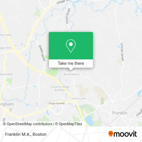
See Franklin M.A., Franklin Town, on the map
Public Transit to Franklin M.A. in Franklin Town
Wondering how to get to Franklin M.A. in Franklin Town? Moovit helps you find the best way to get to Franklin M.A. with step-by-step directions from the nearest public transit station.
Moovit provides free maps and live directions to help you navigate through your city. View schedules, routes, timetables, and find out how long does it take to get to Franklin M.A. in real time.
Looking for the nearest stop or station to Franklin M.A.? Check out this list of stops closest to your destination: Franklin/Dean College.
Bus: 495C.Train: FRANKLIN/FOXBORO.
Want to see if there’s another route that gets you there at an earlier time? Moovit helps you find alternative routes or times. Get directions from and directions to Franklin M.A. easily from the Moovit App or Website.
We make riding to Franklin M.A. easy, which is why over 1.7 million users, including users in Franklin Town, trust Moovit as the best app for public transit. You don’t need to download an individual bus app or train app, Moovit is your all-in-one transit app that helps you find the best bus time or train time available.
For information on prices of train and bus, costs and ride fares to Franklin M.A., please check the Moovit app.
Use the app to navigate to popular places including to the airport, hospital, stadium, grocery store, mall, coffee shop, school, college, and university.
Location: Franklin Town, Boston
- Franklin,
- Milford Regional Medical Center,
- Stop & Shop,
- Grand Residences by Marriott-Boston Franklin,
- Franklin Long Distance Moving,
- Forge Park / 495 MBTA Station - Commuter Rail,
- Neta,
- Heidelberg Engineering US,
- Amazon Delivery Location-DCB8,
- Berkshire Hathaway Homeservices,
- Paramount Heating and Cooling,
- Forge Property,
- The Realty Associates Fund VIII,
- Forge Park,
- Matco Company,
- Arlyn Halpern,
- Estes Logistics,
- Bay State Pt Franklin Ma,
- Net Zero Landscaping,
- Dean College
Places Near Franklin M.A. (Franklin Town)
- Museum Of Science, Boston,
- Quincy Market, Boston,
- Wilbur Theatre, Boston,
- Wang Theater, Boston,
- Faneuil Hall, Boston,
- North End, Boston,
- House Of Blues, Boston,
- Boston Common, Boston,
- Seaport District, Boston,
- Prudential Center, Boston,
- Cheers, Boston,
- Boston Children's Hospital, Boston,
- Mgm Music Hall, Boston,
- Boston Medical Center, Boston,
- Castle Island, Boston,
- Isabella Stewart Gardner Museum, Boston,
- Boston Convention & Exhibition Center, Boston,
- Massachusetts General Hospital, Boston,
- Td Garden, Boston,
- Leader Bank Pavilion (Leader Bank Pavillion), Boston
How to get to popular places in Boston with public transit
Get around Franklin Town by public transit!
Traveling around Franklin Town has never been so easy. See step by step directions as you travel to any attraction, street or major public transit station. View bus and train schedules, arrival times, service alerts and detailed routes on a map, so you know exactly how to get to anywhere in Franklin Town.
When traveling to any destination around Franklin Town use Moovit's Live Directions with Get Off Notifications to know exactly where and how far to walk, how long to wait for your line, and how many stops are left. Moovit will alert you when it's time to get off — no need to constantly re-check whether yours is the next stop.
Wondering how to use public transit in Franklin Town or how to pay for public transit in Franklin Town? Moovit public transit app can help you navigate your way with public transit easily, and at minimum cost. It includes public transit fees, ticket prices, and costs. Looking for a map of Franklin Town public transit lines? Moovit public transit app shows all public transit maps in Franklin Town with all Bus, Train, Subway and Ferry routes and stops on an interactive map.
Boston has 4 transit type(s), including: Bus, Train, Subway and Ferry, operated by several transit agencies, including MBTA, Southeastern Regional Transit Authority, MetroWest Regional Transit Authority, Rhode Island Public Transit Authority, WRTA, Lowell Regional Transit Authority, Merrimack Valley Transit, Montachusett Regional Transit Authority, Cape Cod Regional Transit Authority, Brockton Area Transit Authority, Martha's Vineyard Transit Authority, the WAVE - Nantucket Regional Transit Authority, GATRA, Cape Ann Transportation Authority and Massport