Directions to Fraternal Lodge Af & AM (Barnstable Town) with public transportation
The following transit lines have routes that pass near Fraternal Lodge Af & AM
How to get to Fraternal Lodge Af & AM by bus?
Click on the bus route to see step by step directions with maps, line arrival times and updated time schedules.
Bus stop near Fraternal Lodge Af & AM in Barnstable Town
- Centerville (Old Stage Road & Main Street), 9 min walk,VIEW
Bus lines to Fraternal Lodge Af & AM in Barnstable Town
- SEALINE HYANNIS-FALMOUTH/WOODS HOLE, Mashpee Commons (Stop & Shop),VIEW
What are the closest stations to Fraternal Lodge Af & AM?
The closest stations to Fraternal Lodge Af & AM are:
- Centerville (Old Stage Road & Main Street) is 753 yards away, 9 min walk.
Which bus lines stop near Fraternal Lodge Af & AM?
These bus lines stop near Fraternal Lodge Af & AM: SANDWICH LINE, SEALINE HYANNIS-FALMOUTH/WOODS HOLE.
What’s the nearest bus station to Fraternal Lodge Af & AM in Barnstable Town?
The nearest bus station to Fraternal Lodge Af & AM in Barnstable Town is Centerville (Old Stage Road & Main Street). It’s a 9 min walk away.
What time is the first bus to Fraternal Lodge Af & AM in Barnstable Town?
The SEALINE HYANNIS-FALMOUTH/WOODS HOLE is the first bus that goes to Fraternal Lodge Af & AM in Barnstable Town. It stops nearby at 7:44 AM.
What time is the last bus to Fraternal Lodge Af & AM in Barnstable Town?
The SEALINE HYANNIS-FALMOUTH/WOODS HOLE is the last bus that goes to Fraternal Lodge Af & AM in Barnstable Town. It stops nearby at 8:43 PM.
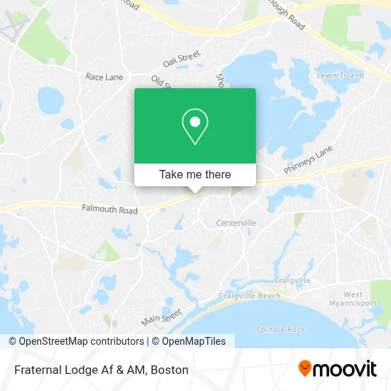
See Fraternal Lodge Af & AM, Barnstable Town, on the map
Public Transit to Fraternal Lodge Af & AM in Barnstable Town
Wondering how to get to Fraternal Lodge Af & AM in Barnstable Town? Moovit helps you find the best way to get to Fraternal Lodge Af & AM with step-by-step directions from the nearest public transit station.
Moovit provides free maps and live directions to help you navigate through your city. View schedules, routes, timetables, and find out how long does it take to get to Fraternal Lodge Af & AM in real time.
Looking for the nearest stop or station to Fraternal Lodge Af & AM? Check out this list of stops closest to your destination: Centerville (Old Stage Road & Main Street).
Bus: SANDWICH LINE, SEALINE HYANNIS-FALMOUTH/WOODS HOLE.
Want to see if there’s another route that gets you there at an earlier time? Moovit helps you find alternative routes or times. Get directions from and directions to Fraternal Lodge Af & AM easily from the Moovit App or Website.
We make riding to Fraternal Lodge Af & AM easy, which is why over 1.7 million users, including users in Barnstable Town, trust Moovit as the best app for public transit. You don’t need to download an individual bus app or train app, Moovit is your all-in-one transit app that helps you find the best bus time or train time available.
For information on prices of bus, costs and ride fares to Fraternal Lodge Af & AM, please check the Moovit app.
Use the app to navigate to popular places including to the airport, hospital, stadium, grocery store, mall, coffee shop, school, college, and university.
Fraternal Lodge Af & AM Address: 1989 Falmouth Rd street in Barnstable Town
- Minuteman Press,
- Agape Ministries,
- Kneeland Landscaping,
- Rousseau Painting & Decorating,
- Enchanted Florist Centerville,
- Kana Construction,
- Cape Cod Foodie Tours,
- Hairball Charters,
- United Prime Cleaning,
- Harbor Haven Landscape,
- Plumbing Concepts of Cape Cod,
- Oracle Bee's Bijouterie,
- Moran & Associates Insurance Staffing,
- All Fixed,
- Shep Hardscape Services,
- E-Vacuum,
- Whiteley Enterprises,
- Chip's House,
- Centerville, Massachusetts,
- 7-Eleven
Places Near Fraternal Lodge Af & AM (Barnstable Town)
- Cheers, Boston,
- Boston Children's Hospital, Boston,
- Boston Medical Center, Boston,
- Prudential Center, Boston,
- Boston Convention & Exhibition Center, Boston,
- Wilbur Theatre, Boston,
- Quincy Market, Boston,
- Castle Island, Boston,
- Mgm Music Hall, Boston,
- House Of Blues, Boston,
- Isabella Stewart Gardner Museum, Boston,
- Td Garden, Boston,
- Seaport District, Boston,
- North End, Boston,
- Museum Of Science, Boston,
- Massachusetts General Hospital, Boston,
- Leader Bank Pavilion (Leader Bank Pavillion), Boston,
- Boston Common, Boston,
- Wang Theater, Boston,
- Faneuil Hall, Boston
How to get to popular places in Boston with public transit
Get around Barnstable Town by public transit!
Traveling around Barnstable Town has never been so easy. See step by step directions as you travel to any attraction, street or major public transit station. View bus and train schedules, arrival times, service alerts and detailed routes on a map, so you know exactly how to get to anywhere in Barnstable Town.
When traveling to any destination around Barnstable Town use Moovit's Live Directions with Get Off Notifications to know exactly where and how far to walk, how long to wait for your line, and how many stops are left. Moovit will alert you when it's time to get off — no need to constantly re-check whether yours is the next stop.
Wondering how to use public transit in Barnstable Town or how to pay for public transit in Barnstable Town? Moovit public transit app can help you navigate your way with public transit easily, and at minimum cost. It includes public transit fees, ticket prices, and costs. Looking for a map of Barnstable Town public transit lines? Moovit public transit app shows all public transit maps in Barnstable Town with all Bus, Train, Subway and Ferry routes and stops on an interactive map.
Boston has 4 transit type(s), including: Bus, Train, Subway and Ferry, operated by several transit agencies, including MBTA, Southeastern Regional Transit Authority, MetroWest Regional Transit Authority, Rhode Island Public Transit Authority, WRTA, Lowell Regional Transit Authority, Merrimack Valley Transit, Montachusett Regional Transit Authority, Cape Cod Regional Transit Authority, Brockton Area Transit Authority, Martha's Vineyard Transit Authority, the WAVE - Nantucket Regional Transit Authority, GATRA, Cape Ann Transportation Authority and Massport