Directions to Freddy Aravena (Everett) with public transportation
The following transit lines have routes that pass near Freddy Aravena
 Bus: 109, 110, 112, SL3, 104.
- Train: NEWBURYPORT/ROCKPORT.
- Subway: ORANGE LINE.
How to get to Freddy Aravena by bus?
Click on the bus route to see step by step directions with maps, line arrival times and updated time schedules.
From Jamaica Plain V.A., Boston
86 minFrom Homewood Suites by Hilton Boston Brookline-Longwood Medical, Brookline
86 minFrom barking crab, Boston
36 minFrom Arsenal Mall, Watertown Town
73 minFrom Arsenal Yards, Watertown Town
74 minFrom Winchester, MA, Winchester
50 minFrom Financial District, Boston
41 minFrom Centre St, Boston
90 minFrom Roxbury Community College, Boston
95 minFrom Maggiano's (Maggiano's Little Italy), Boston
57 min
How to get to Freddy Aravena by train?
Click on the train route to see step by step directions with maps, line arrival times and updated time schedules.
How to get to Freddy Aravena by subway?
Click on the subway route to see step by step directions with maps, line arrival times and updated time schedules.
From Jamaica Plain V.A., Boston
84 minFrom Homewood Suites by Hilton Boston Brookline-Longwood Medical, Brookline
83 minFrom barking crab, Boston
47 minFrom Financial District, Boston
51 minFrom Centre St, Boston
64 minFrom Roxbury Community College, Boston
62 minFrom Maggiano's (Maggiano's Little Italy), Boston
58 min
Bus stops near Freddy Aravena in Everett
Train station near Freddy Aravena in Everett
- Chelsea, 16 min walk,VIEW
Subway station near Freddy Aravena in Everett
- Wellington, 42 min walk,VIEW
Bus lines to Freddy Aravena in Everett
What are the closest stations to Freddy Aravena?
The closest stations to Freddy Aravena are:
- Chelsea St @ Mead St is 217 yards away, 3 min walk.
- Second St @ Spring St is 435 yards away, 6 min walk.
- Anthem/Greystar is 767 yards away, 10 min walk.
- Chelsea is 1117 yards away, 16 min walk.
- Wellington is 3509 yards away, 42 min walk.
Which bus lines stop near Freddy Aravena?
These bus lines stop near Freddy Aravena: 109, 110, 112, SL3.
Which train line stops near Freddy Aravena?
NEWBURYPORT/ROCKPORT (#125 | Newburyport)
Which subway line stops near Freddy Aravena?
ORANGE LINE (Oak Grove)
What’s the nearest train station to Freddy Aravena in Everett?
The nearest train station to Freddy Aravena in Everett is Chelsea. It’s a 16 min walk away.
What’s the nearest bus station to Freddy Aravena in Everett?
The nearest bus station to Freddy Aravena in Everett is Chelsea St @ Mead St. It’s a 3 min walk away.
What time is the first subway to Freddy Aravena in Everett?
The ORANGE LINE is the first subway that goes to Freddy Aravena in Everett. It stops nearby at 5:19 AM.
What time is the last subway to Freddy Aravena in Everett?
The ORANGE LINE is the last subway that goes to Freddy Aravena in Everett. It stops nearby at 1:53 AM.
What time is the first train to Freddy Aravena in Everett?
The NEWBURYPORT/ROCKPORT is the first train that goes to Freddy Aravena in Everett. It stops nearby at 5:40 AM.
What time is the last train to Freddy Aravena in Everett?
The NEWBURYPORT/ROCKPORT is the last train that goes to Freddy Aravena in Everett. It stops nearby at 12:06 AM.
What time is the first bus to Freddy Aravena in Everett?
The 104 is the first bus that goes to Freddy Aravena in Everett. It stops nearby at 4:38 AM.
What time is the last bus to Freddy Aravena in Everett?
The 110 is the last bus that goes to Freddy Aravena in Everett. It stops nearby at 2:10 AM.
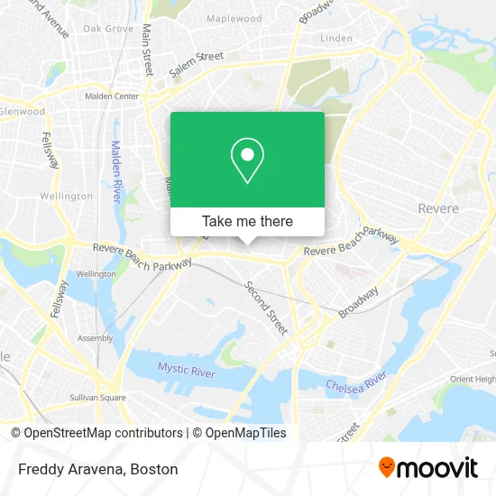
See Freddy Aravena, Everett, on the map
Public Transit to Freddy Aravena in Everett
Wondering how to get to Freddy Aravena in Everett? Moovit helps you find the best way to get to Freddy Aravena with step-by-step directions from the nearest public transit station.
Moovit provides free maps and live directions to help you navigate through your city. View schedules, routes, timetables, and find out how long does it take to get to Freddy Aravena in real time.
Looking for the nearest stop or station to Freddy Aravena? Check out this list of stops closest to your destination: Chelsea St @ Mead St; Second St @ Spring St; Anthem/Greystar; Chelsea; Wellington.
Bus: 109, 110, 112, SL3, 104, LOWER MYSTIC LINK.Train: NEWBURYPORT/ROCKPORT.Subway: ORANGE LINE.
Want to see if there’s another route that gets you there at an earlier time? Moovit helps you find alternative routes or times. Get directions from and directions to Freddy Aravena easily from the Moovit App or Website.
We make riding to Freddy Aravena easy, which is why over 1.7 million users, including users in Everett, trust Moovit as the best app for public transit. You don’t need to download an individual bus app or train app, Moovit is your all-in-one transit app that helps you find the best bus time or train time available.
For information on prices of bus, subway and train, costs and ride fares to Freddy Aravena, please check the Moovit app.
Use the app to navigate to popular places including to the airport, hospital, stadium, grocery store, mall, coffee shop, school, college, and university.
Location: Everett, Boston
- Anne P Umana Treatment Center,
- Everett Public Schools,
- Favoloso Cafe & Pizzeria (Dimitri Place),
- Route 16 Smoke Shop,
- PEP Boys,
- Envision Hotel,
- S Ferry St & Revere Beach Pkwy,
- Popeyes Louisiana Kitchen (Popeyes Famous Fried Chicken),
- Phunk Phenomenon,
- Chelsea Street Bakery (Chelsea Street Bakery - Padaria Brasileira),
- Tejedy Yorgy,
- Luma,
- Boston Harley-Davidson,
- Ferry St & George St,
- Alaadeen Produce & Specialty Foods,
- The Port Boston Distillery,
- Edward G. Connolly Center,
- smart Auto Repair,
- Sparkling Image Car Wash,
- Annes Cleaning Service
Places Near Freddy Aravena (Everett)
- Wilbur Theatre, Boston,
- Boston Convention & Exhibition Center, Boston,
- Castle Island, Boston,
- Cheers, Boston,
- Boston Common, Boston,
- Isabella Stewart Gardner Museum, Boston,
- Museum Of Science, Boston,
- Td Garden, Boston,
- House Of Blues, Boston,
- Boston Medical Center, Boston,
- North End, Boston,
- Quincy Market, Boston,
- Faneuil Hall, Boston,
- Prudential Center, Boston,
- Mgm Music Hall, Boston,
- Seaport District, Boston,
- Boston Children's Hospital, Boston,
- Wang Theater, Boston,
- Massachusetts General Hospital, Boston,
- Leader Bank Pavilion (Leader Bank Pavillion), Boston
How to get to popular places in Boston with public transit
Get around Everett by public transit!
Traveling around Everett has never been so easy. See step by step directions as you travel to any attraction, street or major public transit station. View bus and train schedules, arrival times, service alerts and detailed routes on a map, so you know exactly how to get to anywhere in Everett.
When traveling to any destination around Everett use Moovit's Live Directions with Get Off Notifications to know exactly where and how far to walk, how long to wait for your line, and how many stops are left. Moovit will alert you when it's time to get off — no need to constantly re-check whether yours is the next stop.
Wondering how to use public transit in Everett or how to pay for public transit in Everett? Moovit public transit app can help you navigate your way with public transit easily, and at minimum cost. It includes public transit fees, ticket prices, and costs. Looking for a map of Everett public transit lines? Moovit public transit app shows all public transit maps in Everett with all Bus, Train, Subway and Ferry routes and stops on an interactive map.
Boston has 4 transit type(s), including: Bus, Train, Subway and Ferry, operated by several transit agencies, including MBTA, Southeastern Regional Transit Authority, MetroWest Regional Transit Authority, Rhode Island Public Transit Authority, WRTA, Lowell Regional Transit Authority, Merrimack Valley Transit, Montachusett Regional Transit Authority, Cape Cod Regional Transit Authority, Brockton Area Transit Authority, Martha's Vineyard Transit Authority, the WAVE - Nantucket Regional Transit Authority, GATRA, Cape Ann Transportation Authority and Massport