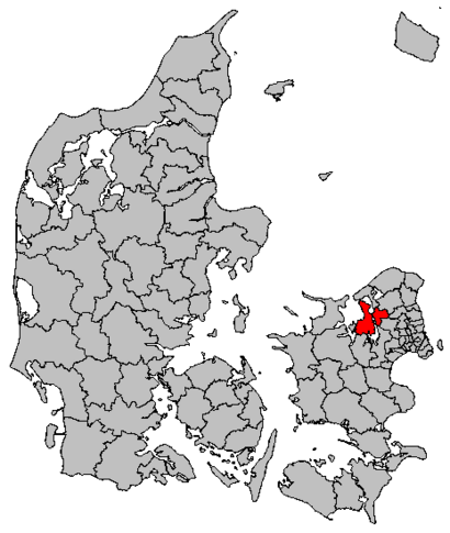
See Frederikssund Kommune on the map
Directions to Frederikssund Kommune with public transportation
The following transit lines have routes that pass near Frederikssund Kommune
 Bus:
Bus: - Train:
How to get to Frederikssund Kommune by bus?
Click on the bus route to see step by step directions with maps, line arrival times and updated time schedules.
How to get to Frederikssund Kommune by train?
Click on the train route to see step by step directions with maps, line arrival times and updated time schedules.
Bus stations near Frederikssund Kommune
- Borgervænget (Færgevej),6 min walk,
- Trekløverskolen Falkenborg (Frederiksborggade),6 min walk,
Train stations near Frederikssund Kommune
- Frederikssund St.,9 min walk,
Bus lines to Frederikssund Kommune
- 98N,Roskilde St. (Stationscentret) - Frederikssund St.,
- 313,Frederikssund St. - Kyndby Huse (Kyndbyvej),
- 316,Frederikssund St. - Kulhuse Havn (Kulhusvej),
- 318,Frederikssund St. - Skibby Bymidten (Hovedgaden),
- 65E,Skibby Bymidten (Hovedgaden) - Hillerød St.,
- 230R,Roskilde St. (Stationscentret) - Frederikssund St.,
- 310R,Frederikssund St. - Farum St.,
- 311,Haldor Topsøe Park (Siliciumvej) - Græse Bakkeby (Højvang),
- 315,Skibby Bymidten (Hovedgaden) - Frederikssund St.,
- 320R,Frederikssund St. - Helsinge St.,
- 325,Frederikssund St. - Hillerød St.,
What are the closest stations to Frederikssund Kommune?
The closest stations to Frederikssund Kommune are:
- Borgervænget (Færgevej) is 394 meters away, 6 min walk.
- Trekløverskolen Falkenborg (Frederiksborggade) is 432 meters away, 6 min walk.
- Frederikssund St. is 666 meters away, 9 min walk.
Which bus lines stop near Frederikssund Kommune?
These bus lines stop near Frederikssund Kommune: 230R, 310R, 312.
Which train line stops near Frederikssund Kommune?
C
What’s the nearest train station to Frederikssund Kommune?
The nearest train station to Frederikssund Kommune is Frederikssund St.. It’s a 9 min walk away.
What’s the nearest bus stop to Frederikssund Kommune?
The nearest bus stops to Frederikssund Kommune are Borgervænget (Færgevej) and Trekløverskolen Falkenborg (Frederiksborggade). The closest one is a 6 min walk away.
What time is the first train to Frederikssund Kommune?
The C is the first train that goes to Frederikssund Kommune. It stops nearby at 3:02 AM.
What time is the last train to Frederikssund Kommune?
The C is the last train that goes to Frederikssund Kommune. It stops nearby at 1:18 AM.
What time is the first bus to Frederikssund Kommune?
The 98N is the first bus that goes to Frederikssund Kommune. It stops nearby at 3:04 AM.
What time is the last bus to Frederikssund Kommune?
The 320R is the last bus that goes to Frederikssund Kommune. It stops nearby at 12:20 AM.
See Frederikssund Kommune on the map
Public Transportation to Frederikssund Kommune
Wondering how to get to Frederikssund Kommune, Denmark? Moovit helps you find the best way to get to Frederikssund Kommune with step-by-step directions from the nearest public transit station.
Moovit provides free maps and live directions to help you navigate through your city. View schedules, routes, timetables, and find out how long does it take to get to Frederikssund Kommune in real time.
Looking for the nearest stop or station to Frederikssund Kommune? Check out this list of stops closest to your destination: Borgervænget (Færgevej); Trekløverskolen Falkenborg (Frederiksborggade); Frederikssund St..
Bus:Train:
Want to see if there’s another route that gets you there at an earlier time? Moovit helps you find alternative routes or times. Get directions from and directions to Frederikssund Kommune easily from the Moovit App or Website.
We make riding to Frederikssund Kommune easy, which is why over 1.5 million users, including users in Frederikssund, trust Moovit as the best app for public transit. You don’t need to download an individual bus app or train app, Moovit is your all-in-one transit app that helps you find the best bus time or train time available.
For information on prices of train and bus, costs and ride fares to Frederikssund Kommune, please check the Moovit app.
Use the app to navigate to popular places including to the airport, hospital, stadium, grocery store, mall, coffee shop, school, college, and university.
Frederikssund Kommune Address: Torvet 2 3600 Frederikssund street in Frederikssund
Attractions near Frederikssund Kommune
Frederikssund City Hall,Veteran Mindesmærke,Frederikssund Rådhus,The Legends Bar Aps,The British Pub Aps,The Legends Bar,Yaya-Sushi,KPMG,Access-Card Holding Aps,Iss Facility Services A/S,Engel Invest Aps,E/F Ågården,Bella Rejser,Skønhedsklinikken,Butik Maxine,Tinglysningskontoret,Hellers Massage og Sportsterapi,Papir Stedet,Audionova Hørecenter,Lokalbanken i NordsjællandHow to get to popular attractions in Frederikssund with public transit
Hotel Propellen Billund, Billund,Scandic Hotel Aarhus, Århus,IKEA Restaurant & Cafe, Gentofte,DXC Technology Denmark, København,Fitness dk, Odense,Søborg, Gladsaxe,Skolerne i Oure - Sport & Performance, Svendborg,Greve Station, Greve,Busstop - Odense Banegård Center, Odense,Højbjerg, Århus,Comwell Kolding, Kolding,Givskud Zoo - Løveparken, Vejle,Vigerslev Alle Station, København,Vallensbæk st., Vallensbæk,Ingerslev Marked, Århus,Diakonhøjskolen, Århus,Esbjerg, Esbjerg,Matematisk Kantine, Aarhus Universitet, Århus,Nonnesøen, Rudersdal,The Shop, OdenseGet around Frederikssund by public transit!
Traveling around Frederikssund has never been so easy. See step by step directions as you travel to any attraction, street or major public transit station. View bus and train schedules, arrival times, service alerts and detailed routes on a map, so you know exactly how to get to anywhere in Frederikssund.
When traveling to any destination around Frederikssund use Moovit's Live Directions with Get Off Notifications to know exactly where and how far to walk, how long to wait for your line, and how many stops are left. Moovit will alert you when it's time to get off — no need to constantly re-check whether yours is the next stop.
Wondering how to use public transit in Frederikssund or how to pay for public transit in Frederikssund? Moovit public transit app can help you navigate your way with public transit easily, and at minimum cost. It includes public transit fees, ticket prices, and costs. Looking for a map of Frederikssund public transit lines? Moovit public transit app shows all public transit maps in Frederikssund with all train or bus routes and stops on an interactive map.
Frederikssund has 2 transit type(s), including: train or bus, operated by several transit agencies, including Metroselskabet, DSB S-tog, Lokaltog A/S, DSB S-tog, Midttrafik, Odense Letbane, DSB, NT, GoCollective, Midttrafik, Skånetrafiken, Metroselskabet, Movia, NT and Midttrafik