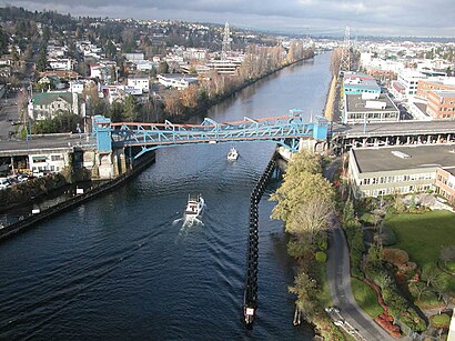
Directions to Fremont Brg (Seattle) with public transportation
The following transit lines have routes that pass near Fremont Brg
How to get to Fremont Brg by bus?
Click on the bus route to see step by step directions with maps, line arrival times and updated time schedules.
Bus stations near Fremont Brg in Seattle
- Nickerson St & 3rd Ave N, 3 min walk,
- Westlake Ave N & Dexter Ave N, 4 min walk,
- Fremont Ave N & N 34th St, 4 min walk,
Bus lines to Fremont Brg in Seattle
- 31, Central Magnolia Fremont,
- 32, Seattle Center Fremont,
- 40, Northgate Station Fremont,
- 62, Downtown Seattle Fremont,
What are the closest stations to Fremont Brg?
The closest stations to Fremont Brg are:
- Nickerson St & 3rd Ave N is 235 yards away, 3 min walk.
- Westlake Ave N & Dexter Ave N is 248 yards away, 4 min walk.
- Fremont Ave N & N 34th St is 267 yards away, 4 min walk.
Which bus lines stop near Fremont Brg?
These bus lines stop near Fremont Brg: 31, 62.
What’s the nearest bus stop to Fremont Brg in Seattle?
The nearest bus stop to Fremont Brg in Seattle is Nickerson St & 3rd Ave N. It’s a 3 min walk away.
See Fremont Brg, Seattle, on the map
Public Transit to Fremont Brg in Seattle
Wondering how to get to Fremont Brg in Seattle, United States? Moovit helps you find the best way to get to Fremont Brg with step-by-step directions from the nearest public transit station.
Moovit provides free maps and live directions to help you navigate through your city. View schedules, routes, timetables, and find out how long does it take to get to Fremont Brg in real time.
Looking for the nearest stop or station to Fremont Brg? Check out this list of stops closest to your destination: Nickerson St & 3rd Ave N; Westlake Ave N & Dexter Ave N; Fremont Ave N & N 34th St.
Bus: 31, 62, 32, 40.
Want to see if there’s another route that gets you there at an earlier time? Moovit helps you find alternative routes or times. Get directions from and directions to Fremont Brg easily from the Moovit App or Website.
We make riding to Fremont Brg easy, which is why over 1.5 million users, including users in Seattle, trust Moovit as the best app for public transit. You don’t need to download an individual bus app or train app, Moovit is your all-in-one transit app that helps you find the best bus time or train time available.
For information on prices of bus, costs and ride fares to Fremont Brg, please check the Moovit app.
Use the app to navigate to popular places including to the airport, hospital, stadium, grocery store, mall, coffee shop, school, college, and university.
Fremont Brg Address: Seattle, WA 98103 street in Seattle
Attractions near Fremont Brg
Fremont Bridge,Wessco Blinds,Nosh,Fremont Bridge,Fremont Ave N ,Fremont Ave N,Cam On Fremont Bridge,HAL Consumer Programs,Cezanne - The 3300,SCI,Florentia Street End,Cafe Amanda,Corner Of Nickerson And Dexter,Electric Cloud Coffee,Poker Night,Database Design Throwdown,Bleitz Funeral Home,Pacific Wildland Fire Sciences Lab,Bleitz Funeral Home,The Seattle Elks Lodge #92How to get to popular attractions in Seattle with public transit
Harborview Medical Center, Seattle,Costco Wholesale, Tacoma,Walmart Supercenter, Puyallup,I-5,The Old Spaghetti Factory, Tacoma,Alaska Airlines' McGee Building, Seatac,Safeway, South Hill,Boeing Field / King County International Airport (BFI), Seattle,Loews Hotel 1000, Seattle, Seattle,Olympia-Lacey Amtrak Station (OLW),Bellevue Transit Center, Bellevue,University Village, Seattle,Coupeville Ferry Terminal,Costco Wholesale, Everett,Edmonds Community College, Lynnwood,The Evergreen State Fairgrounds, Monroe North,Doc's Marina Grill in Bainbridge Island, Bainbridge Island,Club Silverstone, Tacoma,Shoreline Community College, Shoreline,Zulily - Elliott Office, SeattleGet around Seattle - Tacoma, WA by public transit!
Traveling around Seattle - Tacoma, WA has never been so easy. See step by step directions as you travel to any attraction, street or major public transit station. View bus and train schedules, arrival times, service alerts and detailed routes on a map, so you know exactly how to get to anywhere in Seattle - Tacoma, WA.
When traveling to any destination around Seattle - Tacoma, WA use Moovit's Live Directions with Get Off Notifications to know exactly where and how far to walk, how long to wait for your line, and how many stops are left. Moovit will alert you when it's time to get off — no need to constantly re-check whether yours is the next stop.
Wondering how to use public transit in Seattle - Tacoma, WA or how to pay for public transit in Seattle - Tacoma, WA? Moovit public transit app can help you navigate your way with public transit easily, and at minimum cost. It includes public transit fees, ticket prices, and costs. Looking for a map of Seattle - Tacoma, WA public transit lines? Moovit public transit app shows all public transit maps in Seattle - Tacoma, WA with all Bus, Train, Light Rail and Ferry routes and stops on an interactive map.
Seattle - Tacoma, WA has 4 transit type(s), including: Bus, Train, Light Rail and Ferry, operated by several transit agencies, including Sound Transit, Seattle Streetcar, Metro Transit, Whatcom Transportation Authority, Mason Transit Authority, Snoqualmie Valley Transportation (SVT), Snoqualmie Valley Transportation, Amtrak, Island Transit, Kitsap Transit, Intercity Transit, Everett Transit, Community Transit, Skagit Transit, Pierce Transit