Directions to French Club (Cambridge) with public transportation
The following transit lines have routes that pass near French Club
 Bus: 77, 83, 87, 89, 96.
- Train: FITCHBURG, RED LINE.
- Subway: RED LINE, GREEN LINE B, GREEN LINE C, GREEN LINE E.
How to get to French Club by bus?
Click on the bus route to see step by step directions with maps, line arrival times and updated time schedules.
From Dana Farber Cancer Institute, Boston
80 minFrom Hampton Inn Boston Logan Airport, Revere
70 minFrom Brookline High School (Brookline Town High School), Brookline
70 minFrom Flynn Cruiseport Boston, Boston
69 minFrom The Strand Theater, Boston
83 minFrom Beth Israel Deaconess Medical Center, West Campus - Farr Building, Boston
57 minFrom Financial District, Boston
61 minFrom Carson Beach, Boston
89 minFrom Rino's Place, Boston
79 minFrom Four Points by Sheraton Boston Logan Airport, Revere
81 min
How to get to French Club by train?
Click on the train route to see step by step directions with maps, line arrival times and updated time schedules.
How to get to French Club by subway?
Click on the subway route to see step by step directions with maps, line arrival times and updated time schedules.
From Hampton Inn Boston Logan Airport, Revere
72 minFrom Brookline High School (Brookline Town High School), Brookline
59 minFrom The Strand Theater, Boston
58 minFrom Beth Israel Deaconess Medical Center, West Campus - Farr Building, Boston
59 minFrom Financial District, Boston
35 minFrom Carson Beach, Boston
51 minFrom Rino's Place, Boston
55 min
Bus stops near French Club in Cambridge
Train station near French Club in Cambridge
- Porter, 15 min walk,VIEW
Subway station near French Club in Cambridge
- Medford/Tufts Station, 37 min walk,VIEW
Bus lines to French Club in Cambridge
- 87, Lechmere - Arlington Center,VIEW
- 88, Lechmere - Clarendon Hill,VIEW
- RED LINE SHUTTLE, Alewife - Park Street,VIEW
- RED LINE SHUTTLE, Alewife - Harvard via Brattle Street,VIEW
- RED LINE SHUTTLE, Alewife - Davis,VIEW
- RED LINE SHUTTLE, Alewife - Harvard via Holyoke Street,VIEW
- RED LINE SHUTTLE, Alewife - Kendall/MIT,VIEW
- 77, Harvard,VIEW
- 83, Central Square,VIEW
What are the closest stations to French Club?
The closest stations to French Club are:
- Holland St @ Dover St is 139 yards away, 2 min walk.
- Massachusetts Ave @ Haskell St is 243 yards away, 3 min walk.
- Rindge Ave @ Hollis St is 449 yards away, 6 min walk.
- Porter is 1220 yards away, 15 min walk.
- Medford/Tufts Station is 3069 yards away, 37 min walk.
Which bus lines stop near French Club?
These bus lines stop near French Club: 77, 83, 87, 89, 96.
Which train line stops near French Club?
FITCHBURG (#409 | Wachusett)
Which subway line stops near French Club?
RED LINE (Alewife)
What’s the nearest train station to French Club in Cambridge?
The nearest train station to French Club in Cambridge is Porter. It’s a 15 min walk away.
What’s the nearest bus station to French Club in Cambridge?
The nearest bus station to French Club in Cambridge is Holland St @ Dover St. It’s a 2 min walk away.
What time is the first subway to French Club in Cambridge?
The GREEN LINE E is the first subway that goes to French Club in Cambridge. It stops nearby at 4:55 AM.
What time is the last subway to French Club in Cambridge?
The GREEN LINE E is the last subway that goes to French Club in Cambridge. It stops nearby at 2:41 AM.
What time is the first train to French Club in Cambridge?
The FITCHBURG is the first train that goes to French Club in Cambridge. It stops nearby at 5:47 AM.
What time is the last train to French Club in Cambridge?
The FITCHBURG is the last train that goes to French Club in Cambridge. It stops nearby at 12:17 AM.
What time is the first bus to French Club in Cambridge?
The 77 is the first bus that goes to French Club in Cambridge. It stops nearby at 5:00 AM.
What time is the last bus to French Club in Cambridge?
The 83 is the last bus that goes to French Club in Cambridge. It stops nearby at 1:25 AM.
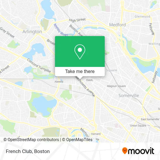
See French Club, Cambridge, on the map
Public Transit to French Club in Cambridge
Wondering how to get to French Club in Cambridge? Moovit helps you find the best way to get to French Club with step-by-step directions from the nearest public transit station.
Moovit provides free maps and live directions to help you navigate through your city. View schedules, routes, timetables, and find out how long does it take to get to French Club in real time.
Looking for the nearest stop or station to French Club? Check out this list of stops closest to your destination: Holland St @ Dover St; Massachusetts Ave @ Haskell St; Rindge Ave @ Hollis St; Porter; Medford/Tufts Station.
Bus: 77, 83, 87, 89, 96, 88, RED LINE SHUTTLE, RED LINE SHUTTLE, RED LINE SHUTTLE.Train: FITCHBURG, RED LINE.Subway: RED LINE, GREEN LINE B, GREEN LINE C, GREEN LINE E.
Want to see if there’s another route that gets you there at an earlier time? Moovit helps you find alternative routes or times. Get directions from and directions to French Club easily from the Moovit App or Website.
We make riding to French Club easy, which is why over 1.7 million users, including users in Cambridge, trust Moovit as the best app for public transit. You don’t need to download an individual bus app or train app, Moovit is your all-in-one transit app that helps you find the best bus time or train time available.
For information on prices of bus, subway and train, costs and ride fares to French Club, please check the Moovit app.
Use the app to navigate to popular places including to the airport, hospital, stadium, grocery store, mall, coffee shop, school, college, and university.
French Club Address: 2322 Massachusetts Ave street in Cambridge
- Frank's Steak House (Franks Steak House),
- Frank's Steak House,
- 4 Buyers Real Estate,
- Ramsey Gilbert Chiropractor,
- Raspberry Beret,
- Momma's Grocery + Wine,
- Madeleine,
- Big Dig Records,
- Emily B Chang, DDS,
- Cafe Luna Catering,
- Johanna Schulman - Ameriprise Financial Services,
- WRMS,
- Gotobus.com,
- Boylston Chess Club,
- Lecture & Tour International Travel,
- Herbs Deep Tissue Massage,
- Masscraft Masonry & Construction,
- La Market,
- Beverly Teknology,
- Chicken & Co
Places Near French Club (Cambridge)
- Boston Common, Boston,
- Boston Medical Center, Boston,
- Td Garden, Boston,
- Seaport District, Boston,
- Massachusetts General Hospital, Boston,
- Castle Island, Boston,
- Museum Of Science, Boston,
- Boston Children's Hospital, Boston,
- Wilbur Theatre, Boston,
- Quincy Market, Boston,
- Cheers, Boston,
- House Of Blues, Boston,
- Wang Theater, Boston,
- Leader Bank Pavilion (Leader Bank Pavillion), Boston,
- Mgm Music Hall, Boston,
- Prudential Center, Boston,
- Isabella Stewart Gardner Museum, Boston,
- North End, Boston,
- Faneuil Hall, Boston,
- Boston Convention & Exhibition Center, Boston
How to get to popular places in Boston with public transit
Get around Cambridge by public transit!
Traveling around Cambridge has never been so easy. See step by step directions as you travel to any attraction, street or major public transit station. View bus and train schedules, arrival times, service alerts and detailed routes on a map, so you know exactly how to get to anywhere in Cambridge.
When traveling to any destination around Cambridge use Moovit's Live Directions with Get Off Notifications to know exactly where and how far to walk, how long to wait for your line, and how many stops are left. Moovit will alert you when it's time to get off — no need to constantly re-check whether yours is the next stop.
Wondering how to use public transit in Cambridge or how to pay for public transit in Cambridge? Moovit public transit app can help you navigate your way with public transit easily, and at minimum cost. It includes public transit fees, ticket prices, and costs. Looking for a map of Cambridge public transit lines? Moovit public transit app shows all public transit maps in Cambridge with all Bus, Train, Subway and Ferry routes and stops on an interactive map.
Boston has 4 transit type(s), including: Bus, Train, Subway and Ferry, operated by several transit agencies, including MBTA, Southeastern Regional Transit Authority, MetroWest Regional Transit Authority, Rhode Island Public Transit Authority, WRTA, Lowell Regional Transit Authority, Merrimack Valley Transit, Montachusett Regional Transit Authority, Cape Cod Regional Transit Authority, Brockton Area Transit Authority, Martha's Vineyard Transit Authority, the WAVE - Nantucket Regional Transit Authority, GATRA, Cape Ann Transportation Authority and Massport