How to get to Frenchs Catering by bus?
Click on the bus route to see step by step directions with maps, line arrival times and updated time schedules.
From Parque de las ardillas, Lawrence
85 minFrom Rockingham Mall Salem New Hampshire, Lawrence
80 minFrom Lawrence, MA, Lawrence
73 minFrom Andover, MA, Andover
110 minFrom Phillips Academy Andover, Andover
116 minFrom Lawrence, Massachusetts, Lawrence
85 minFrom Methuen, Methuen Town
96 minFrom QRD, Methuen Town
91 min
Bus stops near Frenchs Catering in Boston
What are the closest stations to Frenchs Catering?
The closest stations to Frenchs Catering are:
- Andover St & Cobleigh Dr is 26 yards away, 1 min walk.
- Andover St & Remington St is 145 yards away, 2 min walk.
Which bus line stops near Frenchs Catering?
2 (White Dove Plaza)
What’s the nearest bus station to Frenchs Catering in Boston?
The nearest bus station to Frenchs Catering in Boston is Andover St & Cobleigh Dr. It’s a 1 min walk away.
What time is the first bus to Frenchs Catering in Boston?
The 11 is the first bus that goes to Frenchs Catering in Boston. It stops nearby at 6:07 AM.
What time is the last bus to Frenchs Catering in Boston?
The 2 is the last bus that goes to Frenchs Catering in Boston. It stops nearby at 7:23 PM.
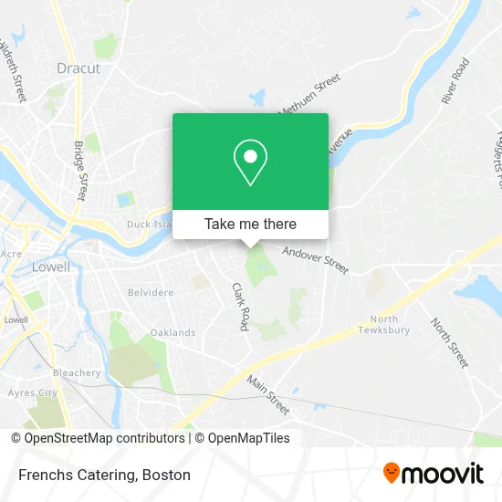
See Frenchs Catering, Boston, on the map
Public Transit to Frenchs Catering in Boston
Wondering how to get to Frenchs Catering in Boston? Moovit helps you find the best way to get to Frenchs Catering with step-by-step directions from the nearest public transit station.
Moovit provides free maps and live directions to help you navigate through your city. View schedules, routes, timetables, and find out how long does it take to get to Frenchs Catering in real time.
Looking for the nearest stop or station to Frenchs Catering? Check out this list of stops closest to your destination: Andover St & Cobleigh Dr; Andover St & Remington St.
Bus: 2, 11.
Want to see if there’s another route that gets you there at an earlier time? Moovit helps you find alternative routes or times. Get directions from and directions to Frenchs Catering easily from the Moovit App or Website.
We make riding to Frenchs Catering easy, which is why over 1.7 million users, including users in Boston, trust Moovit as the best app for public transit. You don’t need to download an individual bus app or train app, Moovit is your all-in-one transit app that helps you find the best bus time or train time available.
For information on prices of bus, costs and ride fares to Frenchs Catering, please check the Moovit app.
Use the app to navigate to popular places including to the airport, hospital, stadium, grocery store, mall, coffee shop, school, college, and university.
Frenchs Catering Address: 165 Havilah St street in Boston
- Pow-Wow Oak,
- Condeventures,
- Accurate Painting & General Contractor,
- Cross Point Construction,
- Sullivan & Company,
- St Johns Rectory,
- Pool 5,
- Ri Associates,
- Janis Rink,
- Censco,
- Field Marshall,
- Belvedere Bike Crew,
- Keller Williams Realty-Merrimack,
- JCK Swimming Pool & Spa Contractors / Consultants,
- Morgan Home Accents,
- Ralph Acbrecht,
- Cawley Memorial Stadium,
- Nabbout Elias,
- Wealth Management Advisors,
- Carly Keafer
Places Near Frenchs Catering (Boston)
- Museum Of Science, Boston,
- Td Garden, Boston,
- Leader Bank Pavilion (Leader Bank Pavillion), Boston,
- Massachusetts General Hospital, Boston,
- Boston Convention & Exhibition Center, Boston,
- Isabella Stewart Gardner Museum, Boston,
- House Of Blues, Boston,
- Seaport District, Boston,
- Wilbur Theatre, Boston,
- Quincy Market, Boston,
- Boston Medical Center, Boston,
- Prudential Center, Boston,
- North End, Boston,
- Cheers, Boston,
- Boston Common, Boston,
- Castle Island, Boston,
- Faneuil Hall, Boston,
- Boston Children's Hospital, Boston,
- Mgm Music Hall, Boston,
- Wang Theater, Boston
How to get to popular places in Boston with public transit
Get around Boston by public transit!
Traveling around Boston has never been so easy. See step by step directions as you travel to any attraction, street or major public transit station. View bus and train schedules, arrival times, service alerts and detailed routes on a map, so you know exactly how to get to anywhere in Boston.
When traveling to any destination around Boston use Moovit's Live Directions with Get Off Notifications to know exactly where and how far to walk, how long to wait for your line, and how many stops are left. Moovit will alert you when it's time to get off — no need to constantly re-check whether yours is the next stop.
Wondering how to use public transit in Boston or how to pay for public transit in Boston? Moovit public transit app can help you navigate your way with public transit easily, and at minimum cost. It includes public transit fees, ticket prices, and costs. Looking for a map of Boston public transit lines? Moovit public transit app shows all public transit maps in Boston with all Bus, Train, Subway and Ferry routes and stops on an interactive map.
Boston has 4 transit type(s), including: Bus, Train, Subway and Ferry, operated by several transit agencies, including MBTA, Southeastern Regional Transit Authority, MetroWest Regional Transit Authority, Rhode Island Public Transit Authority, WRTA, Lowell Regional Transit Authority, Merrimack Valley Transit, Montachusett Regional Transit Authority, Cape Cod Regional Transit Authority, Brockton Area Transit Authority, Martha's Vineyard Transit Authority, the WAVE - Nantucket Regional Transit Authority, GATRA, Cape Ann Transportation Authority and Massport