Directions to Frick Art And Historical Center (Pittsburgh) with public transportation
The following transit lines have routes that pass near Frick Art And Historical Center
How to get to Frick Art And Historical Center by bus?
Click on the bus route to see step by step directions with maps, line arrival times and updated time schedules.
Bus stations near Frick Art And Historical Center in Pittsburgh
- Homewood Ave + Reynolds, 2 min walk,
- Penn Ave + Homewood, 6 min walk,
Bus lines to Frick Art And Historical Center in Pittsburgh
- 74, Outbound-Homewood,
- 67, Outbound-Ccac Boyce,
- 69, Inbound-Pittsburgh Via Oakland-Squirrel Hill,
- 71C, Outbound-Wilkinsburg Station,
What are the closest stations to Frick Art And Historical Center?
The closest stations to Frick Art And Historical Center are:
- Homewood Ave + Reynolds is 100 yards away, 2 min walk.
- Penn Ave + Homewood is 408 yards away, 6 min walk.
Which bus lines stop near Frick Art And Historical Center?
These bus lines stop near Frick Art And Historical Center: 67, 69, 71C, 74, P1, P76.
What’s the nearest bus stop to Frick Art And Historical Center in Pittsburgh?
The nearest bus stop to Frick Art And Historical Center in Pittsburgh is Homewood Ave + Reynolds. It’s a 2 min walk away.
What time is the first bus to Frick Art And Historical Center in Pittsburgh?
The 69 is the first bus that goes to Frick Art And Historical Center in Pittsburgh. It stops nearby at 5:06 AM.
What time is the last bus to Frick Art And Historical Center in Pittsburgh?
The 71C is the last bus that goes to Frick Art And Historical Center in Pittsburgh. It stops nearby at 12:44 AM.
How much is the bus fare to Frick Art And Historical Center?
The bus fare to Frick Art And Historical Center costs about $2.75.
See Frick Art And Historical Center, Pittsburgh, on the map
Public Transit to Frick Art And Historical Center in Pittsburgh
Wondering how to get to Frick Art And Historical Center in Pittsburgh, United States? Moovit helps you find the best way to get to Frick Art And Historical Center with step-by-step directions from the nearest public transit station.
Moovit provides free maps and live directions to help you navigate through your city. View schedules, routes, timetables, and find out how long does it take to get to Frick Art And Historical Center in real time.
Looking for the nearest stop or station to Frick Art And Historical Center? Check out this list of stops closest to your destination: Homewood Ave + Reynolds; Penn Ave + Homewood.
Bus: 67, 69, 71C, 74, P1, P76.
Want to see if there’s another route that gets you there at an earlier time? Moovit helps you find alternative routes or times. Get directions from and directions to Frick Art And Historical Center easily from the Moovit App or Website.
We make riding to Frick Art And Historical Center easy, which is why over 1.5 million users, including users in Pittsburgh, trust Moovit as the best app for public transit. You don’t need to download an individual bus app or train app, Moovit is your all-in-one transit app that helps you find the best bus time or train time available.
For information on prices of bus, costs and ride fares to Frick Art And Historical Center, please check the Moovit app.
Use the app to navigate to popular places including to the airport, hospital, stadium, grocery store, mall, coffee shop, school, college, and university.
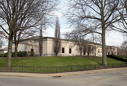
Frick Art And Historical Center Address: Reynolds Street street in Pittsburgh
Attractions near Frick Art And Historical Center
Guardian Angels Medical Service Dogs, Inc.,Education Center,Frick Car & Carriage Museum,The Frick Pittsburgh,Community Center,The Frick Gift Shop,Clayton,The Playhouse,The Frick Greenhouse,City Café,Clayton Mansion,O'Toole James D MD,Frick Park Market,USPS Collection Box - Blue Box,Pittsburgh Schools,Sterrett Classical Academy,Diane S Samuels CPA,Rush Creek Designs,Darkfirestudios,SkymarkHow to get to popular attractions in Pittsburgh with public transit
Children's Hospital Employee Parking Garage, Pittsburgh,McKees Rocks, PA,4727 Friendship Ave, Pittsburgh,Southland Shopping Center, Pleasant Hills,Biomedical Science Tower And Bst South, Pittsburgh,Creighton, Pennsylvania,Ambridge, PA, Ambridge,Port Authority Collier Garage, Bridgeville,Giant Eagle Supermarket, Pittsburgh,Squirrel Hill Night Market, Pittsburgh,Woodland Hills High School, Churchill,Sky's the Limit Hair & Beauty, Pittsburgh,University of Pittsburgh School of Dental Medicine, Pittsburgh,Bus Stop At Stanwix & 4th Ave, Pittsburgh,Giant Eagle - Settlers Ridge,15145, Turtle Creek,The Mall at Robinson,Gabe's, West Mifflin,Upmc Events Center, Carnot-Moon,Port Authority, Collier GarageGet around Pittsburgh by public transit!
Traveling around Pittsburgh has never been so easy. See step by step directions as you travel to any attraction, street or major public transit station. View bus and train schedules, arrival times, service alerts and detailed routes on a map, so you know exactly how to get to anywhere in Pittsburgh.
When traveling to any destination around Pittsburgh use Moovit's Live Directions with Get Off Notifications to know exactly where and how far to walk, how long to wait for your line, and how many stops are left. Moovit will alert you when it's time to get off — no need to constantly re-check whether yours is the next stop.
Wondering how to use public transit in Pittsburgh or how to pay for public transit in Pittsburgh? Moovit public transit app can help you navigate your way with public transit easily, and at minimum cost. It includes public transit fees, ticket prices, and costs. Looking for a map of Pittsburgh public transit lines? Moovit public transit app shows all public transit maps in Pittsburgh with all Bus, Train, Light Rail and Funicular routes and stops on an interactive map.
Pittsburgh has 4 transit type(s), including: Bus, Train, Light Rail and Funicular, operated by several transit agencies, including Pittsburgh Regional Transit, CamTran, Amtran, Mid Mon Valley Transit, BCTA, Butler Transit Authority, IndiGo, Area Transportation Authority, Freedom Transit, Mountain Line Transit Authority, Megabus, Greyhound-us, Fullington Trailways, Amtrak