See Frick International Studies, Pittsburgh, on the map
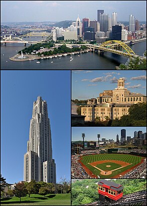
- File:PittSkyline082904.jpg, by Fran Rogers (CC-BY-2.5)
- File:Cathedral of Learning stitch 1.jpg, by Notyourbroom (GFDL 1.2, CC-BY-3.0)
- File:CMU Hamerschlag Hall.jpg, by File Upload Bot (Magnus Manske) (CC-BY-2.0)
- File:Pedro goes to Pittsburgh.jpg, by UCinternational (CC-BY-2.0)
- File:Duquesne Incline from top.jpg, by Plastikspork (GFDL 1.2, CC-BY-SA-3.0)
Directions to Frick International Studies (Pittsburgh) with public transportation
The following transit lines have routes that pass near Frick International Studies
 Bus:
Bus:
How to get to Frick International Studies by bus?
Click on the bus route to see step by step directions with maps, line arrival times and updated time schedules.
How to get to Frick International Studies by {{TRANSIT_TYPE}}?
Click on the {{TRANSIT_TYPE}} route to see step by step directions with maps, line arrival times and updated time schedules.
Which bus lines stop near Frick International Studies?
These bus lines stop near Frick International Studies: 61D, 71A, 71C, 71D, 75.
See Frick International Studies, Pittsburgh, on the map
- File:PittSkyline082904.jpg, by Fran Rogers (CC-BY-2.5)
- File:Cathedral of Learning stitch 1.jpg, by Notyourbroom (GFDL 1.2, CC-BY-3.0)
- File:CMU Hamerschlag Hall.jpg, by File Upload Bot (Magnus Manske) (CC-BY-2.0)
- File:Pedro goes to Pittsburgh.jpg, by UCinternational (CC-BY-2.0)
- File:Duquesne Incline from top.jpg, by Plastikspork (GFDL 1.2, CC-BY-SA-3.0)
Public Transit to Frick International Studies in Pittsburgh
Wondering how to get to Frick International Studies in Pittsburgh, United States? Moovit helps you find the best way to get to Frick International Studies with step-by-step directions from the nearest public transit station.
Moovit provides free maps and live directions to help you navigate through your city. View schedules, routes, timetables, and find out how long does it take to get to Frick International Studies in real time.
Bus:
Want to see if there’s another route that gets you there at an earlier time? Moovit helps you find alternative routes or times. Get directions from and directions to Frick International Studies easily from the Moovit App or Website.
We make riding to Frick International Studies easy, which is why over 1.5 million users, including users in Pittsburgh, trust Moovit as the best app for public transit. You don’t need to download an individual bus app or train app, Moovit is your all-in-one transit app that helps you find the best bus time or train time available.
For information on prices of bus, costs and ride fares to Frick International Studies, please check the Moovit app.
Use the app to navigate to popular places including to the airport, hospital, stadium, grocery store, mall, coffee shop, school, college, and university.
Location: Pittsburgh
- File:PittSkyline082904.jpg, by Fran Rogers (CC-BY-2.5)
- File:Cathedral of Learning stitch 1.jpg, by Notyourbroom (GFDL 1.2, CC-BY-3.0)
- File:CMU Hamerschlag Hall.jpg, by File Upload Bot (Magnus Manske) (CC-BY-2.0)
- File:Pedro goes to Pittsburgh.jpg, by UCinternational (CC-BY-2.0)
- File:Duquesne Incline from top.jpg, by Plastikspork (GFDL 1.2, CC-BY-SA-3.0)
Attractions near Frick International Studies
Student Accounting & Billing,107 Thackeray Ave,Bellefield Presbyterian Church,Pittsburgh Region International Student Ministries,5 Thackeray Avenue,5th Ave / Thackeray Ave,Chick-fil-A,WPTS,Pitt News,Semester At Sea,W P T S-F M,28X Airport Flyer,Mid Atlantic Protel,1 Sci-Tech Drive,Family House University,University Place Family House,The Book Center,Delta Delta Delta,Brioche Dorée,Litchfield Tower BHow to get to popular attractions in Pittsburgh with public transit
UPMC St. Margaret Hospital - Department Of Radiology, Pittsburgh,West Penn Hospital Heliport, Pittsburgh,UPMC Harbor Garden, Pittsburgh,Gateway Center Parking Garage, Pittsburgh,Carnegie Park And Ride, Carnegie,Tequila Cowboy, Pittsburgh,Coraopolis, Coraopolis,Perrysville Exit 279, Pittsburgh,Sewickley, Sewickley,APlus at Sunoco, Whitehall,Bigham Tavern, Pittsburgh,O1 Ross Flyer, Pittsburgh,East Mckeesport, PA, East Mckeesport,Carnegie Science Center, Pittsburgh,Clever Park,Upmc Sports Performance Complex, Pittsburgh,Wharton Square, Pittsburgh,Duquesne park and ride, Duquesne,Winchester Thurston Upper School, Pittsburgh,One Oxford Center, PittsburghGet around Pittsburgh by public transit!
Traveling around Pittsburgh has never been so easy. See step by step directions as you travel to any attraction, street or major public transit station. View bus and train schedules, arrival times, service alerts and detailed routes on a map, so you know exactly how to get to anywhere in Pittsburgh.
When traveling to any destination around Pittsburgh use Moovit's Live Directions with Get Off Notifications to know exactly where and how far to walk, how long to wait for your line, and how many stops are left. Moovit will alert you when it's time to get off — no need to constantly re-check whether yours is the next stop.
Wondering how to use public transit in Pittsburgh or how to pay for public transit in Pittsburgh? Moovit public transit app can help you navigate your way with public transit easily, and at minimum cost. It includes public transit fees, ticket prices, and costs. Looking for a map of Pittsburgh public transit lines? Moovit public transit app shows all public transit maps in Pittsburgh with all bus routes and stops on an interactive map.
Pittsburgh has 1 transit type(s), including: bus, operated by several transit agencies, including Pittsburgh Regional Transit, Pittsburgh Regional Transit, CamTran, Amtran, Mid Mon Valley Transit, BCTA, Butler Transit Authority, IndiGo, Area Transportation Authority, Freedom Transit, Pittsburgh Regional Transit, Mountain Line Transit Authority, Megabus, Greyhound-us and Fullington Trailways