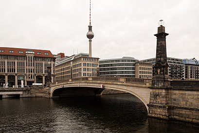
Directions to Friedrichsbrücke (Berlin Mitte) with public transportation
The following transit lines have routes that pass near Friedrichsbrücke
How to get to Friedrichsbrücke by bus?
Click on the bus route to see step by step directions with maps, line arrival times and updated time schedules.
How to get to Friedrichsbrücke by train?
Click on the train route to see step by step directions with maps, line arrival times and updated time schedules.
How to get to Friedrichsbrücke by subway?
Click on the subway route to see step by step directions with maps, line arrival times and updated time schedules.
Which train lines stop near Friedrichsbrücke?
These train lines stop near Friedrichsbrücke: RB21, RB22, RE2.
Which subway lines stop near Friedrichsbrücke?
These subway lines stop near Friedrichsbrücke: U2, U6, U8, U9.
Which light rail line stops near Friedrichsbrücke?
M1
Which bus lines stop near Friedrichsbrücke?
These bus lines stop near Friedrichsbrücke: 100, 200, M45, M48, M82.
See Friedrichsbrücke, Berlin Mitte, on the map
Public Transit to Friedrichsbrücke in Berlin Mitte
Wondering how to get to Friedrichsbrücke in Berlin Mitte, Germany? Moovit helps you find the best way to get to Friedrichsbrücke with step-by-step directions from the nearest public transit station.
Moovit provides free maps and live directions to help you navigate through your city. View schedules, routes, timetables, and find out how long does it take to get to Friedrichsbrücke in real time.
Train:RB21RB22RE2Subway:U2U6U8U9Light Rail:M1Bus:100200M45M48M82
Want to see if there’s another route that gets you there at an earlier time? Moovit helps you find alternative routes or times. Get directions from and directions to Friedrichsbrücke easily from the Moovit App or Website.
We make riding to Friedrichsbrücke easy, which is why over 1.5 million users, including users in Berlin Mitte, trust Moovit as the best app for public transit. You don’t need to download an individual bus app or train app, Moovit is your all-in-one transit app that helps you find the best bus time or train time available.
For information on prices of bus, subway, train and light rail, costs and ride fares to Friedrichsbrücke, please check the Moovit app.
Use the app to navigate to popular places including to the airport, hospital, stadium, grocery store, mall, coffee shop, school, college, and university.
Friedrichsbrücke Address: Anna-Louisa-Karsch-Straße street in Berlin Mitte
Attractions near Friedrichsbrücke
bode friedrichs,Mitte,Craft Beer Cruise Dampfer,Burgstraße (Vera-Brittain-Ufer ecke burg),Lebe Im Ganzen,Alte Börse,Buchhandlung Walther König,Arbeitgeberverband Des Privaten Bankgewerbes Ev,Gesellschaft Für Bankpublizität Mbh,Entschädigungseinrichtung Deutscher Banken Gmbh,Medizin-und Laborbau Gmbh,Bundesverband Deutscher Banken Ev,Allegretto Gran Caffè,MS Belvedere,Ghost Tour,Burgcafé,Stura der Theologischen Fakultät (Hu Berlin),Burgstraße 26,Gerettet,AntikensammlungHow to get to popular attractions in Berlin Mitte with public transit
HU Gebäude Invalidenstraße 110, Berlin Mitte,The Lakeside | Burghotel zu Strausberg, Strausberg,BVG Betriebshof Spandau, Wilhelmstadt,Berlin Pavillon, Tiergarten,Coffee Fellows, Tegel,Werbellinsee, Barnim,GRIPS Theater, Hansaviertel,Ameron Hotel Abion Spreebogen Berlin, Moabit,EDEKA Schmidt, Friedenau,Märkische Allgemeine (MAZ), Potsdam,Saarow Therme, Oder-Spree,Bad Saarow, Oder-Spree,Stadtbrücke Frankfurt [DE] / Słubice [PL], Frankfurt An Der Oder,Kronprinzessinnenweg, Nikolassee,Birkenwäldchen im Mauerpark, Prenzlauer Berg,Baumkronenpfad Beelitz-Heilstätten "Baum und Zeit", Potsdam-Mittelmark,Ringhotel Schorfheide Tagungszentrum der Wirtschaft, Barnim,Tauentzienstraße, Schöneberg,Baumgarteninsel, Köpenick,Bernau bei Berlin, BernauGet around Berlin Mitte by public transit!
Traveling around Berlin Mitte has never been so easy. See step by step directions as you travel to any attraction, street or major public transit station. View bus and train schedules, arrival times, service alerts and detailed routes on a map, so you know exactly how to get to anywhere in Berlin Mitte.
When traveling to any destination around Berlin Mitte use Moovit's Live Directions with Get Off Notifications to know exactly where and how far to walk, how long to wait for your line, and how many stops are left. Moovit will alert you when it's time to get off — no need to constantly re-check whether yours is the next stop.
Wondering how to use public transit in Berlin Mitte or how to pay for public transit in Berlin Mitte? Moovit public transit app can help you navigate your way with public transit easily, and at minimum cost. It includes public transit fees, ticket prices, and costs. Looking for a map of Berlin Mitte public transit lines? Moovit public transit app shows all public transit maps in Berlin Mitte with all bus, subway, train or light rail routes and stops on an interactive map.
Berlin Mitte has 4 transit type(s), including: bus, subway, train or light rail, operated by several transit agencies, including BVG, BVG, BVG, VBB, S-Bahn, Cottbusverkehr, Schöneicher Rüdersdorfer Straßenbahn, Strausberger Eisenbahn GmbH, Stadtverkehrsgesellschaft Tram, Verkehrsbetriebe Brandenburg, Verkehrsverbund Potsdam, BVG, DB Regio Bus, Barnimer Busgesellschaft and Busverkehr Oder-Spree GmbH