Directions to Frost Manufacturing Corporation (Worcester) with public transportation
The following transit lines have routes that pass near Frost Manufacturing Corporation
 Bus: 30, GREYHOUND US0230, 31, 825.
How to get to Frost Manufacturing Corporation by bus?
Click on the bus route to see step by step directions with maps, line arrival times and updated time schedules.
Bus stops near Frost Manufacturing Corporation in Worcester
Bus lines to Frost Manufacturing Corporation in Worcester
What are the closest stations to Frost Manufacturing Corporation?
The closest stations to Frost Manufacturing Corporation are:
- Park Ave + Waconah Rd is 302 yards away, 4 min walk.
- Grove St at 106 Grove is 433 yards away, 6 min walk.
Which bus lines stop near Frost Manufacturing Corporation?
These bus lines stop near Frost Manufacturing Corporation: 30, GREYHOUND US0230.
What’s the nearest bus station to Frost Manufacturing Corporation in Worcester?
The nearest bus station to Frost Manufacturing Corporation in Worcester is Park Ave + Waconah Rd. It’s a 4 min walk away.
What time is the first bus to Frost Manufacturing Corporation in Worcester?
The 30 is the first bus that goes to Frost Manufacturing Corporation in Worcester. It stops nearby at 5:59 AM.
What time is the last bus to Frost Manufacturing Corporation in Worcester?
The 30 is the last bus that goes to Frost Manufacturing Corporation in Worcester. It stops nearby at 10:38 PM.
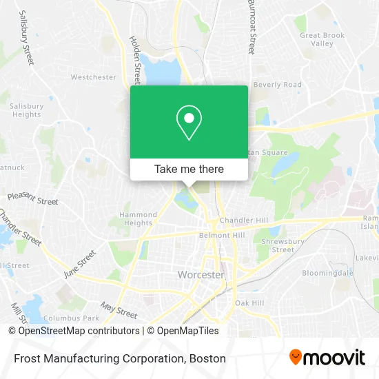
See Frost Manufacturing Corporation, Worcester, on the map
Public Transit to Frost Manufacturing Corporation in Worcester
Wondering how to get to Frost Manufacturing Corporation in Worcester? Moovit helps you find the best way to get to Frost Manufacturing Corporation with step-by-step directions from the nearest public transit station.
Moovit provides free maps and live directions to help you navigate through your city. View schedules, routes, timetables, and find out how long does it take to get to Frost Manufacturing Corporation in real time.
Looking for the nearest stop or station to Frost Manufacturing Corporation? Check out this list of stops closest to your destination: Park Ave + Waconah Rd; Grove St at 106 Grove.
Bus: 30, GREYHOUND US0230, 31, 825.
Want to see if there’s another route that gets you there at an earlier time? Moovit helps you find alternative routes or times. Get directions from and directions to Frost Manufacturing Corporation easily from the Moovit App or Website.
We make riding to Frost Manufacturing Corporation easy, which is why over 1.7 million users, including users in Worcester, trust Moovit as the best app for public transit. You don’t need to download an individual bus app or train app, Moovit is your all-in-one transit app that helps you find the best bus time or train time available.
For information on prices of bus and train, costs and ride fares to Frost Manufacturing Corporation, please check the Moovit app.
Use the app to navigate to popular places including to the airport, hospital, stadium, grocery store, mall, coffee shop, school, college, and university.
Frost Manufacturing Corporation Address: 173 Grove St Ste 2 street in Worcester
- Ghana Wesley Methodist Church in Worcester Ma,
- Ernie's Touchless Car Wash System,
- WFD Training Academy,
- Liberty Tax Service,
- Bonkers Balloon Factory,
- Un1f1ed Global Packaging Group,
- Real Estate Investor Dna,
- Harry Goddard House,
- Amazon Career Center,
- Salisbury St + Park Ave,
- Worcester Area Masters (Wam) Swimming,
- Shelly Weedon, Pa-C,
- Summit Eldercare,
- Fallon Health,
- Lutco,
- David Geist, MD, Faad, Facms,
- Zainab Abbas, MD,
- Strategic Labor,
- Gentle Dental - Worcester at the Trolley Yard,
- USPS Collection Box - Blue Box
Places Near Frost Manufacturing Corporation (Worcester)
- Seaport District, Boston,
- Quincy Market, Boston,
- Isabella Stewart Gardner Museum, Boston,
- Cheers, Boston,
- Boston Medical Center, Boston,
- Castle Island, Boston,
- Wilbur Theatre, Boston,
- Faneuil Hall, Boston,
- Boston Children's Hospital, Boston,
- Mgm Music Hall, Boston,
- Museum Of Science, Boston,
- Leader Bank Pavilion (Leader Bank Pavillion), Boston,
- Prudential Center, Boston,
- Massachusetts General Hospital, Boston,
- Boston Convention & Exhibition Center, Boston,
- Wang Theater, Boston,
- North End, Boston,
- House Of Blues, Boston,
- Td Garden, Boston,
- Boston Common, Boston
How to get to popular places in Boston with public transit
Get around Worcester by public transit!
Traveling around Worcester has never been so easy. See step by step directions as you travel to any attraction, street or major public transit station. View bus and train schedules, arrival times, service alerts and detailed routes on a map, so you know exactly how to get to anywhere in Worcester.
When traveling to any destination around Worcester use Moovit's Live Directions with Get Off Notifications to know exactly where and how far to walk, how long to wait for your line, and how many stops are left. Moovit will alert you when it's time to get off — no need to constantly re-check whether yours is the next stop.
Wondering how to use public transit in Worcester or how to pay for public transit in Worcester? Moovit public transit app can help you navigate your way with public transit easily, and at minimum cost. It includes public transit fees, ticket prices, and costs. Looking for a map of Worcester public transit lines? Moovit public transit app shows all public transit maps in Worcester with all Bus, Train, Subway and Ferry routes and stops on an interactive map.
Boston has 4 transit type(s), including: Bus, Train, Subway and Ferry, operated by several transit agencies, including MBTA, Southeastern Regional Transit Authority, MetroWest Regional Transit Authority, Rhode Island Public Transit Authority, WRTA, Lowell Regional Transit Authority, Merrimack Valley Transit, Montachusett Regional Transit Authority, Cape Cod Regional Transit Authority, Brockton Area Transit Authority, Martha's Vineyard Transit Authority, the WAVE - Nantucket Regional Transit Authority, GATRA, Cape Ann Transportation Authority and Massport