Directions to Fu Soun 2 (Boston) with public transportation
The following transit lines have routes that pass near Fu Soun 2
 Bus: G5, X92, T92, X90, T5.
- Train: LAKE SHORE LIMITED, VERMONTER, AMTRAK HARTFORD LINE, NORTHEAST REGIONAL, VALLEY FLYER.
How to get to Fu Soun 2 by bus?
Click on the bus route to see step by step directions with maps, line arrival times and updated time schedules.
From Palladium, Worcester
121 minFrom Foxwoods, Worcester
145 minFrom Walmart Supercenter, Worcester
175 minFrom Polar Park, Worcester
117 minFrom Worcester, MA, Worcester
116 minFrom Dcu Center, Worcester
118 minFrom Registry Of Motor Vehicles (Rmv) Branch Office, Worcester
120 minFrom South High Community School, Worcester
213 min
How to get to Fu Soun 2 by train?
Click on the train route to see step by step directions with maps, line arrival times and updated time schedules.
Bus stops near Fu Soun 2 in Boston
Train station near Fu Soun 2 in Boston
- Springfield, 42 min walk,VIEW
Bus lines to Fu Soun 2 in Boston
What are the closest stations to Fu Soun 2?
The closest stations to Fu Soun 2 are:
- Central / Beech is 231 yards away, 3 min walk.
- Walnut / Ashley is 299 yards away, 4 min walk.
- Mill / Hancock is 642 yards away, 8 min walk.
- Springfield is 3521 yards away, 42 min walk.
Which bus lines stop near Fu Soun 2?
These bus lines stop near Fu Soun 2: G5, X92.
Which train lines stop near Fu Soun 2?
These train lines stop near Fu Soun 2: LAKE SHORE LIMITED, VERMONTER.
What’s the nearest bus station to Fu Soun 2 in Boston?
The nearest bus station to Fu Soun 2 in Boston is Central / Beech. It’s a 3 min walk away.
What time is the first train to Fu Soun 2 in Boston?
The NORTHEAST REGIONAL is the first train that goes to Fu Soun 2 in Boston. It stops nearby at 4:10 AM.
What time is the last train to Fu Soun 2 in Boston?
The LAKE SHORE LIMITED is the last train that goes to Fu Soun 2 in Boston. It stops nearby at 6:04 PM.
What time is the first bus to Fu Soun 2 in Boston?
The G5 is the first bus that goes to Fu Soun 2 in Boston. It stops nearby at 6:08 AM.
What time is the last bus to Fu Soun 2 in Boston?
The X90 is the last bus that goes to Fu Soun 2 in Boston. It stops nearby at 9:27 PM.
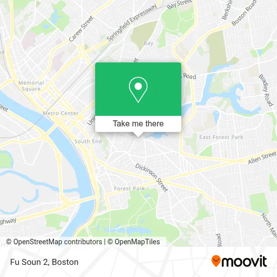
See Fu Soun 2, Boston, on the map
Public Transit to Fu Soun 2 in Boston
Wondering how to get to Fu Soun 2 in Boston? Moovit helps you find the best way to get to Fu Soun 2 with step-by-step directions from the nearest public transit station.
Moovit provides free maps and live directions to help you navigate through your city. View schedules, routes, timetables, and find out how long does it take to get to Fu Soun 2 in real time.
Looking for the nearest stop or station to Fu Soun 2? Check out this list of stops closest to your destination: Central / Beech; Walnut / Ashley; Mill / Hancock; Springfield.
Bus: G5, X92, T92, X90, T5.Train: LAKE SHORE LIMITED, VERMONTER, AMTRAK HARTFORD LINE, NORTHEAST REGIONAL, VALLEY FLYER.
Want to see if there’s another route that gets you there at an earlier time? Moovit helps you find alternative routes or times. Get directions from and directions to Fu Soun 2 easily from the Moovit App or Website.
We make riding to Fu Soun 2 easy, which is why over 1.7 million users, including users in Boston, trust Moovit as the best app for public transit. You don’t need to download an individual bus app or train app, Moovit is your all-in-one transit app that helps you find the best bus time or train time available.
For information on prices of bus and train, costs and ride fares to Fu Soun 2, please check the Moovit app.
Use the app to navigate to popular places including to the airport, hospital, stadium, grocery store, mall, coffee shop, school, college, and university.
Fu Soun 2 Address: 494 Central St street in Boston
- Easy Checks & Variety,
- Noahs Arch Family Day Care,
- Qué Frappé,
- Rifle & Allen,
- Victory Church,
- 1 Stop Plaza,
- City of Springfield K 8,
- Marjam Co,
- Tornado Alley Projects,
- Elias Brookings School,
- Allen St Realty,
- Mainline Industries,
- Sheehan Signs,
- Pynchon Press,
- M & E Heating & Air Conditioning,
- Brookings Elementary School,
- Cherry Lane Cemetery,
- FJ Mobile Detailing,
- Educare Springfield,
- Creative Minds Family Childcare
Places Near Fu Soun 2 (Boston)
- Wang Theater, Boston,
- Boston Medical Center, Boston,
- Mgm Music Hall, Boston,
- Museum Of Science, Boston,
- North End, Boston,
- Cheers, Boston,
- Wilbur Theatre, Boston,
- Prudential Center, Boston,
- Td Garden, Boston,
- Leader Bank Pavilion (Leader Bank Pavillion), Boston,
- Massachusetts General Hospital, Boston,
- House Of Blues, Boston,
- Castle Island, Boston,
- Seaport District, Boston,
- Faneuil Hall, Boston,
- Quincy Market, Boston,
- Isabella Stewart Gardner Museum, Boston,
- Boston Children's Hospital, Boston,
- Boston Common, Boston,
- Boston Convention & Exhibition Center, Boston
How to get to popular places in Boston with public transit
Get around Boston by public transit!
Traveling around Boston has never been so easy. See step by step directions as you travel to any attraction, street or major public transit station. View bus and train schedules, arrival times, service alerts and detailed routes on a map, so you know exactly how to get to anywhere in Boston.
When traveling to any destination around Boston use Moovit's Live Directions with Get Off Notifications to know exactly where and how far to walk, how long to wait for your line, and how many stops are left. Moovit will alert you when it's time to get off — no need to constantly re-check whether yours is the next stop.
Wondering how to use public transit in Boston or how to pay for public transit in Boston? Moovit public transit app can help you navigate your way with public transit easily, and at minimum cost. It includes public transit fees, ticket prices, and costs. Looking for a map of Boston public transit lines? Moovit public transit app shows all public transit maps in Boston with all Bus, Train, Subway and Ferry routes and stops on an interactive map.
Boston has 4 transit type(s), including: Bus, Train, Subway and Ferry, operated by several transit agencies, including MBTA, Southeastern Regional Transit Authority, MetroWest Regional Transit Authority, Rhode Island Public Transit Authority, WRTA, Lowell Regional Transit Authority, Merrimack Valley Transit, Montachusett Regional Transit Authority, Cape Cod Regional Transit Authority, Brockton Area Transit Authority, Martha's Vineyard Transit Authority, the WAVE - Nantucket Regional Transit Authority, GATRA, Cape Ann Transportation Authority and Massport