How to get to Fuchs Furniture by bus?
Click on the bus route to see step by step directions with maps, line arrival times and updated time schedules.
Bus stops near Fuchs Furniture in Boston
Train station near Fuchs Furniture in Boston
- North Billerica, 34 min walk,VIEW
What are the closest stations to Fuchs Furniture?
The closest stations to Fuchs Furniture are:
- Chelmsford Rd & Executive Park Dr is 195 yards away, 3 min walk.
- Brick Kiln Rd & Canal St is 404 yards away, 5 min walk.
- North Billerica is 2850 yards away, 34 min walk.
Which bus lines stop near Fuchs Furniture?
These bus lines stop near Fuchs Furniture: 13, 14, 15.
What’s the nearest bus station to Fuchs Furniture in Boston?
The nearest bus station to Fuchs Furniture in Boston is Chelmsford Rd & Executive Park Dr. It’s a 3 min walk away.
What time is the first train to Fuchs Furniture in Boston?
The LOWELL is the first train that goes to Fuchs Furniture in Boston. It stops nearby at 5:08 AM.
What time is the last train to Fuchs Furniture in Boston?
The LOWELL is the last train that goes to Fuchs Furniture in Boston. It stops nearby at 12:20 AM.
What time is the first bus to Fuchs Furniture in Boston?
The 14 is the first bus that goes to Fuchs Furniture in Boston. It stops nearby at 6:15 AM.
What time is the last bus to Fuchs Furniture in Boston?
The 14 is the last bus that goes to Fuchs Furniture in Boston. It stops nearby at 7:47 PM.
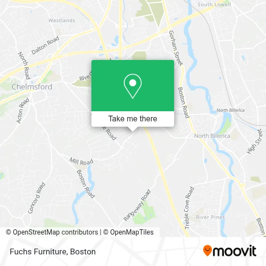
See Fuchs Furniture, Boston, on the map
Public Transit to Fuchs Furniture in Boston
Wondering how to get to Fuchs Furniture in Boston? Moovit helps you find the best way to get to Fuchs Furniture with step-by-step directions from the nearest public transit station.
Moovit provides free maps and live directions to help you navigate through your city. View schedules, routes, timetables, and find out how long does it take to get to Fuchs Furniture in real time.
Looking for the nearest stop or station to Fuchs Furniture? Check out this list of stops closest to your destination: Chelmsford Rd & Executive Park Dr; Brick Kiln Rd & Canal St; North Billerica.
Bus: 13, 14, 15.Train: LOWELL.
Want to see if there’s another route that gets you there at an earlier time? Moovit helps you find alternative routes or times. Get directions from and directions to Fuchs Furniture easily from the Moovit App or Website.
We make riding to Fuchs Furniture easy, which is why over 1.7 million users, including users in Boston, trust Moovit as the best app for public transit. You don’t need to download an individual bus app or train app, Moovit is your all-in-one transit app that helps you find the best bus time or train time available.
For information on prices of bus and train, costs and ride fares to Fuchs Furniture, please check the Moovit app.
Use the app to navigate to popular places including to the airport, hospital, stadium, grocery store, mall, coffee shop, school, college, and university.
Fuchs Furniture Address: 262 Mill Rd street in Boston
- Zoll Medical Corporation,
- Chelmsford Cafe,
- Accutronics, Llc,
- Zoll Medical Corporation,
- Datacon, Inc,
- Exfo Service Assurance,
- Datacon, Inc.,
- KS Gotta Dance,
- Dylan & Pete's Ice Cream Truck,
- Incompass Human Services,
- Department Of Children And Families,
- Kronos Campus- 4 Omni,
- Cesar Sanchez Real Estate,
- Lexie Tice, Realtor,
- Lisa Murphy, Real Estate Agent,
- Tom Mcdevitt Real Estate Agent,
- Sold by Silks,
- Jenny Tran,
- Brooks Automation,
- Triton Systems Inc
Places Near Fuchs Furniture (Boston)
- Wang Theater, Boston,
- Boston Children's Hospital, Boston,
- Seaport District, Boston,
- Faneuil Hall, Boston,
- Cheers, Boston,
- Massachusetts General Hospital, Boston,
- Td Garden, Boston,
- Boston Common, Boston,
- Museum Of Science, Boston,
- Isabella Stewart Gardner Museum, Boston,
- North End, Boston,
- Mgm Music Hall, Boston,
- Wilbur Theatre, Boston,
- House Of Blues, Boston,
- Boston Convention & Exhibition Center, Boston,
- Boston Medical Center, Boston,
- Castle Island, Boston,
- Quincy Market, Boston,
- Prudential Center, Boston,
- Leader Bank Pavilion (Leader Bank Pavillion), Boston
How to get to popular places in Boston with public transit
Get around Boston by public transit!
Traveling around Boston has never been so easy. See step by step directions as you travel to any attraction, street or major public transit station. View bus and train schedules, arrival times, service alerts and detailed routes on a map, so you know exactly how to get to anywhere in Boston.
When traveling to any destination around Boston use Moovit's Live Directions with Get Off Notifications to know exactly where and how far to walk, how long to wait for your line, and how many stops are left. Moovit will alert you when it's time to get off — no need to constantly re-check whether yours is the next stop.
Wondering how to use public transit in Boston or how to pay for public transit in Boston? Moovit public transit app can help you navigate your way with public transit easily, and at minimum cost. It includes public transit fees, ticket prices, and costs. Looking for a map of Boston public transit lines? Moovit public transit app shows all public transit maps in Boston with all Bus, Train, Subway and Ferry routes and stops on an interactive map.
Boston has 4 transit type(s), including: Bus, Train, Subway and Ferry, operated by several transit agencies, including MBTA, Southeastern Regional Transit Authority, MetroWest Regional Transit Authority, Rhode Island Public Transit Authority, WRTA, Lowell Regional Transit Authority, Merrimack Valley Transit, Montachusett Regional Transit Authority, Cape Cod Regional Transit Authority, Brockton Area Transit Authority, Martha's Vineyard Transit Authority, the WAVE - Nantucket Regional Transit Authority, GATRA, Cape Ann Transportation Authority and Massport