How to get to Fw Corporation by bus?
Click on the bus route to see step by step directions with maps, line arrival times and updated time schedules.
From Angell Animal Medical Center (Mspca Angell), Boston
78 minFrom Samuel Adams Brewery, Boston
85 minFrom Warren St, Boston
80 minFrom Sam Adams Boston Brewery Tour, Boston
85 minFrom Sonia, Boston
86 minFrom Charles Playhouse, Boston
39 minFrom Staypineapple, Boston
50 minFrom The Lawn on D, Boston
34 minFrom Brookline High School (Brookline Town High School), Brookline
93 min
How to get to Fw Corporation by subway?
Click on the subway route to see step by step directions with maps, line arrival times and updated time schedules.
From Angell Animal Medical Center (Mspca Angell), Boston
72 minFrom Samuel Adams Brewery, Boston
63 minFrom Warren St, Boston
85 minFrom Sam Adams Boston Brewery Tour, Boston
62 minFrom Sonia, Boston
97 minFrom Charles Playhouse, Boston
50 minFrom Staypineapple, Boston
54 minFrom The Lawn on D, Boston
75 minFrom Brookline High School (Brookline Town High School), Brookline
74 min
Bus stops near Fw Corporation in Chelsea
Subway station near Fw Corporation in Chelsea
- Maverick, 7 min walk,VIEW
Train station near Fw Corporation in Chelsea
- Chelsea, 32 min walk,VIEW
Bus lines to Fw Corporation in Chelsea
What are the closest stations to Fw Corporation?
The closest stations to Fw Corporation are:
- Cross St @ Broadway is 145 yards away, 2 min walk.
- Third St @ Chestnut St is 157 yards away, 2 min walk.
- Maverick is 582 yards away, 7 min walk.
- Chelsea is 2656 yards away, 32 min walk.
Which bus lines stop near Fw Corporation?
These bus lines stop near Fw Corporation: 104, 111, SL3.
Which subway line stops near Fw Corporation?
BLUE LINE (Wonderland)
What’s the nearest subway station to Fw Corporation in Chelsea?
The nearest subway station to Fw Corporation in Chelsea is Maverick. It’s a 7 min walk away.
What’s the nearest bus station to Fw Corporation in Chelsea?
The nearest bus stations to Fw Corporation in Chelsea are Cross St @ Broadway and Third St @ Chestnut St. The closest one is a 2 min walk away.
What time is the first subway to Fw Corporation in Chelsea?
The BLUE LINE is the first subway that goes to Fw Corporation in Chelsea. It stops nearby at 5:10 AM.
What time is the last subway to Fw Corporation in Chelsea?
The BLUE LINE is the last subway that goes to Fw Corporation in Chelsea. It stops nearby at 2:01 AM.
What time is the first train to Fw Corporation in Chelsea?
The NEWBURYPORT/ROCKPORT is the first train that goes to Fw Corporation in Chelsea. It stops nearby at 5:40 AM.
What time is the last train to Fw Corporation in Chelsea?
The NEWBURYPORT/ROCKPORT is the last train that goes to Fw Corporation in Chelsea. It stops nearby at 12:06 AM.
What time is the first bus to Fw Corporation in Chelsea?
The 104 is the first bus that goes to Fw Corporation in Chelsea. It stops nearby at 4:31 AM.
What time is the last bus to Fw Corporation in Chelsea?
The 111 is the last bus that goes to Fw Corporation in Chelsea. It stops nearby at 2:28 AM.
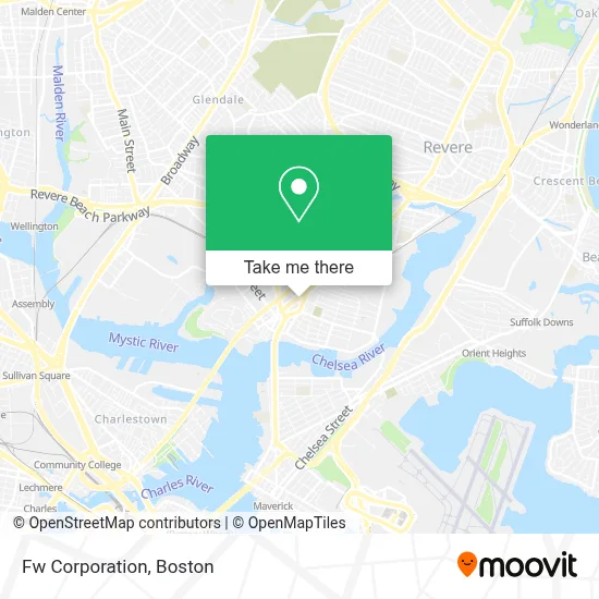
See Fw Corporation, Chelsea, on the map
Public Transit to Fw Corporation in Chelsea
Wondering how to get to Fw Corporation in Chelsea? Moovit helps you find the best way to get to Fw Corporation with step-by-step directions from the nearest public transit station.
Moovit provides free maps and live directions to help you navigate through your city. View schedules, routes, timetables, and find out how long does it take to get to Fw Corporation in real time.
Looking for the nearest stop or station to Fw Corporation? Check out this list of stops closest to your destination: Cross St @ Broadway; Third St @ Chestnut St; Maverick; Chelsea.
Bus: 104, 111, SL3, 112, 114, 116.Train: NEWBURYPORT/ROCKPORT.Subway: BLUE LINE.
Want to see if there’s another route that gets you there at an earlier time? Moovit helps you find alternative routes or times. Get directions from and directions to Fw Corporation easily from the Moovit App or Website.
We make riding to Fw Corporation easy, which is why over 1.7 million users, including users in Chelsea, trust Moovit as the best app for public transit. You don’t need to download an individual bus app or train app, Moovit is your all-in-one transit app that helps you find the best bus time or train time available.
For information on prices of bus, subway and train, costs and ride fares to Fw Corporation, please check the Moovit app.
Use the app to navigate to popular places including to the airport, hospital, stadium, grocery store, mall, coffee shop, school, college, and university.
Fw Corporation Address: 377 Broadway street in Chelsea
- 4th St,
- Queens Beauty Salon,
- Colombian Boutique,
- Cataldo Ambulance,
- Stop and Compare Office,
- DF Wireless,
- Iglesia Intervencion Divina,
- T-Mobile,
- Ponde Juancho,
- Live Well Nutrition,
- CVS,
- Global Cargo,
- Jonathan All Hours Lock & Key,
- F & S Djs',
- Transportes Lorenzana,
- Flag Pharmacy,
- La Colaborativa,
- Laronde de Marie Claire Early Learning,
- Flavorfulz,
- Bellingham Fruit & Pro
Places Near Fw Corporation (Chelsea)
- House Of Blues, Boston,
- Wilbur Theatre, Boston,
- Prudential Center, Boston,
- Museum Of Science, Boston,
- Castle Island, Boston,
- North End, Boston,
- Boston Children's Hospital, Boston,
- Faneuil Hall, Boston,
- Boston Medical Center, Boston,
- Cheers, Boston,
- Leader Bank Pavilion (Leader Bank Pavillion), Boston,
- Massachusetts General Hospital, Boston,
- Mgm Music Hall, Boston,
- Seaport District, Boston,
- Boston Common, Boston,
- Td Garden, Boston,
- Wang Theater, Boston,
- Boston Convention & Exhibition Center, Boston,
- Quincy Market, Boston,
- Isabella Stewart Gardner Museum, Boston
How to get to popular places in Boston with public transit
Get around Chelsea by public transit!
Traveling around Chelsea has never been so easy. See step by step directions as you travel to any attraction, street or major public transit station. View bus and train schedules, arrival times, service alerts and detailed routes on a map, so you know exactly how to get to anywhere in Chelsea.
When traveling to any destination around Chelsea use Moovit's Live Directions with Get Off Notifications to know exactly where and how far to walk, how long to wait for your line, and how many stops are left. Moovit will alert you when it's time to get off — no need to constantly re-check whether yours is the next stop.
Wondering how to use public transit in Chelsea or how to pay for public transit in Chelsea? Moovit public transit app can help you navigate your way with public transit easily, and at minimum cost. It includes public transit fees, ticket prices, and costs. Looking for a map of Chelsea public transit lines? Moovit public transit app shows all public transit maps in Chelsea with all Bus, Train, Subway and Ferry routes and stops on an interactive map.
Boston has 4 transit type(s), including: Bus, Train, Subway and Ferry, operated by several transit agencies, including MBTA, Southeastern Regional Transit Authority, MetroWest Regional Transit Authority, Rhode Island Public Transit Authority, WRTA, Lowell Regional Transit Authority, Merrimack Valley Transit, Montachusett Regional Transit Authority, Cape Cod Regional Transit Authority, Brockton Area Transit Authority, Martha's Vineyard Transit Authority, the WAVE - Nantucket Regional Transit Authority, GATRA, Cape Ann Transportation Authority and Massport