Directions to G Chavez Landscaping (Malden) with public transportation
The following transit lines have routes that pass near G Chavez Landscaping
 Bus: 104, 105, 97.
- Train: HAVERHILL, NEWBURYPORT/ROCKPORT, ORANGE LINE.
- Subway: ORANGE LINE.
How to get to G Chavez Landscaping by bus?
Click on the bus route to see step by step directions with maps, line arrival times and updated time schedules.
From Pemberton Square, Boston
50 minFrom O'Bryant High School, Boston
86 minFrom Hotel Indigo Boston Garden an IHG Hotel, Boston
45 minFrom Holiday Inn Express & Suites Boston - Cambridge, Cambridge
48 minFrom Best Buy, Boston
98 minFrom South Bay Center, Boston
98 minFrom Brigham and Women's, Boston
79 minFrom Hilton Boston Logan Airport, Boston
40 minFrom Dana-Farber Cancer Institute, Boston
61 minFrom Reggie Lewis Athletic Center, Boston
88 min
How to get to G Chavez Landscaping by train?
Click on the train route to see step by step directions with maps, line arrival times and updated time schedules.
How to get to G Chavez Landscaping by subway?
Click on the subway route to see step by step directions with maps, line arrival times and updated time schedules.
From Pemberton Square, Boston
45 minFrom O'Bryant High School, Boston
61 minFrom Hotel Indigo Boston Garden an IHG Hotel, Boston
43 minFrom Holiday Inn Express & Suites Boston - Cambridge, Cambridge
54 minFrom Best Buy, Boston
64 minFrom South Bay Center, Boston
65 minFrom Brigham and Women's, Boston
72 minFrom Hilton Boston Logan Airport, Boston
58 minFrom Dana-Farber Cancer Institute, Boston
77 minFrom Reggie Lewis Athletic Center, Boston
56 min
Bus stops near G Chavez Landscaping in Malden
Train stations near G Chavez Landscaping in Malden
What are the closest stations to G Chavez Landscaping?
The closest stations to G Chavez Landscaping are:
- Ferry St @ Harvard St is 89 yards away, 2 min walk.
- Cross St @ Stevens St is 128 yards away, 2 min walk.
- Hancock St @ Belmont St is 482 yards away, 6 min walk.
- Oak Grove is 1978 yards away, 24 min walk.
- Chelsea is 4997 yards away, 62 min walk.
Which bus lines stop near G Chavez Landscaping?
These bus lines stop near G Chavez Landscaping: 104, 105, 97.
Which train lines stop near G Chavez Landscaping?
These train lines stop near G Chavez Landscaping: HAVERHILL, NEWBURYPORT/ROCKPORT.
Which subway line stops near G Chavez Landscaping?
ORANGE LINE (Oak Grove)
What’s the nearest train station to G Chavez Landscaping in Malden?
The nearest train station to G Chavez Landscaping in Malden is Oak Grove. It’s a 24 min walk away.
What’s the nearest bus station to G Chavez Landscaping in Malden?
The nearest bus stations to G Chavez Landscaping in Malden are Ferry St @ Harvard St and Cross St @ Stevens St. The closest one is a 2 min walk away.
What time is the first subway to G Chavez Landscaping in Malden?
The ORANGE LINE is the first subway that goes to G Chavez Landscaping in Malden. It stops nearby at 5:15 AM.
What time is the last subway to G Chavez Landscaping in Malden?
The ORANGE LINE is the last subway that goes to G Chavez Landscaping in Malden. It stops nearby at 1:59 AM.
What time is the first train to G Chavez Landscaping in Malden?
The HAVERHILL is the first train that goes to G Chavez Landscaping in Malden. It stops nearby at 5:35 AM.
What time is the last train to G Chavez Landscaping in Malden?
The NEWBURYPORT/ROCKPORT is the last train that goes to G Chavez Landscaping in Malden. It stops nearby at 12:06 AM.
What time is the first bus to G Chavez Landscaping in Malden?
The 104 is the first bus that goes to G Chavez Landscaping in Malden. It stops nearby at 4:29 AM.
What time is the last bus to G Chavez Landscaping in Malden?
The 104 is the last bus that goes to G Chavez Landscaping in Malden. It stops nearby at 1:33 AM.
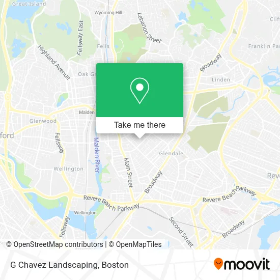
See G Chavez Landscaping, Malden, on the map
Public Transit to G Chavez Landscaping in Malden
Wondering how to get to G Chavez Landscaping in Malden? Moovit helps you find the best way to get to G Chavez Landscaping with step-by-step directions from the nearest public transit station.
Moovit provides free maps and live directions to help you navigate through your city. View schedules, routes, timetables, and find out how long does it take to get to G Chavez Landscaping in real time.
Looking for the nearest stop or station to G Chavez Landscaping? Check out this list of stops closest to your destination: Ferry St @ Harvard St; Cross St @ Stevens St; Hancock St @ Belmont St; Oak Grove; Chelsea.
Bus: 104, 105, 97.Train: HAVERHILL, NEWBURYPORT/ROCKPORT, ORANGE LINE.Subway: ORANGE LINE.
Want to see if there’s another route that gets you there at an earlier time? Moovit helps you find alternative routes or times. Get directions from and directions to G Chavez Landscaping easily from the Moovit App or Website.
We make riding to G Chavez Landscaping easy, which is why over 1.7 million users, including users in Malden, trust Moovit as the best app for public transit. You don’t need to download an individual bus app or train app, Moovit is your all-in-one transit app that helps you find the best bus time or train time available.
For information on prices of bus, subway and train, costs and ride fares to G Chavez Landscaping, please check the Moovit app.
Use the app to navigate to popular places including to the airport, hospital, stadium, grocery store, mall, coffee shop, school, college, and university.
G Chavez Landscaping Address: 11 Fairmont Pl street in Malden
- Amazing Client Reviews,
- Alex Handyman Services,
- Gerardo's Scrap & Recycling,
- Portillo Brothers Market II,
- Ferryway School,
- Artistic Video Productions,
- Pk Motor Cars,
- Laserenastudios,
- Casablanca Services in,
- Thistle Safe and Lock Co Inc,
- Cafe Creole Restaurant,
- Little Garden Daycare,
- The Park Thats Not A Park,
- Oliver Home Improvement,
- GNG Limo,
- Iglesia Adventista de Everett,
- Jimmys Liquor,
- Malden Mobile Locksmith Store,
- Ferry St Service and Auto Sales,
- North East USA Companies
Places Near G Chavez Landscaping (Malden)
- Boston Medical Center, Boston,
- Leader Bank Pavilion (Leader Bank Pavillion), Boston,
- House Of Blues, Boston,
- Mgm Music Hall, Boston,
- Museum Of Science, Boston,
- Castle Island, Boston,
- Boston Convention & Exhibition Center, Boston,
- Isabella Stewart Gardner Museum, Boston,
- Td Garden, Boston,
- Wang Theater, Boston,
- Massachusetts General Hospital, Boston,
- Quincy Market, Boston,
- Boston Common, Boston,
- North End, Boston,
- Wilbur Theatre, Boston,
- Seaport District, Boston,
- Cheers, Boston,
- Faneuil Hall, Boston,
- Boston Children's Hospital, Boston,
- Prudential Center, Boston
How to get to popular places in Boston with public transit
Get around Malden by public transit!
Traveling around Malden has never been so easy. See step by step directions as you travel to any attraction, street or major public transit station. View bus and train schedules, arrival times, service alerts and detailed routes on a map, so you know exactly how to get to anywhere in Malden.
When traveling to any destination around Malden use Moovit's Live Directions with Get Off Notifications to know exactly where and how far to walk, how long to wait for your line, and how many stops are left. Moovit will alert you when it's time to get off — no need to constantly re-check whether yours is the next stop.
Wondering how to use public transit in Malden or how to pay for public transit in Malden? Moovit public transit app can help you navigate your way with public transit easily, and at minimum cost. It includes public transit fees, ticket prices, and costs. Looking for a map of Malden public transit lines? Moovit public transit app shows all public transit maps in Malden with all Bus, Train, Subway and Ferry routes and stops on an interactive map.
Boston has 4 transit type(s), including: Bus, Train, Subway and Ferry, operated by several transit agencies, including MBTA, Southeastern Regional Transit Authority, MetroWest Regional Transit Authority, Rhode Island Public Transit Authority, WRTA, Lowell Regional Transit Authority, Merrimack Valley Transit, Montachusett Regional Transit Authority, Cape Cod Regional Transit Authority, Brockton Area Transit Authority, Martha's Vineyard Transit Authority, the WAVE - Nantucket Regional Transit Authority, GATRA, Cape Ann Transportation Authority and Massport