Directions to Gail Petersen Bell (Boston) with public transportation
The following transit lines have routes that pass near Gail Petersen Bell
 Bus: 220.
- Train: GREENBUSH.
- Ferry: BUMPKIN ISLAND FERRY, GEORGES ISLAND FERRY, HEWITT'S COVE FERRY, PEDDOCKS ISLAND FERRY, HINGHAM FERRY.
How to get to Gail Petersen Bell by bus?
Click on the bus route to see step by step directions with maps, line arrival times and updated time schedules.
From Boston Scientific, Quincy
86 minFrom Granite Links Golf Club at Quarry Hills, Quincy
82 minFrom Ramada by Wyndham Boston, Boston
81 minFrom Archbishop Williams High School, Braintree Town
44 minFrom Quincy, MA, Quincy
25 minFrom Best Western Adams Inn Quincy - Boston, Quincy
75 minFrom Marina Bay, Quincy
85 minFrom South Shore Hospital Outpatient Center, Weymouth Town
82 minFrom South Shore Plaza, Braintree Town
72 min
How to get to Gail Petersen Bell by train?
Click on the train route to see step by step directions with maps, line arrival times and updated time schedules.
Bus stop near Gail Petersen Bell in Boston
- Lincoln St @ Bradley Woods Dr, 1 min walk,VIEW
Train station near Gail Petersen Bell in Boston
- West Hingham, 10 min walk,VIEW
Ferry stations near Gail Petersen Bell in Boston
Bus lines to Gail Petersen Bell in Boston
- 220, Quincy Center Via Shipyard,VIEW
What are the closest stations to Gail Petersen Bell?
The closest stations to Gail Petersen Bell are:
- Lincoln St @ Bradley Woods Dr is 10 yards away, 1 min walk.
- West Hingham is 819 yards away, 10 min walk.
- Hewitt's Cove is 3170 yards away, 38 min walk.
- Hingham is 3182 yards away, 38 min walk.
Which bus line stops near Gail Petersen Bell?
220 (Hingham Depot Via Shipyard)
Which train line stops near Gail Petersen Bell?
GREENBUSH (#1061 | Greenbush)
What’s the nearest train station to Gail Petersen Bell in Boston?
The nearest train station to Gail Petersen Bell in Boston is West Hingham. It’s a 10 min walk away.
What’s the nearest bus station to Gail Petersen Bell in Boston?
The nearest bus station to Gail Petersen Bell in Boston is Lincoln St @ Bradley Woods Dr. It’s a 1 min walk away.
What time is the first train to Gail Petersen Bell in Boston?
The GREENBUSH is the first train that goes to Gail Petersen Bell in Boston. It stops nearby at 5:37 AM.
What time is the last train to Gail Petersen Bell in Boston?
The GREENBUSH is the last train that goes to Gail Petersen Bell in Boston. It stops nearby at 12:22 AM.
What time is the first bus to Gail Petersen Bell in Boston?
The 220 is the first bus that goes to Gail Petersen Bell in Boston. It stops nearby at 5:25 AM.
What time is the last bus to Gail Petersen Bell in Boston?
The 220 is the last bus that goes to Gail Petersen Bell in Boston. It stops nearby at 1:40 AM.
What time is the first ferry to Gail Petersen Bell in Boston?
The HINGHAM/HULL FERRY is the first ferry that goes to Gail Petersen Bell in Boston. It stops nearby at 5:40 AM.
What time is the last ferry to Gail Petersen Bell in Boston?
The HINGHAM/HULL FERRY is the last ferry that goes to Gail Petersen Bell in Boston. It stops nearby at 10:50 PM.
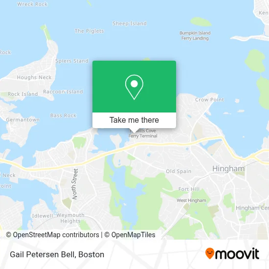
See Gail Petersen Bell, Boston, on the map
Public Transit to Gail Petersen Bell in Boston
Wondering how to get to Gail Petersen Bell in Boston? Moovit helps you find the best way to get to Gail Petersen Bell with step-by-step directions from the nearest public transit station.
Moovit provides free maps and live directions to help you navigate through your city. View schedules, routes, timetables, and find out how long does it take to get to Gail Petersen Bell in real time.
Looking for the nearest stop or station to Gail Petersen Bell? Check out this list of stops closest to your destination: Lincoln St @ Bradley Woods Dr; West Hingham; Hewitt's Cove; Hingham.
Bus: 220.Train: GREENBUSH.Ferry: BUMPKIN ISLAND FERRY, GEORGES ISLAND FERRY, HEWITT'S COVE FERRY, PEDDOCKS ISLAND FERRY, HINGHAM FERRY, HINGHAM/HULL FERRY.
Want to see if there’s another route that gets you there at an earlier time? Moovit helps you find alternative routes or times. Get directions from and directions to Gail Petersen Bell easily from the Moovit App or Website.
We make riding to Gail Petersen Bell easy, which is why over 1.7 million users, including users in Boston, trust Moovit as the best app for public transit. You don’t need to download an individual bus app or train app, Moovit is your all-in-one transit app that helps you find the best bus time or train time available.
For information on prices of bus, subway and train, costs and ride fares to Gail Petersen Bell, please check the Moovit app.
Use the app to navigate to popular places including to the airport, hospital, stadium, grocery store, mall, coffee shop, school, college, and university.
Gail Petersen Bell Address: 18 Shipyard Dr street in Boston
- Next Generation Strategies Public Affairs Group,
- Alison Sheerin,
- Sharon Norman Realtor,
- Benjamin Lincoln Real Estate,
- Angela Stevenson Group Real Estate Compass,
- Cara Williams,
- Julie Mccarthy Real Estate,
- Ameriprise Financial,
- International Citizens Insurance,
- Alyson Ferrando, Realtor,
- Camryn Caron, Compass Real Estate,
- Pam Steele Parker | Northpoint Mortgage | Nmls 114462,
- Darrel Da Cunha - Financial Advisor, Ameriprise Financial Services, Llc,
- Pure Barre Hingham,
- Suzanne Troyer Real Estate,
- Jeff Alexander Living,
- Ryan Ahern Real Estate,
- Jason Wojciechowski Tiaa Wealth Management Advisor,
- Justin Oliver, Realtor,
- Denise Marshall, Realtor - Hingham, South Shore & Boston
Places Near Gail Petersen Bell (Boston)
- House Of Blues, Boston,
- Isabella Stewart Gardner Museum, Boston,
- North End, Boston,
- Prudential Center, Boston,
- Td Garden, Boston,
- Mgm Music Hall, Boston,
- Wilbur Theatre, Boston,
- Boston Common, Boston,
- Boston Medical Center, Boston,
- Boston Children's Hospital, Boston,
- Wang Theater, Boston,
- Massachusetts General Hospital, Boston,
- Castle Island, Boston,
- Faneuil Hall, Boston,
- Boston Convention & Exhibition Center, Boston,
- Seaport District, Boston,
- Cheers, Boston,
- Museum Of Science, Boston,
- Quincy Market, Boston,
- Leader Bank Pavilion (Leader Bank Pavillion), Boston
How to get to popular places in Boston with public transit
Get around Boston by public transit!
Traveling around Boston has never been so easy. See step by step directions as you travel to any attraction, street or major public transit station. View bus and train schedules, arrival times, service alerts and detailed routes on a map, so you know exactly how to get to anywhere in Boston.
When traveling to any destination around Boston use Moovit's Live Directions with Get Off Notifications to know exactly where and how far to walk, how long to wait for your line, and how many stops are left. Moovit will alert you when it's time to get off — no need to constantly re-check whether yours is the next stop.
Wondering how to use public transit in Boston or how to pay for public transit in Boston? Moovit public transit app can help you navigate your way with public transit easily, and at minimum cost. It includes public transit fees, ticket prices, and costs. Looking for a map of Boston public transit lines? Moovit public transit app shows all public transit maps in Boston with all Bus, Train, Subway and Ferry routes and stops on an interactive map.
Boston has 4 transit type(s), including: Bus, Train, Subway and Ferry, operated by several transit agencies, including MBTA, Southeastern Regional Transit Authority, MetroWest Regional Transit Authority, Rhode Island Public Transit Authority, WRTA, Lowell Regional Transit Authority, Merrimack Valley Transit, Montachusett Regional Transit Authority, Cape Cod Regional Transit Authority, Brockton Area Transit Authority, Martha's Vineyard Transit Authority, the WAVE - Nantucket Regional Transit Authority, GATRA, Cape Ann Transportation Authority and Massport