Directions to Gaius Media (Malden) with public transportation
The following transit lines have routes that pass near Gaius Media
 Bus: 104, 105, 106, 411, 430.
- Train: HAVERHILL, NEWBURYPORT/ROCKPORT.
- Subway: ORANGE LINE.
How to get to Gaius Media by bus?
Click on the bus route to see step by step directions with maps, line arrival times and updated time schedules.
From World Trade Center, Boston
67 minFrom Four Seasons Hotel Boston, Boston
73 minFrom MCPHS University-Boston, Boston
82 minFrom Coolidge Corner Theatre, Brookline
97 minFrom Beth Israel Deaconess Medical Center West Campus, Boston
73 minFrom 221 Longwood, Boston
84 minFrom The Colonnade Hotel Boston, Boston
86 minFrom Staypineapple, Boston
85 minFrom Tufts University, Boston
66 minFrom Bidmc, Boston
73 min
How to get to Gaius Media by train?
Click on the train route to see step by step directions with maps, line arrival times and updated time schedules.
How to get to Gaius Media by subway?
Click on the subway route to see step by step directions with maps, line arrival times and updated time schedules.
From World Trade Center, Boston
50 minFrom Four Seasons Hotel Boston, Boston
35 minFrom MCPHS University-Boston, Boston
53 minFrom Coolidge Corner Theatre, Brookline
60 minFrom Beth Israel Deaconess Medical Center West Campus, Boston
62 minFrom 221 Longwood, Boston
54 minFrom The Colonnade Hotel Boston, Boston
40 minFrom Staypineapple, Boston
38 minFrom Tufts University, Boston
32 minFrom Bidmc, Boston
62 min
Bus stops near Gaius Media in Malden
Subway station near Gaius Media in Malden
- Wellington, 30 min walk,VIEW
Bus lines to Gaius Media in Malden
What are the closest stations to Gaius Media?
The closest stations to Gaius Media are:
- Main St @ Brown Terr is 14 yards away, 1 min walk.
- Ferry St @ Eastern Ave is 170 yards away, 3 min walk.
- Eastern Ave @ Ferry St is 189 yards away, 3 min walk.
- Centre St @ Jackson St is 352 yards away, 5 min walk.
- Wellington is 2488 yards away, 30 min walk.
- Chelsea is 2524 yards away, 32 min walk.
- Oak Grove is 4875 yards away, 57 min walk.
Which bus lines stop near Gaius Media?
These bus lines stop near Gaius Media: 104, 105, 106, 411, 430, 99.
Which train line stops near Gaius Media?
HAVERHILL (#229 | Haverhill)
Which subway line stops near Gaius Media?
ORANGE LINE (Oak Grove)
What’s the nearest subway station to Gaius Media in Malden?
The nearest subway station to Gaius Media in Malden is Wellington. It’s a 30 min walk away.
What’s the nearest bus station to Gaius Media in Malden?
The nearest bus station to Gaius Media in Malden is Main St @ Brown Terr. It’s a 1 min walk away.
What time is the first subway to Gaius Media in Malden?
The ORANGE LINE is the first subway that goes to Gaius Media in Malden. It stops nearby at 5:15 AM.
What time is the last subway to Gaius Media in Malden?
The ORANGE LINE is the last subway that goes to Gaius Media in Malden. It stops nearby at 1:59 AM.
What time is the first train to Gaius Media in Malden?
The HAVERHILL is the first train that goes to Gaius Media in Malden. It stops nearby at 5:35 AM.
What time is the last train to Gaius Media in Malden?
The NEWBURYPORT/ROCKPORT is the last train that goes to Gaius Media in Malden. It stops nearby at 12:06 AM.
What time is the first bus to Gaius Media in Malden?
The 104 is the first bus that goes to Gaius Media in Malden. It stops nearby at 4:27 AM.
What time is the last bus to Gaius Media in Malden?
The 104 is the last bus that goes to Gaius Media in Malden. It stops nearby at 1:38 AM.
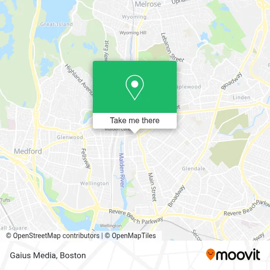
See Gaius Media, Malden, on the map
Public Transit to Gaius Media in Malden
Wondering how to get to Gaius Media in Malden? Moovit helps you find the best way to get to Gaius Media with step-by-step directions from the nearest public transit station.
Moovit provides free maps and live directions to help you navigate through your city. View schedules, routes, timetables, and find out how long does it take to get to Gaius Media in real time.
Looking for the nearest stop or station to Gaius Media? Check out this list of stops closest to your destination: Main St @ Brown Terr; Ferry St @ Eastern Ave; Eastern Ave @ Ferry St; Centre St @ Jackson St; Wellington; Chelsea; Oak Grove.
Bus: 104, 105, 106, 411, 430, 99.Train: HAVERHILL, NEWBURYPORT/ROCKPORT.Subway: ORANGE LINE.
Want to see if there’s another route that gets you there at an earlier time? Moovit helps you find alternative routes or times. Get directions from and directions to Gaius Media easily from the Moovit App or Website.
We make riding to Gaius Media easy, which is why over 1.7 million users, including users in Malden, trust Moovit as the best app for public transit. You don’t need to download an individual bus app or train app, Moovit is your all-in-one transit app that helps you find the best bus time or train time available.
For information on prices of bus, subway and train, costs and ride fares to Gaius Media, please check the Moovit app.
Use the app to navigate to popular places including to the airport, hospital, stadium, grocery store, mall, coffee shop, school, college, and university.
Gaius Media Address: Charles St street in Malden
- Digi Burgers,
- Radio Brazuca,
- Auto Braz,
- Maxima Automobile Sales Co.,
- F F Motorsports,
- New England Sports Car Center,
- Medicare Insurance Advisors Malden,
- Wantea,
- Atlantic Seafood Restaurant,
- Paws & Purrfection Company,
- Beca Shoes,
- First Choice Cars,
- Army Recuiter,
- Caliente Mexican Grill,
- Meloondabeat,
- Sterlinglocs,
- Khouri Services,
- Bare It All with Cyn,
- Malden Locksmith PRO,
- Accounting Express
Places Near Gaius Media (Malden)
- Castle Island, Boston,
- Wang Theater, Boston,
- Museum Of Science, Boston,
- Wilbur Theatre, Boston,
- Massachusetts General Hospital, Boston,
- Boston Medical Center, Boston,
- Cheers, Boston,
- Mgm Music Hall, Boston,
- Boston Children's Hospital, Boston,
- Td Garden, Boston,
- House Of Blues, Boston,
- Faneuil Hall, Boston,
- Leader Bank Pavilion (Leader Bank Pavillion), Boston,
- Boston Convention & Exhibition Center, Boston,
- Seaport District, Boston,
- Quincy Market, Boston,
- Prudential Center, Boston,
- North End, Boston,
- Isabella Stewart Gardner Museum, Boston,
- Boston Common, Boston
How to get to popular places in Boston with public transit
Get around Malden by public transit!
Traveling around Malden has never been so easy. See step by step directions as you travel to any attraction, street or major public transit station. View bus and train schedules, arrival times, service alerts and detailed routes on a map, so you know exactly how to get to anywhere in Malden.
When traveling to any destination around Malden use Moovit's Live Directions with Get Off Notifications to know exactly where and how far to walk, how long to wait for your line, and how many stops are left. Moovit will alert you when it's time to get off — no need to constantly re-check whether yours is the next stop.
Wondering how to use public transit in Malden or how to pay for public transit in Malden? Moovit public transit app can help you navigate your way with public transit easily, and at minimum cost. It includes public transit fees, ticket prices, and costs. Looking for a map of Malden public transit lines? Moovit public transit app shows all public transit maps in Malden with all Bus, Train, Subway and Ferry routes and stops on an interactive map.
Boston has 4 transit type(s), including: Bus, Train, Subway and Ferry, operated by several transit agencies, including MBTA, Southeastern Regional Transit Authority, MetroWest Regional Transit Authority, Rhode Island Public Transit Authority, WRTA, Lowell Regional Transit Authority, Merrimack Valley Transit, Montachusett Regional Transit Authority, Cape Cod Regional Transit Authority, Brockton Area Transit Authority, Martha's Vineyard Transit Authority, the WAVE - Nantucket Regional Transit Authority, GATRA, Cape Ann Transportation Authority and Massport