How to get to Gallo Thomas Insurance by bus?
Click on the bus route to see step by step directions with maps, line arrival times and updated time schedules.
How to get to Gallo Thomas Insurance by train?
Click on the train route to see step by step directions with maps, line arrival times and updated time schedules.
Bus stops near Gallo Thomas Insurance in Boston
Train station near Gallo Thomas Insurance in Boston
- T.F. Green Airport, 50 min walk,VIEW
Bus lines to Gallo Thomas Insurance in Boston
What are the closest stations to Gallo Thomas Insurance?
The closest stations to Gallo Thomas Insurance are:
- Opposite 700 Jefferson is 624 yards away, 8 min walk.
- Greenwich After Naples is 1446 yards away, 18 min walk.
- T.F. Green Airport is 4249 yards away, 50 min walk.
Which bus lines stop near Gallo Thomas Insurance?
These bus lines stop near Gallo Thomas Insurance: 1, 14, 21, 22, 66.
Which train line stops near Gallo Thomas Insurance?
PROVIDENCE/STOUGHTON (#827 | Wickford Junction)
What’s the nearest bus station to Gallo Thomas Insurance in Boston?
The nearest bus station to Gallo Thomas Insurance in Boston is Opposite 700 Jefferson. It’s a 8 min walk away.
What time is the first train to Gallo Thomas Insurance in Boston?
The PROVIDENCE/STOUGHTON is the first train that goes to Gallo Thomas Insurance in Boston. It stops nearby at 6:00 AM.
What time is the last train to Gallo Thomas Insurance in Boston?
The PROVIDENCE/STOUGHTON is the last train that goes to Gallo Thomas Insurance in Boston. It stops nearby at 7:56 PM.
What time is the first bus to Gallo Thomas Insurance in Boston?
The 30 is the first bus that goes to Gallo Thomas Insurance in Boston. It stops nearby at 5:06 AM.
What time is the last bus to Gallo Thomas Insurance in Boston?
The 21 is the last bus that goes to Gallo Thomas Insurance in Boston. It stops nearby at 10:24 PM.
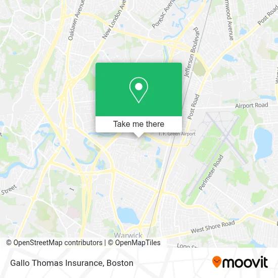
See Gallo Thomas Insurance, Boston, on the map
Public Transit to Gallo Thomas Insurance in Boston
Wondering how to get to Gallo Thomas Insurance in Boston? Moovit helps you find the best way to get to Gallo Thomas Insurance with step-by-step directions from the nearest public transit station.
Moovit provides free maps and live directions to help you navigate through your city. View schedules, routes, timetables, and find out how long does it take to get to Gallo Thomas Insurance in real time.
Looking for the nearest stop or station to Gallo Thomas Insurance? Check out this list of stops closest to your destination: Opposite 700 Jefferson; Greenwich After Naples; T.F. Green Airport.
Bus: 1, 14, 21, 22, 66, 30.Train: PROVIDENCE/STOUGHTON.
Want to see if there’s another route that gets you there at an earlier time? Moovit helps you find alternative routes or times. Get directions from and directions to Gallo Thomas Insurance easily from the Moovit App or Website.
We make riding to Gallo Thomas Insurance easy, which is why over 1.7 million users, including users in Boston, trust Moovit as the best app for public transit. You don’t need to download an individual bus app or train app, Moovit is your all-in-one transit app that helps you find the best bus time or train time available.
For information on prices of bus and train, costs and ride fares to Gallo Thomas Insurance, please check the Moovit app.
Use the app to navigate to popular places including to the airport, hospital, stadium, grocery store, mall, coffee shop, school, college, and university.
Gallo Thomas Insurance Address: 125 Metro Center Blvd street in Boston
- Glidden Professional Paint Center,
- Craft Beer Guild Distributing of Ri,
- Motion Industries,
- Steven Hagopian - Financial Advisor, Ameriprise Financial Services,
- Pathview Wealth - Ameriprise Financial Services,
- Ocean State Engineering,
- DCJ Landscape Services,
- Top Dog K9 Training,
- Ivy Wealth Management,
- Verizon, Cranston Central Office,
- Mylocal Carpet Cleaners,
- Salt Water Pest Control,
- Grammy's House,
- Tender Hearts Child Care & Learning Center,
- Shipyard Brewport,
- William Basile,
- Environmental Enterprises,
- Hyatt Place-Warwick Providence,
- State Institution Cemetery 2,
- Deblois Oil Company
Places Near Gallo Thomas Insurance (Boston)
- House Of Blues, Boston,
- Isabella Stewart Gardner Museum, Boston,
- Boston Common, Boston,
- Seaport District, Boston,
- Museum Of Science, Boston,
- Massachusetts General Hospital, Boston,
- Cheers, Boston,
- North End, Boston,
- Prudential Center, Boston,
- Quincy Market, Boston,
- Boston Convention & Exhibition Center, Boston,
- Boston Children's Hospital, Boston,
- Faneuil Hall, Boston,
- Mgm Music Hall, Boston,
- Td Garden, Boston,
- Leader Bank Pavilion (Leader Bank Pavillion), Boston,
- Wang Theater, Boston,
- Wilbur Theatre, Boston,
- Castle Island, Boston,
- Boston Medical Center, Boston
How to get to popular places in Boston with public transit
Get around Boston by public transit!
Traveling around Boston has never been so easy. See step by step directions as you travel to any attraction, street or major public transit station. View bus and train schedules, arrival times, service alerts and detailed routes on a map, so you know exactly how to get to anywhere in Boston.
When traveling to any destination around Boston use Moovit's Live Directions with Get Off Notifications to know exactly where and how far to walk, how long to wait for your line, and how many stops are left. Moovit will alert you when it's time to get off — no need to constantly re-check whether yours is the next stop.
Wondering how to use public transit in Boston or how to pay for public transit in Boston? Moovit public transit app can help you navigate your way with public transit easily, and at minimum cost. It includes public transit fees, ticket prices, and costs. Looking for a map of Boston public transit lines? Moovit public transit app shows all public transit maps in Boston with all Bus, Train, Subway and Ferry routes and stops on an interactive map.
Boston has 4 transit type(s), including: Bus, Train, Subway and Ferry, operated by several transit agencies, including MBTA, Southeastern Regional Transit Authority, MetroWest Regional Transit Authority, Rhode Island Public Transit Authority, WRTA, Lowell Regional Transit Authority, Merrimack Valley Transit, Montachusett Regional Transit Authority, Cape Cod Regional Transit Authority, Brockton Area Transit Authority, Martha's Vineyard Transit Authority, the WAVE - Nantucket Regional Transit Authority, GATRA, Cape Ann Transportation Authority and Massport