Directions to Gap Factory (Everett) with public transportation
The following transit lines have routes that pass near Gap Factory
 Bus: 105, 109, 110, 97, 99.
- Train: NEWBURYPORT/ROCKPORT.
- Subway: ORANGE LINE.
How to get to Gap Factory by bus?
Click on the bus route to see step by step directions with maps, line arrival times and updated time schedules.
From Jamaica Pond, Boston
110 minFrom Westin Copley Place Hotel Boston, Boston
64 minFrom Amtrak-Boston South Station, Boston
63 minFrom Hilton Garden Inn Boston Brookline, Brookline
97 minFrom Chinatown Station MBTA, Boston
70 minFrom Washington St, Boston
120 minFrom Dorchester, Boston
123 minFrom Franklin Park, Boston
123 minFrom Hyatt Regency Boston, Boston
69 minFrom McLean Hospital, Belmont
91 min
How to get to Gap Factory by train?
Click on the train route to see step by step directions with maps, line arrival times and updated time schedules.
How to get to Gap Factory by subway?
Click on the subway route to see step by step directions with maps, line arrival times and updated time schedules.
From Jamaica Pond, Boston
60 minFrom Westin Copley Place Hotel Boston, Boston
40 minFrom Amtrak-Boston South Station, Boston
38 minFrom Hilton Garden Inn Boston Brookline, Brookline
63 minFrom Chinatown Station MBTA, Boston
33 minFrom Washington St, Boston
52 minFrom Dorchester, Boston
61 minFrom Franklin Park, Boston
57 minFrom Hyatt Regency Boston, Boston
35 min
Bus stops near Gap Factory in Everett
Train station near Gap Factory in Everett
- Chelsea, 15 min walk,VIEW
Subway station near Gap Factory in Everett
- Wellington, 34 min walk,VIEW
Bus lines to Gap Factory in Everett
- 97, Wellington - Malden,VIEW
- 99, Wellington - Woodland Rd,VIEW
- 106, Wellington - Lebanon Loop,VIEW
- 110, Wellington - Wonderland,VIEW
- 112, Wood Island via Market Basket & Admiral's Hill - Wellington via Admiral's Hill & Market Basket,VIEW
- 105, Sullivan,VIEW
- 109, Linden Square Via Sullivan,VIEW
- 100, Elm St,VIEW
- 108, Wellington,VIEW
- 134, North Woburn Via Veterans Senior Center,VIEW
- ORANGE LINE SHUTTLE, Oak Grove (Local Shuttle),VIEW
- ORANGE LINE SHUTTLE, Wellington (Express Shuttle),VIEW
- ORANGE LINE SHUTTLE, North Station (Local Shuttle),VIEW
What are the closest stations to Gap Factory?
The closest stations to Gap Factory are:
- Santilli Circle is 141 yards away, 2 min walk.
- Broadway @ Horizon Way is 382 yards away, 5 min walk.
- Wellington is 831 yards away, 11 min walk.
- Chelsea is 1038 yards away, 15 min walk.
Which bus lines stop near Gap Factory?
These bus lines stop near Gap Factory: 105, 109, 110, 97.
Which train line stops near Gap Factory?
NEWBURYPORT/ROCKPORT (#125 | Newburyport)
Which subway line stops near Gap Factory?
ORANGE LINE (Oak Grove)
What’s the nearest train station to Gap Factory in Everett?
The nearest train station to Gap Factory in Everett is Chelsea. It’s a 15 min walk away.
What’s the nearest bus station to Gap Factory in Everett?
The nearest bus station to Gap Factory in Everett is Santilli Circle. It’s a 2 min walk away.
What time is the first subway to Gap Factory in Everett?
The ORANGE LINE is the first subway that goes to Gap Factory in Everett. It stops nearby at 5:19 AM.
What time is the last subway to Gap Factory in Everett?
The ORANGE LINE is the last subway that goes to Gap Factory in Everett. It stops nearby at 1:53 AM.
What time is the first train to Gap Factory in Everett?
The NEWBURYPORT/ROCKPORT is the first train that goes to Gap Factory in Everett. It stops nearby at 5:40 AM.
What time is the last train to Gap Factory in Everett?
The NEWBURYPORT/ROCKPORT is the last train that goes to Gap Factory in Everett. It stops nearby at 12:06 AM.
What time is the first bus to Gap Factory in Everett?
The 109 is the first bus that goes to Gap Factory in Everett. It stops nearby at 4:42 AM.
What time is the last bus to Gap Factory in Everett?
The 110 is the last bus that goes to Gap Factory in Everett. It stops nearby at 2:09 AM.
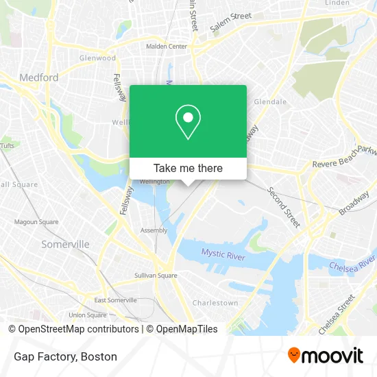
See Gap Factory, Everett, on the map
Public Transit to Gap Factory in Everett
Wondering how to get to Gap Factory in Everett? Moovit helps you find the best way to get to Gap Factory with step-by-step directions from the nearest public transit station.
Moovit provides free maps and live directions to help you navigate through your city. View schedules, routes, timetables, and find out how long does it take to get to Gap Factory in real time.
Looking for the nearest stop or station to Gap Factory? Check out this list of stops closest to your destination: Santilli Circle; Broadway @ Horizon Way; Wellington; Chelsea.
Bus: 105, 109, 110, 97, 99, 106, 112, 100, 108, 134, ORANGE LINE SHUTTLE, ORANGE LINE SHUTTLE.Train: NEWBURYPORT/ROCKPORT.Subway: ORANGE LINE.
Want to see if there’s another route that gets you there at an earlier time? Moovit helps you find alternative routes or times. Get directions from and directions to Gap Factory easily from the Moovit App or Website.
We make riding to Gap Factory easy, which is why over 1.7 million users, including users in Everett, trust Moovit as the best app for public transit. You don’t need to download an individual bus app or train app, Moovit is your all-in-one transit app that helps you find the best bus time or train time available.
For information on prices of bus, subway and train, costs and ride fares to Gap Factory, please check the Moovit app.
Use the app to navigate to popular places including to the airport, hospital, stadium, grocery store, mall, coffee shop, school, college, and university.
Gap Factory Address: 10 Mystic View Rd street in Everett
- Five Below,
- Gateway Center,
- Texas Roadhouse,
- Ulta Beauty,
- The Home Depot,
- TGI Fridays,
- Target,
- Chuck E. Cheese's,
- Dollar Tree,
- Costco,
- Encore Boston Harbor,
- Costco Wholesale,
- Costco,
- Chuck E. Cheese's,
- Costco Optical,
- MBTA Main Repair Facility,
- Mbta Commuter Rail, Newburyport Line,
- Gurdwara Sikh Sangat Boston,
- Encore Boston Harbor Hotel,
- Mémoire
Places Near Gap Factory (Everett)
- Boston Common, Boston,
- Faneuil Hall, Boston,
- Castle Island, Boston,
- Wilbur Theatre, Boston,
- Td Garden, Boston,
- Cheers, Boston,
- Boston Children's Hospital, Boston,
- Museum Of Science, Boston,
- Boston Convention & Exhibition Center, Boston,
- Prudential Center, Boston,
- Wang Theater, Boston,
- Isabella Stewart Gardner Museum, Boston,
- Seaport District, Boston,
- Mgm Music Hall, Boston,
- Massachusetts General Hospital, Boston,
- House Of Blues, Boston,
- North End, Boston,
- Leader Bank Pavilion (Leader Bank Pavillion), Boston,
- Boston Medical Center, Boston,
- Quincy Market, Boston
How to get to popular places in Boston with public transit
Get around Everett by public transit!
Traveling around Everett has never been so easy. See step by step directions as you travel to any attraction, street or major public transit station. View bus and train schedules, arrival times, service alerts and detailed routes on a map, so you know exactly how to get to anywhere in Everett.
When traveling to any destination around Everett use Moovit's Live Directions with Get Off Notifications to know exactly where and how far to walk, how long to wait for your line, and how many stops are left. Moovit will alert you when it's time to get off — no need to constantly re-check whether yours is the next stop.
Wondering how to use public transit in Everett or how to pay for public transit in Everett? Moovit public transit app can help you navigate your way with public transit easily, and at minimum cost. It includes public transit fees, ticket prices, and costs. Looking for a map of Everett public transit lines? Moovit public transit app shows all public transit maps in Everett with all Bus, Train, Subway and Ferry routes and stops on an interactive map.
Boston has 4 transit type(s), including: Bus, Train, Subway and Ferry, operated by several transit agencies, including MBTA, Southeastern Regional Transit Authority, MetroWest Regional Transit Authority, Rhode Island Public Transit Authority, WRTA, Lowell Regional Transit Authority, Merrimack Valley Transit, Montachusett Regional Transit Authority, Cape Cod Regional Transit Authority, Brockton Area Transit Authority, Martha's Vineyard Transit Authority, the WAVE - Nantucket Regional Transit Authority, GATRA, Cape Ann Transportation Authority and Massport