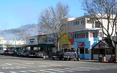
See Garberville CA on the map
Directions to Garberville CA with public transportation
The following transit lines have routes that pass near Garberville CA
 Bus:
Bus:
How to get to Garberville CA by bus?
Click on the bus route to see step by step directions with maps, line arrival times and updated time schedules.
Bus stations near Garberville CA
- Garberville Amtrak Bus Stop,4 min walk,
- Redwood Dr & Melville Rd,5 min walk,
Bus lines to Garberville CA
- AMTRAK THRUWAY CONNECTING SERVICE,Arcata,
- RCX,,
- SHI,Bayshore Mall (Northbound),
What are the closest stations to Garberville CA?
The closest stations to Garberville CA are:
- Garberville Amtrak Bus Stop is 279 yards away, 4 min walk.
- Redwood Dr & Melville Rd is 327 yards away, 5 min walk.
Which bus line stops near Garberville CA?
SHI
What’s the nearest bus stop to Garberville CA?
The nearest bus stop to Garberville CA is Garberville Amtrak Bus Stop. It’s a 4 min walk away.
What time is the first bus to Garberville CA?
The SHI is the first bus that goes to Garberville CA. It stops nearby at 6:53 AM.
What time is the last bus to Garberville CA?
The AMTRAK THRUWAY CONNECTING SERVICE is the last bus that goes to Garberville CA. It stops nearby at 7:00 PM.
How much is the bus fare to Garberville CA?
The bus fare to Garberville CA costs about $1.65 - $6.25.
See Garberville CA on the map
Public Transportation to Garberville CA
Wondering how to get to Garberville CA, United States? Moovit helps you find the best way to get to Garberville CA with step-by-step directions from the nearest public transit station.
Moovit provides free maps and live directions to help you navigate through your city. View schedules, routes, timetables, and find out how long does it take to get to Garberville CA in real time.
Looking for the nearest stop or station to Garberville CA? Check out this list of stops closest to your destination: Garberville Amtrak Bus Stop; Redwood Dr & Melville Rd.
Bus:
Want to see if there’s another route that gets you there at an earlier time? Moovit helps you find alternative routes or times. Get directions from and directions to Garberville CA easily from the Moovit App or Website.
We make riding to Garberville CA easy, which is why over 1.5 million users, including users in Garberville, trust Moovit as the best app for public transit. You don’t need to download an individual bus app or train app, Moovit is your all-in-one transit app that helps you find the best bus time or train time available.
For information on prices of bus, costs and ride fares to Garberville CA, please check the Moovit app.
Use the app to navigate to popular places including to the airport, hospital, stadium, grocery store, mall, coffee shop, school, college, and university.
Location: Garberville, Humboldt County
Attractions near Garberville CA
Wealth of Having Your Health,Branscomb Center,Sacred Artifact Tattoo,Gloeggler Frank X CPA,Lost Coast Vintage Guitars,Humboldt Visitors & Tourism Guide,Humboldt Cure,Beth McKey LMFT,Gallery and Frames,Southern Humboldt Chamber of Commerce & Visitors Center,Souji House,Vocality Community Credit Union,Garberville,The North Face,Dancing Cranes Healing Arts,Pineapple Express Hawaiian Food Truck,Garberville, California,Garberville Women's Civic Club,TEXACO,Stern Peter ND L.Ac.How to get to popular attractions in Garberville with public transit
Kirkwood Ct, Mckinleyville,Sunshine Asian Massage, Eureka,Willow Creek, Willow Creek,Pelican Bay State Prison, Crescent City,7 7th St, Eureka,Trinidad State Beach,Muddy Waters Coffee Co, Eureka,114 Darby St, Bertsch-Oceanview,Surf with Katie,Cooke Lighting & Electric (Cooke Electric), Mckinleyville,Fortuna, Fortuna,Del Norte High School, Crescent City,Blue Lake Casino & Hotel ,Greyhound: Bus Stop - Eureka Bus Stop, Eureka,2nd Ave, Blue Lake,Loleta, Loleta,Miller St, Klamath,Vista Point,North Coast Mobile Notary Service,Teacher's Pet Educational Preschool (Teachers Pet School), EurekaGet around Garberville by public transit!
Traveling around Garberville has never been so easy. See step by step directions as you travel to any attraction, street or major public transit station. View bus and train schedules, arrival times, service alerts and detailed routes on a map, so you know exactly how to get to anywhere in Garberville.
When traveling to any destination around Garberville use Moovit's Live Directions with Get Off Notifications to know exactly where and how far to walk, how long to wait for your line, and how many stops are left. Moovit will alert you when it's time to get off — no need to constantly re-check whether yours is the next stop.
Wondering how to use public transit in Garberville or how to pay for public transit in Garberville? Moovit public transit app can help you navigate your way with public transit easily, and at minimum cost. It includes public transit fees, ticket prices, and costs. Looking for a map of Garberville public transit lines? Moovit public transit app shows all public transit maps in Garberville with all bus routes and stops on an interactive map.
Garberville has 1 transit type(s), including: bus, operated by several transit agencies, including Eureka Transit Service, Arcata & Mad River Transit System, Redwood Coast Transit, Redwood Transit System, Greyhound-us and Amtrak Chartered Vehicle