How to get to Gasnot Pascal by bus?
Click on the bus route to see step by step directions with maps, line arrival times and updated time schedules.
Bus stops near Gasnot Pascal in Le Mans
Light Rail stations near Gasnot Pascal in Le Mans
- Zola, 27 min walk,VIEW
Bus lines to Gasnot Pascal in Le Mans
- 31, Ehpad,VIEW
- 4, Bellevue,VIEW
- 12, Chanzy Bollee,VIEW
- 15, Guetteloup,VIEW
- 22, Zam Sarge Zam,VIEW
- T2, Bellevue - Hauts De Coulaines,VIEW
- 7, Éperon par Auchan,VIEW
- 11, Le Cadran / St-Aubin - Closerie,VIEW
- 14, Parc Manceau - St-Martin,VIEW
- 16, Lafayette - Californie,VIEW
- 17, Gallière - Eperon,VIEW
- 20, Éperon - Aigné,VIEW
What are the closest stations to Gasnot Pascal?
The closest stations to Gasnot Pascal are:
- Grand Bois is 254 meters away, 4 min walk.
- Zamenhof is 437 meters away, 6 min walk.
- Zola is 2067 meters away, 27 min walk.
- Lafayette is 3967 meters away, 51 min walk.
Which bus lines stop near Gasnot Pascal?
These bus lines stop near Gasnot Pascal: 111, 12, 31.
Which light rail line stops near Gasnot Pascal?
T2 (Bellevue - Hauts De Coulaines)
What’s the nearest light rail station to Gasnot Pascal in Le Mans?
The nearest light rail station to Gasnot Pascal in Le Mans is Zola. It’s a 27 min walk away.
What’s the nearest bus station to Gasnot Pascal in Le Mans?
The nearest bus station to Gasnot Pascal in Le Mans is Grand Bois. It’s a 4 min walk away.
What time is the first light rail to Gasnot Pascal in Le Mans?
The T2 is the first light rail that goes to Gasnot Pascal in Le Mans. It stops nearby at 5:10 AM.
What time is the last light rail to Gasnot Pascal in Le Mans?
The T1 is the last light rail that goes to Gasnot Pascal in Le Mans. It stops nearby at 1:12 AM.
What time is the first bus to Gasnot Pascal in Le Mans?
The 16 is the first bus that goes to Gasnot Pascal in Le Mans. It stops nearby at 6:30 AM.
What time is the last bus to Gasnot Pascal in Le Mans?
The 12 is the last bus that goes to Gasnot Pascal in Le Mans. It stops nearby at 8:42 PM.
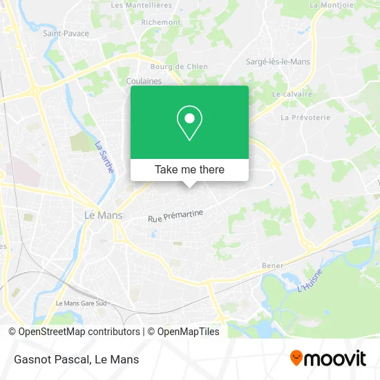
See Gasnot Pascal, Le Mans, on the map
Public Transit to Gasnot Pascal in Le Mans
Wondering how to get to Gasnot Pascal in Le Mans? Moovit helps you find the best way to get to Gasnot Pascal with step-by-step directions from the nearest public transit station.
Moovit provides free maps and live directions to help you navigate through your city. View schedules, routes, timetables, and find out how long does it take to get to Gasnot Pascal in real time.
Looking for the nearest stop or station to Gasnot Pascal? Check out this list of stops closest to your destination: Grand Bois; Zamenhof; Zola; Lafayette.
Bus: 111, 12, 31, 4, 15, 22, T2, 7, 11, 14, 16, 17.Light Rail: T2.
Want to see if there’s another route that gets you there at an earlier time? Moovit helps you find alternative routes or times. Get directions from and directions to Gasnot Pascal easily from the Moovit App or Website.
We make riding to Gasnot Pascal easy, which is why over 1.5 million users, including users in Le Mans, trust Moovit as the best app for public transit. You don’t need to download an individual bus app or train app, Moovit is your all-in-one transit app that helps you find the best bus time or train time available.
For information on prices of bus and light rail, costs and ride fares to Gasnot Pascal, please check the Moovit app.
Use the app to navigate to popular places including to the airport, hospital, stadium, grocery store, mall, coffee shop, school, college, and university.
Gasnot Pascal Address: 8 Allée des Lavandes 72000 Le Mans street in Le Mans
- Logement au Calme Proche Centre,
- Salle Polyvalente Verdigne,
- Esn le Mans,
- Végé Super,
- La Mie do Re,
- Jorez-Charbonn,
- Parc Verdigné,
- Dart Pier,
- Le Patio de Ronsard,
- Cosy Break,
- Chambre d'Hôtes de Verdigné Piscine Parking,
- Église Saint-Aldric,
- Carrefour Market,
- Carrefour Market Le Mans Bonnetable,
- École Élémentaire Villaret,
- Theaudin,
- Prémartine,
- Gymnase Villaret,
- Stade les Fontenelles,
- Rue Prémartine
Places Near Gasnot Pascal (Le Mans)
- Clinique Du Pré, Le Mans,
- Gare SNCF du Mans, Le Mans,
- Parc Des Expositions, Le Mans,
- Hôpital, Le Mans,
- Université, Le Mans,
- Clinique Pôle Santé Sud, Le Mans,
- Place des Jacobins (le Mans), Le Mans,
- Auchan le Mans, La Chapelle-Saint-Aubin,
- Saint-Saturnin, Saint-Saturnin,
- Centre Hospitalier Du Mans, Le Mans,
- Avenue Bollée, Le Mans,
- E.Leclerc, Le Mans,
- Coulaines, Coulaines,
- Family Village, Ruaudin,
- Circuit des 24 Heures du Mans, Le Mans,
- Maison D'Arrêt Le Mans - Les Croisettes, Coulaines,
- Changé, Changé,
- Camp du 2e RIMa, Champagné,
- Pôle Santé Sud-Elsan, Le Mans,
- La Chapelle-Saint-Aubin, La Chapelle-Saint-Aubin
How to get to popular places in Le Mans with public transit
Get around Le Mans by public transit!
Traveling around Le Mans has never been so easy. See step by step directions as you travel to any attraction, street or major public transit station. View bus and train schedules, arrival times, service alerts and detailed routes on a map, so you know exactly how to get to anywhere in Le Mans.
When traveling to any destination around Le Mans use Moovit's Live Directions with Get Off Notifications to know exactly where and how far to walk, how long to wait for your line, and how many stops are left. Moovit will alert you when it's time to get off — no need to constantly re-check whether yours is the next stop.
Wondering how to use public transit in Le Mans or how to pay for public transit in Le Mans? Moovit public transit app can help you navigate your way with public transit easily, and at minimum cost. It includes public transit fees, ticket prices, and costs. Looking for a map of Le Mans public transit lines? Moovit public transit app shows all public transit maps in Le Mans with all Bus and Light Rail routes and stops on an interactive map.
Le Mans has 2 transit type(s), including: Bus and Light Rail, operated by several transit agencies, including SETRAM