Directions to Gates Financial (Quincy) with public transportation
The following transit lines have routes that pass near Gates Financial
 Bus: 210, 215, 23, 211, 217.
- Subway: RED LINE, MATTAPAN LINE.
- Ferry: QUINCY FERRY, WINTHROP/QUINCY FERRY.
How to get to Gates Financial by bus?
Click on the bus route to see step by step directions with maps, line arrival times and updated time schedules.
From Homewood Suites by Hilton Boston Brookline-Longwood Medical, Brookline
81 minFrom Reelhouse, Boston
143 minFrom Charles Playhouse, Boston
66 minFrom South End, Boston
88 minFrom Royal Sonesta Hotel, Cambridge
111 minFrom Shubert Theatre, Boston
67 minFrom Museum Of Science, Boston
91 minFrom West Roxbury, Boston
71 minFrom Earls Kitchen + Bar, Boston
74 minFrom Google, Cambridge
93 min
How to get to Gates Financial by subway?
Click on the subway route to see step by step directions with maps, line arrival times and updated time schedules.
From Homewood Suites by Hilton Boston Brookline-Longwood Medical, Brookline
58 minFrom Reelhouse, Boston
44 minFrom Charles Playhouse, Boston
36 minFrom South End, Boston
35 minFrom Royal Sonesta Hotel, Cambridge
47 minFrom Shubert Theatre, Boston
36 minFrom Museum Of Science, Boston
45 minFrom Earls Kitchen + Bar, Boston
43 minFrom Google, Cambridge
34 min
Bus stops near Gates Financial in Quincy
Subway stations near Gates Financial in Quincy
Ferry station near Gates Financial in Quincy
- Quincy, 42 min walk,VIEW
Bus lines to Gates Financial in Quincy
- 210, Fields Corner,VIEW
- 211, Squantum,VIEW
- 217, Bryant Ave & Upton St,VIEW
- RED LINE SHUTTLE, North Quincy (Shuttle),VIEW
- RED LINE SHUTTLE, Braintree (Shuttle),VIEW
- 215, Ashmont - Quincy Center,VIEW
- RED LINE SHUTTLE, Ashmont - Braintree,VIEW
- RED LINE SHUTTLE, North Quincy - JFK/UMass,VIEW
- RED LINE SHUTTLE, Braintree - Broadway,VIEW
- RED LINE SHUTTLE, Braintree - JFK/UMass (Shuttle),VIEW
- RED LINE SHUTTLE, Quincy Center - Broadway (Shuttle),VIEW
What are the closest stations to Gates Financial?
The closest stations to Gates Financial are:
- Newport Ave @ Heritage Dr is 266 yards away, 4 min walk.
- E Squantum St @ Holyoke St is 394 yards away, 5 min walk.
- E Squantum St @ Faxon Rd. is 432 yards away, 6 min walk.
- North Quincy is 728 yards away, 9 min walk.
- North Quincy - Hancock Street Garage is 865 yards away, 11 min walk.
- Cedar Grove is 3248 yards away, 38 min walk.
- Quincy is 3591 yards away, 42 min walk.
Which bus lines stop near Gates Financial?
These bus lines stop near Gates Financial: 210, 215, 23.
Which subway line stops near Gates Financial?
RED LINE (Ashmont/Braintree)
What’s the nearest subway station to Gates Financial in Quincy?
The nearest subway station to Gates Financial in Quincy is North Quincy. It’s a 9 min walk away.
What’s the nearest bus station to Gates Financial in Quincy?
The nearest bus station to Gates Financial in Quincy is Newport Ave @ Heritage Dr. It’s a 4 min walk away.
What time is the first subway to Gates Financial in Quincy?
The MATTAPAN LINE is the first subway that goes to Gates Financial in Quincy. It stops nearby at 5:07 AM.
What time is the last subway to Gates Financial in Quincy?
The MATTAPAN LINE is the last subway that goes to Gates Financial in Quincy. It stops nearby at 2:34 AM.
What time is the first bus to Gates Financial in Quincy?
The 210 is the first bus that goes to Gates Financial in Quincy. It stops nearby at 5:07 AM.
What time is the last bus to Gates Financial in Quincy?
The 210 is the last bus that goes to Gates Financial in Quincy. It stops nearby at 1:10 AM.
What time is the first ferry to Gates Financial in Quincy?
The QUINCY FERRY is the first ferry that goes to Gates Financial in Quincy. It stops nearby at 6:15 AM.
What time is the last ferry to Gates Financial in Quincy?
The QUINCY FERRY is the last ferry that goes to Gates Financial in Quincy. It stops nearby at 8:55 PM.
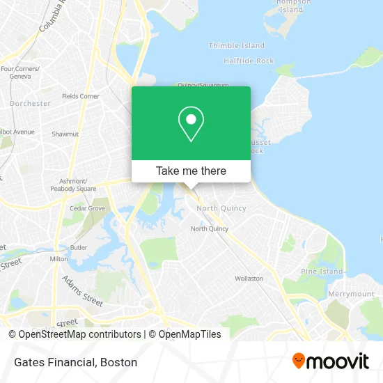
See Gates Financial, Quincy, on the map
Public Transit to Gates Financial in Quincy
Wondering how to get to Gates Financial in Quincy? Moovit helps you find the best way to get to Gates Financial with step-by-step directions from the nearest public transit station.
Moovit provides free maps and live directions to help you navigate through your city. View schedules, routes, timetables, and find out how long does it take to get to Gates Financial in real time.
Looking for the nearest stop or station to Gates Financial? Check out this list of stops closest to your destination: Newport Ave @ Heritage Dr; E Squantum St @ Holyoke St; E Squantum St @ Faxon Rd.; North Quincy; North Quincy - Hancock Street Garage; Cedar Grove; Quincy.
Bus: 210, 215, 23, 211, 217.Subway: RED LINE, MATTAPAN LINE.Ferry: QUINCY FERRY, WINTHROP/QUINCY FERRY.
Want to see if there’s another route that gets you there at an earlier time? Moovit helps you find alternative routes or times. Get directions from and directions to Gates Financial easily from the Moovit App or Website.
We make riding to Gates Financial easy, which is why over 1.7 million users, including users in Quincy, trust Moovit as the best app for public transit. You don’t need to download an individual bus app or train app, Moovit is your all-in-one transit app that helps you find the best bus time or train time available.
For information on prices of subway and bus, costs and ride fares to Gates Financial, please check the Moovit app.
Use the app to navigate to popular places including to the airport, hospital, stadium, grocery store, mall, coffee shop, school, college, and university.
Gates Financial Address: 100 Hancock St street in Quincy
- MFS Investment Management,
- 100 Hancock St,
- Cathay Pacific Restaurant,
- Cathy Pacific,
- MassDot (RMV),
- Neponset Landing,
- Granite Telecommunications,
- Best Western Adams Inn Quincy - Boston,
- Freightplus,
- Quincy College,
- State Street - JAB,
- Grante Telecommunicati,
- Newport Cafe,
- PNC Bank,
- We Know Roofing,
- Amazon Locker-Monte,
- PNC Mortgage,
- PARIS BAGUETTE,
- State Street,
- Discount Locksmith
Places Near Gates Financial (Quincy)
- Castle Island, Boston,
- Wang Theater, Boston,
- Museum Of Science, Boston,
- Massachusetts General Hospital, Boston,
- Leader Bank Pavilion (Leader Bank Pavillion), Boston,
- Boston Children's Hospital, Boston,
- Cheers, Boston,
- Boston Convention & Exhibition Center, Boston,
- Td Garden, Boston,
- Boston Medical Center, Boston,
- North End, Boston,
- Faneuil Hall, Boston,
- House Of Blues, Boston,
- Boston Common, Boston,
- Mgm Music Hall, Boston,
- Wilbur Theatre, Boston,
- Quincy Market, Boston,
- Seaport District, Boston,
- Isabella Stewart Gardner Museum, Boston,
- Prudential Center, Boston
How to get to popular places in Boston with public transit
Get around Quincy by public transit!
Traveling around Quincy has never been so easy. See step by step directions as you travel to any attraction, street or major public transit station. View bus and train schedules, arrival times, service alerts and detailed routes on a map, so you know exactly how to get to anywhere in Quincy.
When traveling to any destination around Quincy use Moovit's Live Directions with Get Off Notifications to know exactly where and how far to walk, how long to wait for your line, and how many stops are left. Moovit will alert you when it's time to get off — no need to constantly re-check whether yours is the next stop.
Wondering how to use public transit in Quincy or how to pay for public transit in Quincy? Moovit public transit app can help you navigate your way with public transit easily, and at minimum cost. It includes public transit fees, ticket prices, and costs. Looking for a map of Quincy public transit lines? Moovit public transit app shows all public transit maps in Quincy with all Bus, Train, Subway and Ferry routes and stops on an interactive map.
Boston has 4 transit type(s), including: Bus, Train, Subway and Ferry, operated by several transit agencies, including MBTA, Southeastern Regional Transit Authority, MetroWest Regional Transit Authority, Rhode Island Public Transit Authority, WRTA, Lowell Regional Transit Authority, Merrimack Valley Transit, Montachusett Regional Transit Authority, Cape Cod Regional Transit Authority, Brockton Area Transit Authority, Martha's Vineyard Transit Authority, the WAVE - Nantucket Regional Transit Authority, GATRA, Cape Ann Transportation Authority and Massport